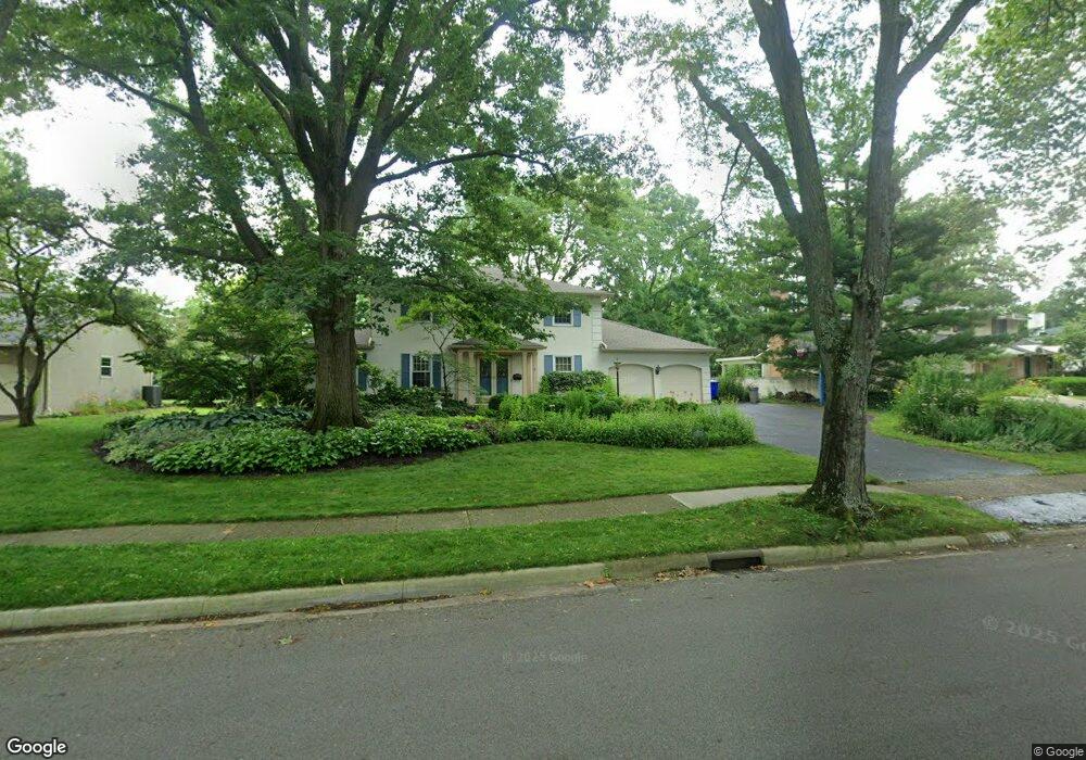
4351 Lyon Dr Columbus, OH 43220
Estimated Value: $724,000 - $934,000
4
Beds
3
Baths
3,106
Sq Ft
$266/Sq Ft
Est. Value
About This Home
This home is located at 4351 Lyon Dr, Columbus, OH 43220 and is currently estimated at $826,678, approximately $266 per square foot. 4351 Lyon Dr is a home located in Franklin County with nearby schools including Greensview Elementary School, Hastings Middle School, and Upper Arlington High School.
Ownership History
Date
Name
Owned For
Owner Type
Purchase Details
Closed on
Jul 13, 1992
Bought by
Snyder R Gordon
Current Estimated Value
Purchase Details
Closed on
Sep 26, 1989
Create a Home Valuation Report for This Property
The Home Valuation Report is an in-depth analysis detailing your home's value as well as a comparison with similar homes in the area
Home Values in the Area
Average Home Value in this Area
Purchase History
| Date | Buyer | Sale Price | Title Company |
|---|---|---|---|
| Snyder R Gordon | $217,500 | -- | |
| -- | -- | -- |
Source: Public Records
Tax History Compared to Growth
Tax History
| Year | Tax Paid | Tax Assessment Tax Assessment Total Assessment is a certain percentage of the fair market value that is determined by local assessors to be the total taxable value of land and additions on the property. | Land | Improvement |
|---|---|---|---|---|
| 2024 | $13,505 | $233,280 | $89,010 | $144,270 |
| 2023 | $13,338 | $233,280 | $89,010 | $144,270 |
| 2022 | $12,349 | $176,720 | $52,750 | $123,970 |
| 2021 | $10,931 | $176,720 | $52,750 | $123,970 |
| 2020 | $10,835 | $176,720 | $52,750 | $123,970 |
| 2019 | $10,345 | $149,180 | $52,750 | $96,430 |
| 2018 | $10,500 | $149,180 | $52,750 | $96,430 |
| 2017 | $10,265 | $149,180 | $52,750 | $96,430 |
| 2016 | $10,724 | $162,190 | $43,330 | $118,860 |
| 2015 | $10,714 | $162,190 | $43,330 | $118,860 |
| 2014 | $10,727 | $162,190 | $43,330 | $118,860 |
| 2013 | $4,802 | $138,215 | $39,375 | $98,840 |
Source: Public Records
Map
Nearby Homes
- 1610 Lafayette Dr Unit 1610
- 1594 Lafayette Dr Unit 1594
- 1512 Lafayette Dr Unit B
- 4094 Lyon Dr
- 4020 Ritamarie Dr
- 4543 Ducrest Dr
- 4740 Merrifield Place Unit 25
- 4450 Haverford Ct
- 4115 Woodbridge Rd
- 4924 Reed Rd Unit B
- 4326 Kenny Rd
- 1835 Willoway Cir N
- 4765 Coach Rd
- 4271 Kenbury Place
- 1865 Willoway Cir N Unit 1865
- 1466 Weybridge Rd
- 3959 Woodbridge Rd
- 1033 Folkestone Rd
- 2165 Partlow Dr
- 2198 Sandston Rd