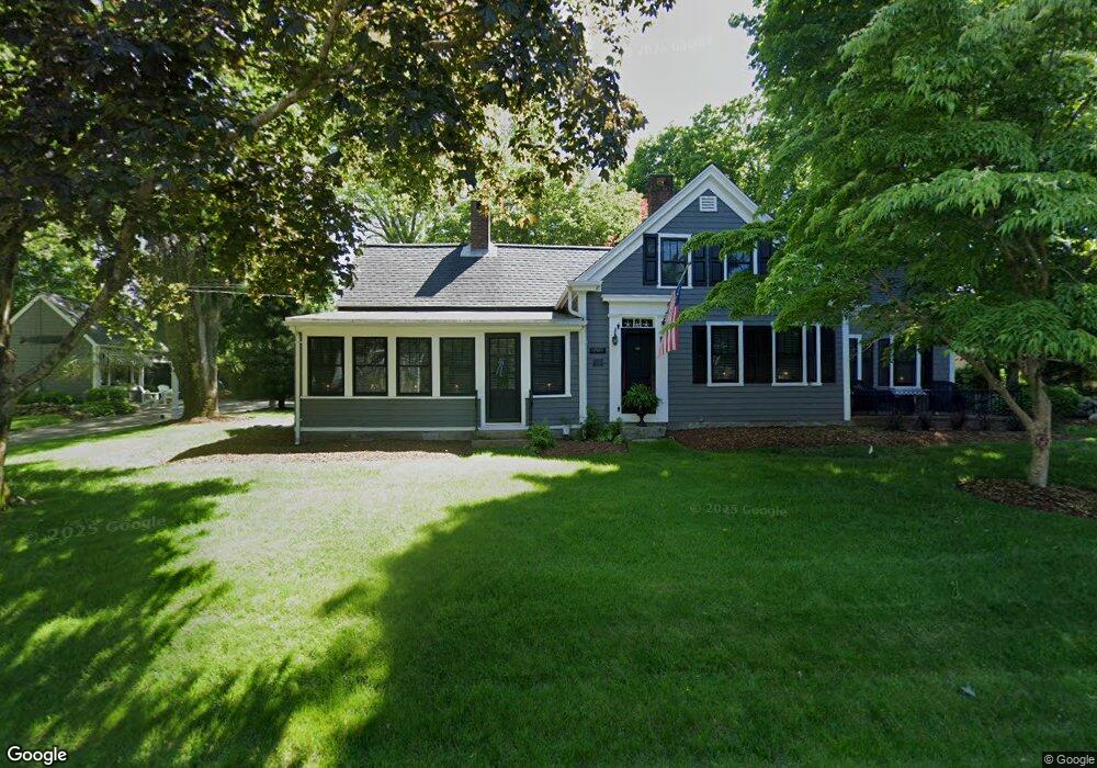
4351 Route 6a Yarmouth Port, MA 02675
Barnstable Village NeighborhoodEstimated Value: $819,905 - $951,000
4
Beds
2
Baths
1,711
Sq Ft
$521/Sq Ft
Est. Value
About This Home
This home is located at 4351 Route 6a, Yarmouth Port, MA 02675 and is currently estimated at $891,976, approximately $521 per square foot. 4351 Route 6a is a home located in Barnstable County with nearby schools including West Barnstable Elementary School, Barnstable United Elementary School, and Barnstable Intermediate School.
Ownership History
Date
Name
Owned For
Owner Type
Purchase Details
Closed on
Dec 19, 1997
Sold by
Andrashko Gary E and Andrashko Faye A
Bought by
Grzywoc Mitchell P and Grzywoc Donna C
Current Estimated Value
Purchase Details
Closed on
Sep 2, 1993
Sold by
Smiley Jerome C
Bought by
Andraskho Gary F and Andrashko Faye A
Create a Home Valuation Report for This Property
The Home Valuation Report is an in-depth analysis detailing your home's value as well as a comparison with similar homes in the area
Home Values in the Area
Average Home Value in this Area
Purchase History
| Date | Buyer | Sale Price | Title Company |
|---|---|---|---|
| Grzywoc Mitchell P | $215,000 | -- | |
| Andraskho Gary F | $134,000 | -- |
Source: Public Records
Mortgage History
| Date | Status | Borrower | Loan Amount |
|---|---|---|---|
| Open | Andraskho Gary F | $185,225 | |
| Closed | Andraskho Gary F | $80,000 | |
| Closed | Andraskho Gary F | $208,000 |
Source: Public Records
Tax History Compared to Growth
Tax History
| Year | Tax Paid | Tax Assessment Tax Assessment Total Assessment is a certain percentage of the fair market value that is determined by local assessors to be the total taxable value of land and additions on the property. | Land | Improvement |
|---|---|---|---|---|
| 2025 | $6,268 | $678,400 | $281,900 | $396,500 |
| 2024 | $5,953 | $679,600 | $281,900 | $397,700 |
| 2023 | $5,528 | $615,600 | $278,900 | $336,700 |
| 2022 | $5,086 | $455,700 | $178,600 | $277,100 |
| 2021 | $4,899 | $418,400 | $189,800 | $228,600 |
| 2020 | $4,841 | $394,900 | $201,000 | $193,900 |
| 2019 | $4,689 | $383,700 | $212,100 | $171,600 |
| 2018 | $4,901 | $346,300 | $211,500 | $134,800 |
| 2017 | $4,375 | $350,000 | $217,400 | $132,600 |
| 2016 | $4,264 | $345,800 | $213,200 | $132,600 |
| 2015 | $4,482 | $370,100 | $215,400 | $154,700 |
Source: Public Records
Map
Nearby Homes
- 4351 Massachusetts 6a
- 4333 Route 6a
- 4340 Route 6a
- 4340 Massachusetts 6a
- 4351 Main St
- 4257 Main St
- 42 Setter Way
- 4352 Main St
- 4352 Route 6a
- 4352 Main (Rte 6a) St
- 4352 Main (Rte 6a) St Unit 5
- 4352 Old King's Hwy
- 4352 Route 6a
- 15 Marstons Ln
- 15 Marstons
- 4360 Main St
- 4360 Main St
- 4360 Route 6a
- 4259 Massachusetts 6a
- 4317 Route 6a