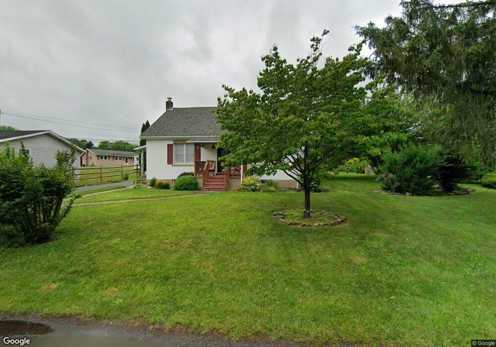
4352 2nd St Walnutport, PA 18088
Estimated Value: $298,000 - $349,000
4
Beds
1
Bath
1,470
Sq Ft
$219/Sq Ft
Est. Value
About This Home
This home is located at 4352 2nd St, Walnutport, PA 18088 and is currently estimated at $322,199, approximately $219 per square foot. 4352 2nd St is a home located in Northampton County with nearby schools including Lehigh Elementary School, Northampton Area Middle School, and Northampton Area High School.
Ownership History
Date
Name
Owned For
Owner Type
Purchase Details
Closed on
Dec 1, 2011
Sold by
Steeley Mark C and Steeley Mary Rose
Bought by
Case Sarah A and Case James D
Current Estimated Value
Home Financials for this Owner
Home Financials are based on the most recent Mortgage that was taken out on this home.
Original Mortgage
$168,367
Outstanding Balance
$115,671
Interest Rate
4.1%
Mortgage Type
New Conventional
Estimated Equity
$206,528
Create a Home Valuation Report for This Property
The Home Valuation Report is an in-depth analysis detailing your home's value as well as a comparison with similar homes in the area
Home Values in the Area
Average Home Value in this Area
Purchase History
| Date | Buyer | Sale Price | Title Company |
|---|---|---|---|
| Case Sarah A | $165,000 | None Available |
Source: Public Records
Mortgage History
| Date | Status | Borrower | Loan Amount |
|---|---|---|---|
| Open | Case Sarah A | $168,367 |
Source: Public Records
Tax History
| Year | Tax Paid | Tax Assessment Tax Assessment Total Assessment is a certain percentage of the fair market value that is determined by local assessors to be the total taxable value of land and additions on the property. | Land | Improvement |
|---|---|---|---|---|
| 2025 | $508 | $47,000 | $16,100 | $30,900 |
| 2024 | $3,455 | $47,000 | $16,100 | $30,900 |
| 2023 | $3,394 | $47,000 | $16,100 | $30,900 |
| 2022 | $3,394 | $47,000 | $16,100 | $30,900 |
| 2021 | $3,402 | $47,000 | $16,100 | $30,900 |
| 2020 | $3,402 | $47,000 | $16,100 | $30,900 |
| 2019 | $3,353 | $47,000 | $16,100 | $30,900 |
| 2018 | $3,303 | $47,000 | $16,100 | $30,900 |
| 2017 | $3,231 | $47,000 | $16,100 | $30,900 |
| 2016 | -- | $47,000 | $16,100 | $30,900 |
| 2015 | -- | $47,000 | $16,100 | $30,900 |
| 2014 | -- | $47,000 | $16,100 | $30,900 |
Source: Public Records
Map
Nearby Homes
- 436 Willow Rd Unit Lot 15
- 1041 Dogwood St
- 1042 Dogwood St Unit 442
- 1022 Dogwood St Unit 422
- 1070 Aspen St Unit 170
- 1321 Rising Sun Rd
- 464 Long Lane Rd
- 448 Long Lane Rd
- 1021 Aspen St
- 4270 Chestnut Dr
- 4266 Chestnut Dr
- 582 Ironwood Rd
- 616 Almond Rd
- 1990 Settlers Ridge Rd
- 1970 Settlers Ridge Rd
- 2010 Settlers Ridge Rd
- 2010 Settlers Ridge Rd Unit 4
- 621 Bishops Place
- 723 Fir Dr
- 35 Linda Dr
- 318 Long Lane Rd
- 4353 Second St
- 4349 Second St
- 4351 Second St
- 4355 Second St
- 322 Long Lane Rd
- 4353 2nd St
- 307 Long Lane Rd
- 323 Long Lane Rd
- 4347 2nd St
- 328 Long Lane Rd
- 4346 2nd St
- 4347 2nd St
- 298 Long Lane Rd
- 291 Long Lane Rd
- 305 Long Lane Rd
- 297 Blue Mountain Dr
- 305 Blue Mountain Dr
- 4342 Second St
- 331 Long Lane Rd
Your Personal Tour Guide
Ask me questions while you tour the home.