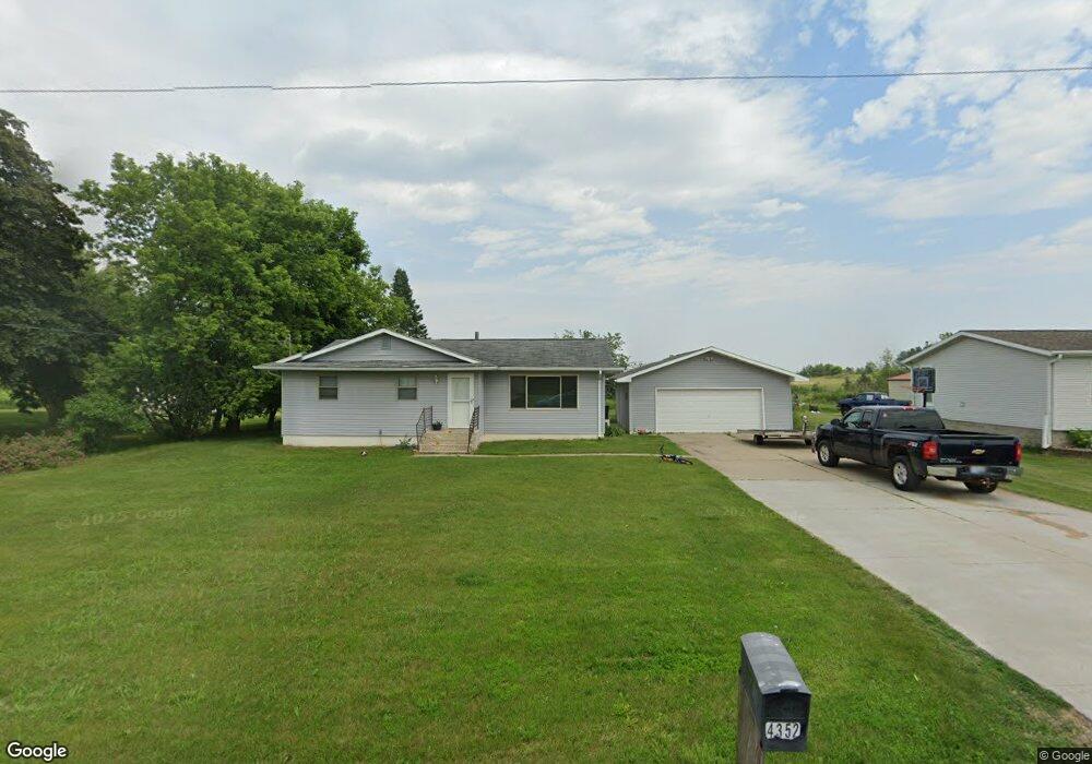
4352 D.15 Rd Bark River, MI 49807
Estimated Value: $109,282 - $180,000
Studio
--
Bath
--
Sq Ft
0.38
Acres
About This Home
This home is located at 4352 D.15 Rd, Bark River, MI 49807 and is currently estimated at $144,321. 4352 D.15 Rd is a home with nearby schools including Bark River-Harris Elementary School and Bark River-Harris Jr/Sr High School.
Ownership History
Date
Name
Owned For
Owner Type
Purchase Details
Closed on
Jul 15, 2015
Sold by
James A James A and Knuth Lisa
Bought by
Adams Brian
Current Estimated Value
Home Financials for this Owner
Home Financials are based on the most recent Mortgage that was taken out on this home.
Original Mortgage
$75,050
Outstanding Balance
$58,845
Interest Rate
4.02%
Mortgage Type
Stand Alone Refi Refinance Of Original Loan
Estimated Equity
$85,476
Purchase Details
Closed on
Jun 25, 2008
Sold by
Englund Michael T and Englund Amy S
Bought by
Knuth James A
Home Financials for this Owner
Home Financials are based on the most recent Mortgage that was taken out on this home.
Original Mortgage
$81,900
Interest Rate
6.1%
Mortgage Type
Purchase Money Mortgage
Create a Home Valuation Report for This Property
The Home Valuation Report is an in-depth analysis detailing your home's value as well as a comparison with similar homes in the area
Purchase History
| Date | Buyer | Sale Price | Title Company |
|---|---|---|---|
| Adams Brian | -- | -- | |
| Knuth James A | -- | -- |
Source: Public Records
Mortgage History
| Date | Status | Borrower | Loan Amount |
|---|---|---|---|
| Open | Adams Brian | $75,050 | |
| Closed | Knuth James A | $81,900 |
Source: Public Records
Tax History
| Year | Tax Paid | Tax Assessment Tax Assessment Total Assessment is a certain percentage of the fair market value that is determined by local assessors to be the total taxable value of land and additions on the property. | Land | Improvement |
|---|---|---|---|---|
| 2025 | $409 | $50,900 | $0 | $0 |
| 2024 | $398 | $47,700 | $0 | $0 |
| 2023 | $379 | $41,600 | $0 | $0 |
| 2022 | $821 | $36,500 | $0 | $0 |
| 2020 | -- | $34,600 | $0 | $0 |
| 2019 | $378 | $31,400 | $0 | $0 |
| 2018 | $856 | $35,400 | $0 | $0 |
| 2017 | -- | $39,500 | $0 | $0 |
| 2016 | $962 | $40,500 | $0 | $0 |
| 2014 | -- | $43,700 | $0 | $0 |
| 2013 | -- | $35,400 | $0 | $0 |
Source: Public Records
Map
Nearby Homes
- 3143 D Rd
- N16246 Co 557 Rd
- 4318 K Rd
- W715 Rd
- TBD Cr 400 Parcel B Rd
- TBD 13 75
- TBD 19th Ln
- TBD Danforth M 2 Blvd
- 7011 G 75
- 4237 M Rd
- 1070 Michigan 35
- TBD Old State South Rd
- 0 State Highway M-35 Hwy
- W6349 Greenwood Ave
- W3657 Greenwood Ave
- 1620 Willow Creek Rd Unit Lot 13
- US HWY 2 & 41
- TBD E Labelle Rd
- 3949 20th Rd
- TBD Delta 17 5 Dr