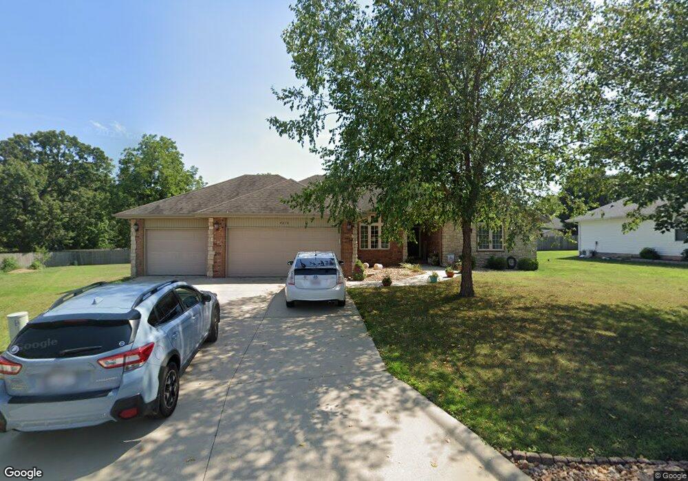
4354 W Curtice Dr Battlefield, MO 65619
Estimated Value: $320,000 - $388,000
4
Beds
3
Baths
2,301
Sq Ft
$151/Sq Ft
Est. Value
About This Home
This home is located at 4354 W Curtice Dr, Battlefield, MO 65619 and is currently estimated at $348,209, approximately $151 per square foot. 4354 W Curtice Dr is a home located in Greene County with nearby schools including McBride Elementary School, Wilson's Creek Intermediate School, and Cherokee Middle School.
Ownership History
Date
Name
Owned For
Owner Type
Purchase Details
Closed on
Jan 7, 2014
Sold by
Norton Frank Byron and Norton Jewell Marie
Bought by
Norton Frank Byron and Norton Jewell Marie
Current Estimated Value
Home Financials for this Owner
Home Financials are based on the most recent Mortgage that was taken out on this home.
Original Mortgage
$163,214
Interest Rate
4.34%
Mortgage Type
VA
Purchase Details
Closed on
Sep 7, 2005
Sold by
Norton Frank B and Norton Jewell M
Bought by
Norton Frank Byron and Norton Jewell Marie
Create a Home Valuation Report for This Property
The Home Valuation Report is an in-depth analysis detailing your home's value as well as a comparison with similar homes in the area
Home Values in the Area
Average Home Value in this Area
Purchase History
| Date | Buyer | Sale Price | Title Company |
|---|---|---|---|
| Norton Frank Byron | -- | Lincoln Land Title | |
| Norton Frank Byron | -- | None Available |
Source: Public Records
Mortgage History
| Date | Status | Borrower | Loan Amount |
|---|---|---|---|
| Closed | Norton Frank Byron | $163,214 |
Source: Public Records
Tax History Compared to Growth
Tax History
| Year | Tax Paid | Tax Assessment Tax Assessment Total Assessment is a certain percentage of the fair market value that is determined by local assessors to be the total taxable value of land and additions on the property. | Land | Improvement |
|---|---|---|---|---|
| 2025 | $2,696 | $49,880 | $8,550 | $41,330 |
| 2024 | $2,300 | $39,540 | $4,750 | $34,790 |
| 2023 | $2,288 | $39,540 | $4,750 | $34,790 |
| 2022 | $1,957 | $34,410 | $4,750 | $29,660 |
| 2021 | $1,956 | $34,410 | $4,750 | $29,660 |
| 2020 | $1,577 | $26,330 | $4,750 | $21,580 |
| 2019 | $1,532 | $26,330 | $4,750 | $21,580 |
| 2018 | $1,662 | $28,420 | $4,180 | $24,240 |
| 2017 | $1,645 | $25,820 | $4,180 | $21,640 |
| 2016 | $1,500 | $25,820 | $4,180 | $21,640 |
| 2015 | $1,487 | $25,820 | $4,180 | $21,640 |
| 2014 | $1,474 | $25,380 | $4,180 | $21,200 |
Source: Public Records
Map
Nearby Homes
- 5141 S Tamarack Ln
- 5147 S Tamarack Ln
- 6110 S Ivey Ln Unit Lot 156
- 4362 W Weaver Rd
- 4351 W Roxie St
- 000 West Bypass
- 5237 Logan Dr
- 4345 W Roxie St
- 5214 S Logan Dr
- 5255 Logan Dr
- 5243 Logan Dr
- 5267 Logan Dr
- 5208 S April Ct
- 5207 S April Ct
- 4141 W Ridgeview St
- 4636 W Curtice Dr
- 5253 S Morgan Ave
- 5259 S Morgan Ave
- 4359 W Walker St
- 5205 S Morgan Ave
- 4344 W Curtice Dr
- 4365 W Curtice Dr
- 5116 S Tamarack Ln
- 4404 W Curtice Dr
- 4395 W Curtice Dr
- 4345 W Curtice Dr
- 4403 W Westwood Dr
- 4405 W Curtice Dr
- 4409 W Westwood Dr
- 4414 W Curtice Dr
- 5122 S Tamarack Ln
- 5123 S Tamarack Ln
- 4415 W Curtice Dr
- 4417 W Westwood Dr
- 5128 S Tamarack Ln
- 5129 S Tamarack Ln
- 4424 W Curtice Dr
- 4404 W Westwood Dr
- 4423 W Westwood Dr
- 5025 S State Highway Ff