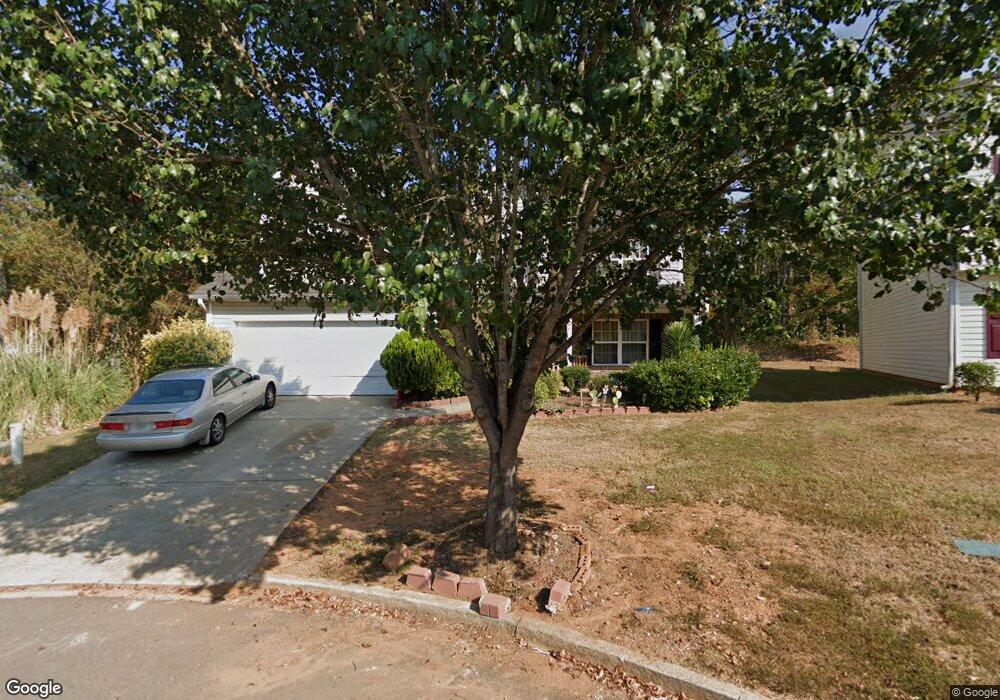
4357 Shoreside Cir Snellville, GA 30039
Estimated Value: $330,000 - $354,000
4
Beds
3
Baths
2,114
Sq Ft
$160/Sq Ft
Est. Value
About This Home
This home is located at 4357 Shoreside Cir, Snellville, GA 30039 and is currently estimated at $337,871, approximately $159 per square foot. 4357 Shoreside Cir is a home located in Gwinnett County with nearby schools including Anderson-Livsey Elementary School, Shiloh Middle School, and Shiloh High School.
Ownership History
Date
Name
Owned For
Owner Type
Purchase Details
Closed on
Feb 5, 2021
Sold by
Umoren Folashade Taiwo
Bought by
Rojas Laeva and Reynolds Wesley
Current Estimated Value
Home Financials for this Owner
Home Financials are based on the most recent Mortgage that was taken out on this home.
Original Mortgage
$227,797
Outstanding Balance
$203,563
Interest Rate
2.65%
Mortgage Type
FHA
Estimated Equity
$134,308
Purchase Details
Closed on
Jul 12, 2006
Sold by
Umoren Uwemedimo Effiong
Bought by
Umoren Folashade Taiwo
Purchase Details
Closed on
May 17, 2004
Sold by
Damascus Homes Llc
Bought by
Umoren Folashade T
Home Financials for this Owner
Home Financials are based on the most recent Mortgage that was taken out on this home.
Original Mortgage
$142,350
Interest Rate
5.77%
Mortgage Type
New Conventional
Create a Home Valuation Report for This Property
The Home Valuation Report is an in-depth analysis detailing your home's value as well as a comparison with similar homes in the area
Home Values in the Area
Average Home Value in this Area
Purchase History
| Date | Buyer | Sale Price | Title Company |
|---|---|---|---|
| Rojas Laeva | $232,000 | -- | |
| Umoren Folashade Taiwo | -- | -- | |
| Umoren Folashade T | $150,900 | -- |
Source: Public Records
Mortgage History
| Date | Status | Borrower | Loan Amount |
|---|---|---|---|
| Open | Rojas Laeva | $227,797 | |
| Previous Owner | Umoren Folashade T | $142,350 |
Source: Public Records
Tax History Compared to Growth
Tax History
| Year | Tax Paid | Tax Assessment Tax Assessment Total Assessment is a certain percentage of the fair market value that is determined by local assessors to be the total taxable value of land and additions on the property. | Land | Improvement |
|---|---|---|---|---|
| 2024 | $4,221 | $131,880 | $25,800 | $106,080 |
| 2023 | $4,221 | $120,840 | $26,000 | $94,840 |
| 2022 | $3,598 | $92,800 | $24,000 | $68,800 |
| 2021 | $3,182 | $80,000 | $13,840 | $66,160 |
| 2020 | $3,199 | $80,000 | $13,840 | $66,160 |
| 2019 | $2,951 | $76,200 | $13,840 | $62,360 |
| 2018 | $2,642 | $67,400 | $13,840 | $53,560 |
| 2016 | $2,090 | $51,120 | $10,000 | $41,120 |
| 2015 | $2,010 | $48,240 | $8,000 | $40,240 |
| 2014 | $2,020 | $48,240 | $8,000 | $40,240 |
Source: Public Records
Map
Nearby Homes
- 4237 Shoreside Cir Unit 1
- 3909 Laurens Ln
- 4211 Crestside Ridge
- 3992 Wrexham Dr
- 4111 Wrexham Dr
- 3885 Laurens Ln
- 4331 Wrexham Ct
- 3915 Laurel Brook Way Unit 2
- 4107 Round Stone Trail
- 4262 Mountain Glen Trace
- 4184 Red Laurel Way
- 4341 Horder Ct
- 4212 Medlock River Ct
- 3845 Laurel Brook Ln
- 4357 James Wade Dr
- 4216 Preserve Trail
- 3926 Yosemite Park Ln
- 4347 Shoreside Cir Unit 2
- 4367 Shoreside Cir Unit 2
- 4337 Shoreside Cir SW
- 4377 Shoreside Cir Unit 2
- 4337 Shoreside Cir
- 4145 Waters End Ln Unit 2
- 4125 Waters End Ln
- 4125 Waters End Ln Unit 2
- 4115 Waters End Ln
- 4356 Shoreside Cir
- 4366 Shoreside Cir Unit 2
- 4336 Shoreside Cir Unit 2
- 4105 Waters End Ln
- 4326 Shoreside Cir
- 4095 Waters End Ln
- 4317 Shoreside Cir
- 4154 Waters End Ln
- 4144 Waters End Ln Unit 2
- 4134 Waters End Ln
- 4124 Waters End Ln