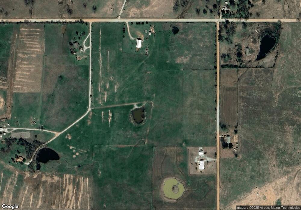
Estimated Value: $155,000 - $225,309
3
Beds
2
Baths
2,960
Sq Ft
$64/Sq Ft
Est. Value
About This Home
This home is located at 435815 E 360 Rd, Adair, OK 74330 and is currently estimated at $190,155, approximately $64 per square foot. 435815 E 360 Rd is a home located in Mayes County with nearby schools including Bernita Hughes Elementary School, Adair Middle School, and Adair High School.
Ownership History
Date
Name
Owned For
Owner Type
Purchase Details
Closed on
Aug 30, 2016
Sold by
Hoyt Virginia Delamater
Bought by
Zacharias Ronnie Zeke and Zacharias Jullane
Current Estimated Value
Purchase Details
Closed on
Jun 3, 2011
Sold by
Oklahoma State Bank
Bought by
Hoyt Virginia D
Purchase Details
Closed on
Mar 7, 2002
Sold by
Schneider Wayne and Schneider Dean
Bought by
Motter Ronald
Purchase Details
Closed on
Nov 17, 2000
Sold by
Gilbert Ragsdale Ranch
Bought by
Schneider Wayne and Schneider Bette
Purchase Details
Closed on
Apr 29, 1997
Sold by
Schneider Wayne
Bought by
Ragsdale, Gilbert Ranch
Purchase Details
Closed on
Sep 1, 1995
Sold by
Bevoni Joyce
Bought by
Schneider Wayne
Create a Home Valuation Report for This Property
The Home Valuation Report is an in-depth analysis detailing your home's value as well as a comparison with similar homes in the area
Home Values in the Area
Average Home Value in this Area
Purchase History
| Date | Buyer | Sale Price | Title Company |
|---|---|---|---|
| Zacharias Ronnie Zeke | $130,000 | None Available | |
| Hoyt Virginia D | $150,000 | None Available | |
| Motter Ronald | $66,000 | -- | |
| Schneider Wayne | $150,000 | -- | |
| Ragsdale, Gilbert Ranch | $100,000 | -- | |
| Schneider Wayne | $50,000 | -- |
Source: Public Records
Tax History Compared to Growth
Tax History
| Year | Tax Paid | Tax Assessment Tax Assessment Total Assessment is a certain percentage of the fair market value that is determined by local assessors to be the total taxable value of land and additions on the property. | Land | Improvement |
|---|---|---|---|---|
| 2023 | $106 | $1,087 | $1,087 | $0 |
| 2022 | $95 | $1,087 | $1,087 | $0 |
| 2021 | $96 | $1,087 | $1,087 | $0 |
| 2020 | $97 | $1,084 | $1,084 | $0 |
| 2019 | $98 | $1,084 | $1,084 | $0 |
| 2018 | $140 | $1,551 | $1,092 | $459 |
| 2017 | $135 | $1,551 | $1,092 | $459 |
| 2016 | $136 | $1,551 | $1,092 | $459 |
| 2015 | $137 | $1,551 | $1,092 | $459 |
| 2014 | $1,350 | $15,313 | $1,140 | $14,173 |
Source: Public Records
Map
Nearby Homes
- 3779 W 360 Rd
- 2 W 360 Rd
- 0 N 435 Rd Unit 2539975
- 0 N 435 Rd Unit 25-1899
- 0 N 435 Rd Unit 2530771
- 3165 W 370 Rd
- 435414 E 350 Rd
- 12387 Highway 69 N
- 000 434 Rd & E 350
- 434525 E 340 Rd
- 438498 E 370 Rd
- N 433 Rd
- 0002 E 330 Rd
- 0 W 390 Rd Unit 2540097
- 433600 E 336 Dr
- 439408 W 370 Rd
- E 3060 Rd
- 439408 E 370 Rd
- 112 Cove
- 8576 N 439 Rd
- 36281 S 436 Rd
- 36308 S 4360 Rd
- 36102 S 4360 Rd
- 436052 E 360 Rd
- 435802 E 360 Rd
- 435755 E 360 Rd
- 435755 E 360 Rd
- 36618 S 4360 Rd
- 435706 E 370 Rd
- 0 S 4360 Rd
- 69 W 360 Rd
- 436506 E 370 Rd
- 435455 E 370 Rd
- 13455 U S 69
- 13455 Highway 69 N
- 13212 Highway 69 N
- 470 E 370 Rd
- 375 E 370 Rd
- 386 E 370 Rd
- 3691 E 350 Rd
