Estimated Value: $108,000 - $177,000
2
Beds
1
Bath
1,372
Sq Ft
$101/Sq Ft
Est. Value
About This Home
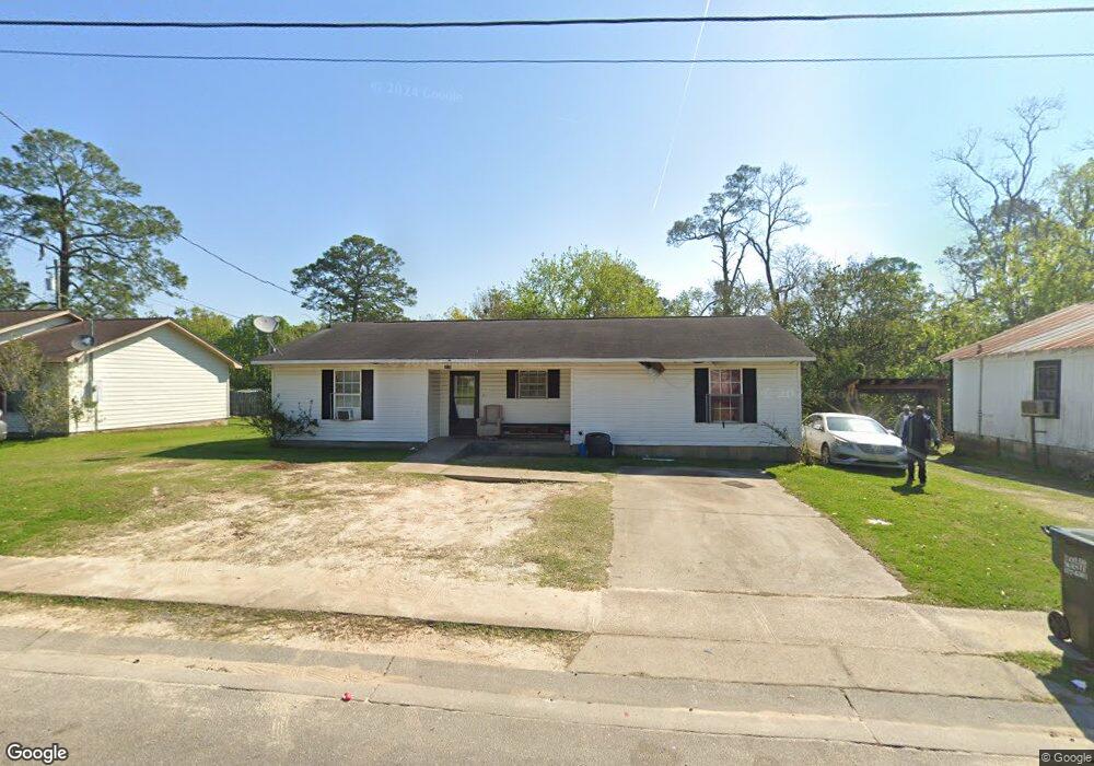
This home is located at 436 1st St NE, Cairo, GA 39828 and is currently estimated at $138,304, approximately $100 per square foot. 436 1st St NE is a home located in Grady County with nearby schools including Cairo High School.
Ownership History
Date
Name
Owned For
Owner Type
Purchase Details
Closed on
Oct 1, 2002
Bought by
Broomfield Charlie Mae
Current Estimated Value
Purchase Details
Closed on
Nov 9, 2001
Sold by
Cairo City Of
Bought by
Thomas Charles A
Purchase Details
Closed on
Jul 23, 2001
Sold by
Thomas Charles A
Bought by
Grady County Habitat
Purchase Details
Closed on
Oct 9, 1996
Sold by
City Of Cairo
Bought by
Cairo City Of
Purchase Details
Closed on
Dec 3, 1957
Bought by
Goar Willie J
Create a Home Valuation Report for This Property
The Home Valuation Report is an in-depth analysis detailing your home's value as well as a comparison with similar homes in the area
Home Values in the Area
Average Home Value in this Area
Purchase History
| Date | Buyer | Sale Price | Title Company |
|---|---|---|---|
| Broomfield Charlie Mae | $40,000 | -- | |
| Thomas Charles A | $3,500 | -- | |
| Grady County Habitat | -- | -- | |
| Cairo City Of | $12,000 | -- | |
| Goar Willie J | -- | -- |
Source: Public Records
Tax History Compared to Growth
Tax History
| Year | Tax Paid | Tax Assessment Tax Assessment Total Assessment is a certain percentage of the fair market value that is determined by local assessors to be the total taxable value of land and additions on the property. | Land | Improvement |
|---|---|---|---|---|
| 2024 | $1,583 | $45,276 | $1,800 | $43,476 |
| 2023 | $1,213 | $38,268 | $2,624 | $35,644 |
| 2022 | $1,270 | $38,268 | $2,624 | $35,644 |
| 2021 | $1,273 | $38,268 | $2,624 | $35,644 |
| 2020 | $1,311 | $38,268 | $2,624 | $35,644 |
| 2019 | $1,310 | $38,268 | $2,624 | $35,644 |
| 2018 | $1,240 | $38,268 | $2,624 | $35,644 |
| 2017 | $1,189 | $38,268 | $2,624 | $35,644 |
| 2016 | $981 | $31,808 | $2,624 | $29,184 |
| 2015 | $971 | $31,808 | $2,624 | $29,184 |
| 2014 | $971 | $31,808 | $2,624 | $29,184 |
| 2013 | -- | $28,131 | $2,624 | $25,507 |
Source: Public Records
Map
Nearby Homes
- 4761 Hadley Ferry Rd
- 125 6th Ave NW
- 2975 U S 84
- 00 00 Hwy 111 South Tract 2
- 220 8th Ave NW
- X 1st St
- 00 Hwy 111 South Tract 1
- 316,322 NW 1st St + Lot
- 0 1st St
- Lot #15, 3 64 Acres Oakbend Cir
- 711 2nd Ave NE
- 309 3rd St SE
- 00 NW 9th Ave
- 000 S Broad St
- 117 6th St SW
- 000 Hwy 111 South 20 59 Acres
- 471 4th St SE
- 40 5th Ave SW
- 00 6th St NW
- 481 4th St SE
- 440 1st St NE
- 214 6th Ave NE
- 201 6th Ave NE
- 435 1st St NE
- 213 6th Ave NE
- 432 1st St NE
- 431 1st St NE
- 191 6th Ave NE
- 106 6th Ave NE
- 426 1st St NE
- 427 1st St NE
- 590 Bell Alley
- 424 Bell Alley
- 181 6th Ave NE
- 420 Bell Alley
- 420 1st St NE
- 630 Bell Alley
- 00 Pebble Brook Gardens Subdivision 21 Properties+lot
- 660 Bell Alley
- 416 1st St NE