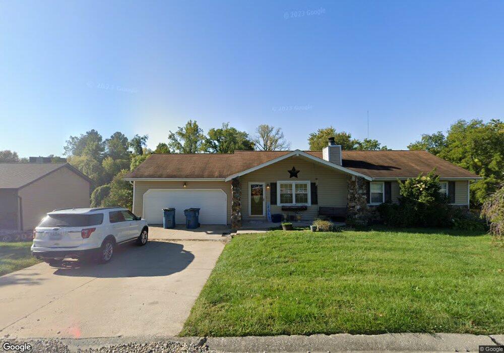
436 Bunker Hill Dr Collinsville, IL 62234
Estimated Value: $262,000 - $310,000
4
Beds
2
Baths
1,334
Sq Ft
$210/Sq Ft
Est. Value
About This Home
This home is located at 436 Bunker Hill Dr, Collinsville, IL 62234 and is currently estimated at $280,628, approximately $210 per square foot. 436 Bunker Hill Dr is a home located in Madison County with nearby schools including John A Renfro Elementary School, Dorris Intermediate School, and Collinsville Middle School.
Ownership History
Date
Name
Owned For
Owner Type
Purchase Details
Closed on
Apr 23, 2010
Sold by
Miresse Steven A and Miresse Lisa A
Bought by
Ford Ronald
Current Estimated Value
Home Financials for this Owner
Home Financials are based on the most recent Mortgage that was taken out on this home.
Original Mortgage
$169,375
Outstanding Balance
$114,198
Interest Rate
5.25%
Mortgage Type
FHA
Estimated Equity
$166,430
Purchase Details
Closed on
Jan 1, 2004
Sold by
Bank One Na
Bought by
Miresse Steven A and Miresse Lisa A
Home Financials for this Owner
Home Financials are based on the most recent Mortgage that was taken out on this home.
Original Mortgage
$125,305
Interest Rate
5.91%
Mortgage Type
Purchase Money Mortgage
Purchase Details
Closed on
Sep 19, 2003
Sold by
Williams Marva
Bought by
Bank One Na
Create a Home Valuation Report for This Property
The Home Valuation Report is an in-depth analysis detailing your home's value as well as a comparison with similar homes in the area
Home Values in the Area
Average Home Value in this Area
Purchase History
| Date | Buyer | Sale Price | Title Company |
|---|---|---|---|
| Ford Ronald | $172,500 | Abstracts & Titles Inc | |
| Miresse Steven A | $132,000 | Fatic | |
| Bank One Na | -- | -- |
Source: Public Records
Mortgage History
| Date | Status | Borrower | Loan Amount |
|---|---|---|---|
| Open | Ford Ronald | $169,375 | |
| Previous Owner | Miresse Steven A | $125,305 |
Source: Public Records
Tax History Compared to Growth
Tax History
| Year | Tax Paid | Tax Assessment Tax Assessment Total Assessment is a certain percentage of the fair market value that is determined by local assessors to be the total taxable value of land and additions on the property. | Land | Improvement |
|---|---|---|---|---|
| 2024 | $4,443 | $75,490 | $14,650 | $60,840 |
| 2023 | $4,443 | $68,820 | $13,330 | $55,490 |
| 2022 | $4,134 | $63,640 | $12,330 | $51,310 |
| 2021 | $3,716 | $59,790 | $11,580 | $48,210 |
| 2020 | $3,563 | $57,050 | $11,050 | $46,000 |
| 2019 | $3,265 | $52,400 | $10,310 | $42,090 |
| 2018 | $3,178 | $49,640 | $9,770 | $39,870 |
| 2017 | $3,174 | $48,660 | $9,580 | $39,080 |
| 2016 | $3,334 | $48,660 | $9,580 | $39,080 |
| 2015 | $3,485 | $47,390 | $9,330 | $38,060 |
| 2014 | $3,485 | $47,390 | $9,330 | $38,060 |
| 2013 | $3,485 | $47,390 | $9,330 | $38,060 |
Source: Public Records
Map
Nearby Homes
- 22 Brookwood Dr
- 414 Bunker Hill Dr
- 5 Brookwood Dr
- 1224 Cedar Ridge Ct
- 2007 Belt Line Rd
- 10 White Lily Dr
- 1121 Carraway Ct
- 0 N Keebler Ave
- 1059 Lafayette Ct Unit A
- 1035 Lafayette Ct Unit B
- 1051 Lafayette Ct Unit A
- 123 Elliot St
- 203 Greenfield Dr
- 308 Brown Ave
- 0 Strong Ave
- 1120 Williams St
- 617 N Morrison Ave
- 123 W Wickliffe Ave
- 1210 Constance St
- 580 N Guernsey St
- 438 Bunker Hill Dr
- 434 Bunker Hill Dr
- 432 Bunker Hill Dr
- 423 Bunker Hill Dr
- 440 Bunker Hill Dr
- 425 Bunker Hill Dr
- 427 Bunker Hill Dr
- 302 Monticello Dr
- 430 Bunker Hill Dr
- 308 Monticello Dr
- 200 Omega Dr
- 419 Bunker Hill Dr
- 428 Bunker Hill Dr
- 310 Monticello Dr
- 19 Brookwood Dr
- 307 Monticello Dr
- 309 Monticello Dr
- 420 Chapel Dr
- 16 Delta Dr
- 303 Monticello Dr