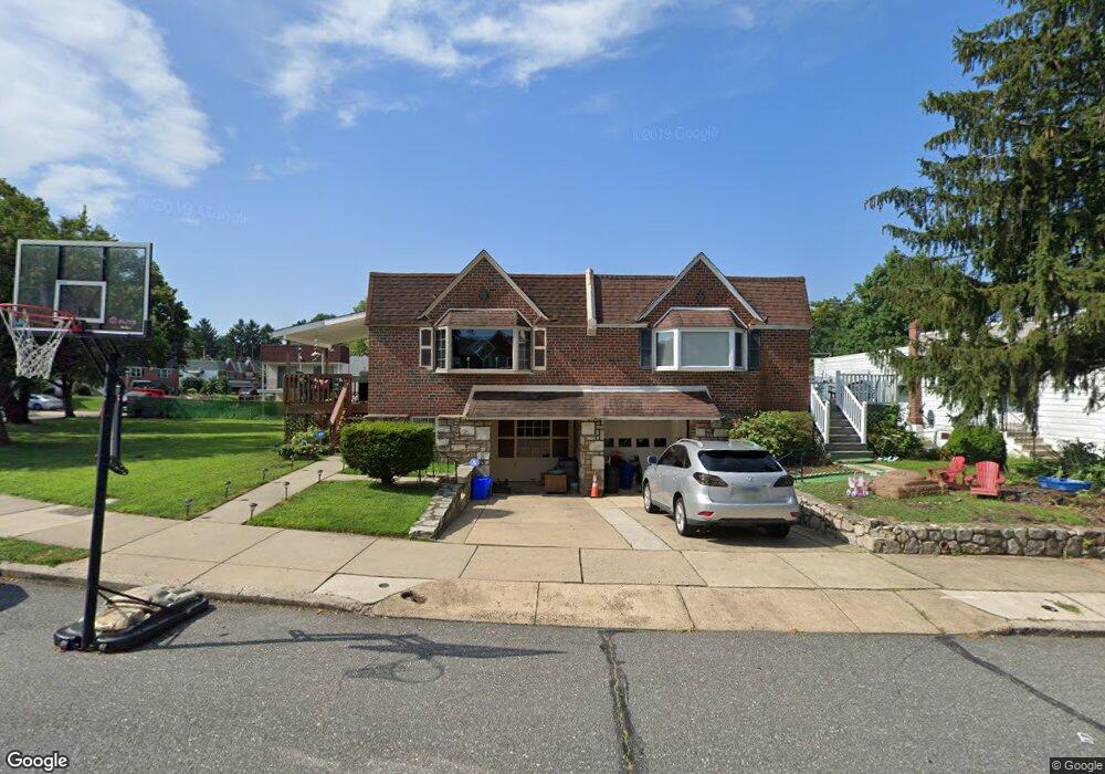
436 Densmore St Philadelphia, PA 19116
Somerton NeighborhoodEstimated Value: $372,000 - $383,000
--
Bed
--
Bath
1,200
Sq Ft
$315/Sq Ft
Est. Value
About This Home
This home is located at 436 Densmore St, Philadelphia, PA 19116 and is currently estimated at $377,447, approximately $314 per square foot. 436 Densmore St is a home located in Philadelphia County with nearby schools including Watson Comly School, CCA Baldi Middle School, and George Washington High School.
Ownership History
Date
Name
Owned For
Owner Type
Purchase Details
Closed on
Aug 7, 2018
Sold by
Fridman Edward
Bought by
Fridman Edward and Friedman Michael
Current Estimated Value
Purchase Details
Closed on
Aug 24, 2001
Sold by
Alfimow Valerick Edward and Alfimow Igor Walter
Bought by
Fridman Edward and Fridman Klara
Home Financials for this Owner
Home Financials are based on the most recent Mortgage that was taken out on this home.
Original Mortgage
$62,000
Outstanding Balance
$24,028
Interest Rate
7.06%
Estimated Equity
$353,419
Purchase Details
Closed on
Jan 31, 2001
Sold by
Alfimow Igor Walter and Estate Of Nadja Alfimow
Bought by
Alfimow Valerik Edward and Alfimow Igor Walter
Create a Home Valuation Report for This Property
The Home Valuation Report is an in-depth analysis detailing your home's value as well as a comparison with similar homes in the area
Home Values in the Area
Average Home Value in this Area
Purchase History
| Date | Buyer | Sale Price | Title Company |
|---|---|---|---|
| Fridman Edward | -- | None Available | |
| Fridman Edward | $96,000 | -- | |
| Alfimow Valerik Edward | -- | -- |
Source: Public Records
Mortgage History
| Date | Status | Borrower | Loan Amount |
|---|---|---|---|
| Open | Fridman Edward | $62,000 |
Source: Public Records
Tax History Compared to Growth
Tax History
| Year | Tax Paid | Tax Assessment Tax Assessment Total Assessment is a certain percentage of the fair market value that is determined by local assessors to be the total taxable value of land and additions on the property. | Land | Improvement |
|---|---|---|---|---|
| 2025 | $3,725 | $343,900 | $68,780 | $275,120 |
| 2024 | $3,725 | $343,900 | $68,780 | $275,120 |
| 2023 | $3,725 | $266,100 | $53,220 | $212,880 |
| 2022 | $2,382 | $221,100 | $53,220 | $167,880 |
| 2021 | $3,012 | $0 | $0 | $0 |
| 2020 | $3,012 | $0 | $0 | $0 |
| 2019 | $2,836 | $0 | $0 | $0 |
| 2018 | $2,249 | $0 | $0 | $0 |
| 2017 | $2,669 | $0 | $0 | $0 |
| 2016 | $2,249 | $0 | $0 | $0 |
| 2015 | $2,153 | $0 | $0 | $0 |
| 2014 | -- | $190,700 | $86,112 | $104,588 |
| 2012 | -- | $26,144 | $3,376 | $22,768 |
Source: Public Records
Map
Nearby Homes
- 11715 Jeanes St
- 11722 Audubon Ave
- 11243 Jeanes Place
- 509 Larkspur St
- 11992 Lockart Rd
- 166 Rennard St
- 11022 Ferndale St
- 11169 Hendrix St
- 11012 Audubon Ave
- 300 Byberry Rd Unit 303
- 133 Gardner St
- 290 Byberry Rd Unit 18
- 11990 Rennard St
- 375 Avon St
- 807 Larkspur St
- 301 Byberry Rd Unit F7
- 301 Byberry Rd Unit H10
- 808 Densmore Rd
- 11008 Proctor Rd
- 10922 Lockart Rd
- 434 Densmore St
- 434 Densmore Rd
- 438 Densmore St
- 432 Densmore St
- 430 Densmore St
- 437 Regina St
- 435 Regina St
- 439 Regina St
- 433 Regina St
- 441 Regina St
- 428 Densmore St
- 431 Regina St
- 439 Densmore Rd
- 439 Densmore St
- 437 Densmore St
- 441 Densmore St
- 429 Regina St
- 435 Densmore St
- 441 Densmore Rd
- 426 Densmore St