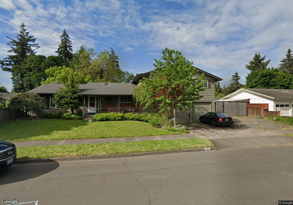
436 Durham Ave Eugene, OR 97404
Santa Clara NeighborhoodEstimated Value: $523,000 - $535,000
4
Beds
3
Baths
2,088
Sq Ft
$254/Sq Ft
Est. Value
About This Home
This home is located at 436 Durham Ave, Eugene, OR 97404 and is currently estimated at $530,154, approximately $253 per square foot. 436 Durham Ave is a home located in Lane County with nearby schools including Spring Creek Elementary School, Madison Middle School, and North Eugene High School.
Ownership History
Date
Name
Owned For
Owner Type
Purchase Details
Closed on
Dec 31, 2012
Sold by
Stone Financing Llc
Bought by
White Trevor A and White Julia R
Current Estimated Value
Home Financials for this Owner
Home Financials are based on the most recent Mortgage that was taken out on this home.
Original Mortgage
$184,500
Outstanding Balance
$127,009
Interest Rate
3.31%
Mortgage Type
New Conventional
Estimated Equity
$403,145
Purchase Details
Closed on
Nov 17, 2012
Sold by
Mam Yossa M
Bought by
Stone Financing Llc
Home Financials for this Owner
Home Financials are based on the most recent Mortgage that was taken out on this home.
Original Mortgage
$184,500
Outstanding Balance
$127,009
Interest Rate
3.31%
Mortgage Type
New Conventional
Estimated Equity
$403,145
Purchase Details
Closed on
Nov 22, 2010
Sold by
Rund Warren L and Rund Sheilah J
Bought by
Mam Yossa M
Home Financials for this Owner
Home Financials are based on the most recent Mortgage that was taken out on this home.
Original Mortgage
$193,955
Interest Rate
4.16%
Mortgage Type
FHA
Purchase Details
Closed on
Jul 20, 2007
Sold by
Murison Gavin C
Bought by
Rund Warren L and Rund Sheilah J
Home Financials for this Owner
Home Financials are based on the most recent Mortgage that was taken out on this home.
Original Mortgage
$294,405
Interest Rate
6.66%
Mortgage Type
Purchase Money Mortgage
Purchase Details
Closed on
Dec 12, 2005
Sold by
Murison Gavin C and Murison Elizabeth A
Bought by
Murison Gavin C
Home Financials for this Owner
Home Financials are based on the most recent Mortgage that was taken out on this home.
Original Mortgage
$248,000
Interest Rate
6.31%
Mortgage Type
New Conventional
Purchase Details
Closed on
Sep 25, 2001
Sold by
Bennett James C and Bennett Sally L
Bought by
Murison Gavin C and Murison Elizabeth A
Home Financials for this Owner
Home Financials are based on the most recent Mortgage that was taken out on this home.
Original Mortgage
$165,300
Interest Rate
6.9%
Create a Home Valuation Report for This Property
The Home Valuation Report is an in-depth analysis detailing your home's value as well as a comparison with similar homes in the area
Home Values in the Area
Average Home Value in this Area
Purchase History
| Date | Buyer | Sale Price | Title Company |
|---|---|---|---|
| White Trevor A | $205,000 | Evergreen Land Title Co | |
| Stone Financing Llc | $205,000 | Evergreen Land Title Company | |
| Mam Yossa M | $199,000 | Western Title & Escrow | |
| Rund Warren L | $309,900 | First American Title | |
| Murison Gavin C | -- | Western Title & Escrow Compa | |
| Murison Gavin C | $174,000 | Fidelity National Title Ins |
Source: Public Records
Mortgage History
| Date | Status | Borrower | Loan Amount |
|---|---|---|---|
| Open | White Trevor A | $184,500 | |
| Previous Owner | Mam Yossa M | $193,955 | |
| Previous Owner | Rund Warren L | $294,405 | |
| Previous Owner | Murison Gavin C | $248,000 | |
| Previous Owner | Murison Gavin C | $165,300 |
Source: Public Records
Tax History
| Year | Tax Paid | Tax Assessment Tax Assessment Total Assessment is a certain percentage of the fair market value that is determined by local assessors to be the total taxable value of land and additions on the property. | Land | Improvement |
|---|---|---|---|---|
| 2025 | $3,964 | $309,763 | -- | -- |
| 2024 | $3,944 | $300,741 | -- | -- |
| 2023 | $3,944 | $291,982 | $0 | $0 |
| 2022 | $3,707 | $283,478 | $0 | $0 |
| 2021 | $3,401 | $275,222 | $0 | $0 |
| 2020 | $3,465 | $267,206 | $0 | $0 |
| 2019 | $3,336 | $259,424 | $0 | $0 |
| 2018 | $3,044 | $244,532 | $0 | $0 |
| 2017 | $2,815 | $244,532 | $0 | $0 |
| 2016 | $2,681 | $237,410 | $0 | $0 |
| 2015 | $2,564 | $230,495 | $0 | $0 |
| 2014 | $2,426 | $223,782 | $0 | $0 |
Source: Public Records
Map
Nearby Homes
- 303 Lenore Loop
- 2563 York St
- 401 Sterling Dr
- 349 Irving Rd
- 215 Jonquil Ave
- 193 Santa Clara Ave
- 200 Irving Rd
- 2740 Stark St
- 1755 Brentwood Ave
- 1880 Manihi Dr
- 2937 Stark St
- 2488 Northampton
- 190 Hunsaker Ln
- 1682 Hemlock St
- 3007 River Rd
- 2923 Maranta St
- 835 Bobolink Ave
- 389 Maxwell Rd
- 1384 David Ave
- 190 River Loop 1
- 452 Durham Ave
- 2450 Leyton Ln
- 439 Heywood Ave
- 425 Heywood Ave
- 427 Durham Ave
- 468 Durham Ave
- 441 Durham Ave
- 411 Durham Ave
- 453 Heywood Ave
- 380 Durham Ave
- 411 Heywood Ave
- 484 Durham Ave
- 467 Heywood Ave
- 385 Ruby Ave
- 389 Durham Ave
- 398 Santa Clara Ave
- 424 Santa Clara Ave
- 2425 Leyton Ln
- 473 Durham Ave
- 382 Santa Clara Ave
Your Personal Tour Guide
Ask me questions while you tour the home.