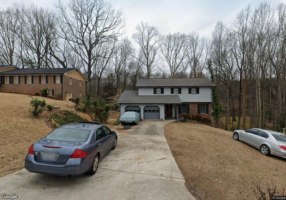
436 Landmark Way Austell, GA 30168
Estimated Value: $294,302 - $378,000
3
Beds
2
Baths
1,932
Sq Ft
$167/Sq Ft
Est. Value
About This Home
This home is located at 436 Landmark Way, Austell, GA 30168 and is currently estimated at $323,326, approximately $167 per square foot. 436 Landmark Way is a home located in Cobb County with nearby schools including Riverside Primary School, Lindley Middle School, and Pebblebrook High School.
Ownership History
Date
Name
Owned For
Owner Type
Purchase Details
Closed on
Apr 2, 1993
Sold by
Shopf Scott G
Bought by
Farley Jeffery L Tracy
Current Estimated Value
Home Financials for this Owner
Home Financials are based on the most recent Mortgage that was taken out on this home.
Original Mortgage
$83,172
Interest Rate
7.57%
Mortgage Type
FHA
Create a Home Valuation Report for This Property
The Home Valuation Report is an in-depth analysis detailing your home's value as well as a comparison with similar homes in the area
Home Values in the Area
Average Home Value in this Area
Purchase History
| Date | Buyer | Sale Price | Title Company |
|---|---|---|---|
| Farley Jeffery L Tracy | $84,500 | -- |
Source: Public Records
Mortgage History
| Date | Status | Borrower | Loan Amount |
|---|---|---|---|
| Closed | Farley Jeffery L Tracy | $83,172 |
Source: Public Records
Tax History Compared to Growth
Tax History
| Year | Tax Paid | Tax Assessment Tax Assessment Total Assessment is a certain percentage of the fair market value that is determined by local assessors to be the total taxable value of land and additions on the property. | Land | Improvement |
|---|---|---|---|---|
| 2025 | $610 | $136,688 | $22,000 | $114,688 |
| 2024 | $2,243 | $102,640 | $14,000 | $88,640 |
| 2023 | $1,701 | $102,640 | $14,000 | $88,640 |
| 2022 | $1,814 | $82,172 | $8,000 | $74,172 |
| 2021 | $997 | $44,868 | $4,800 | $40,068 |
| 2020 | $997 | $44,868 | $4,800 | $40,068 |
| 2019 | $997 | $44,868 | $4,800 | $40,068 |
| 2018 | $997 | $44,868 | $4,800 | $40,068 |
| 2017 | $896 | $41,924 | $4,800 | $37,124 |
| 2016 | $758 | $35,592 | $4,800 | $30,792 |
| 2015 | $778 | $35,592 | $4,800 | $30,792 |
| 2014 | $784 | $35,592 | $0 | $0 |
Source: Public Records
Map
Nearby Homes
- 6914 Fairway Trail
- 6837 Shenandoah Trail
- 306 Bonnes Dr
- 7010 Oakhill Cir
- 7074 Oakhill Cir
- 7066 Oakhill Cir
- 6649 Valley Hill Dr SW
- 6650 Valley Hill Dr SW
- 7080 Fringe Flower Dr Unit 18
- 760 Wade Farm Dr
- 7282 Rockhouse Rd Unit 5
- 761 Knox Springs Rd
- 295 Sweetshrub Dr Unit 2
- 7224 Kings Cove Unit 10
- Foxglove Plan at Leydenview
- Marigold Plan at Leydenview
- 361 Gordon Valley Ln SW
- 6722 Armonia Dr
- 6874 Bridgewood Dr
- 6714 Armonia Dr
- 428 Landmark Way
- 500 Landmark Way
- 473 Landmark Way
- 463 Landmark Way
- 6869 Keith Ave
- 483 Landmark Way
- 510 Landmark Way
- 493 Landmark Way
- 6901 Richard Ln
- 6911 Richard Ln
- 6926 Fairway Trail
- 6913 Fairway Trail
- 6910 Keith Ave
- 6843 Keith Ave
- 6938 Fairway Trail
- 6860 Keith Ave
- 0 Richard Ln Unit 3122339
- 0 Richard Ln Unit 3181957
- 0 Richard Ln Unit 3181954
- 6919 Fairway Trail