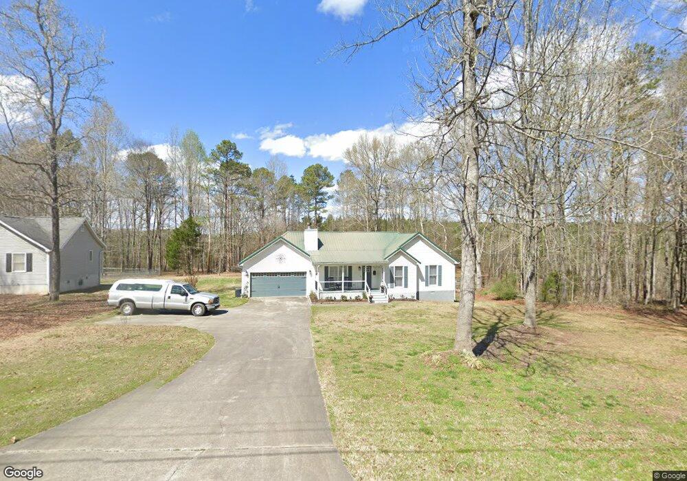
436 Michael Blvd Cedartown, GA 30125
Estimated Value: $212,876 - $262,000
3
Beds
2
Baths
1,012
Sq Ft
$237/Sq Ft
Est. Value
About This Home
This home is located at 436 Michael Blvd, Cedartown, GA 30125 and is currently estimated at $240,219, approximately $237 per square foot. 436 Michael Blvd is a home located in Polk County.
Ownership History
Date
Name
Owned For
Owner Type
Purchase Details
Closed on
Jul 22, 2020
Sold by
Cassel Kenneth P
Bought by
Cassel Kenneth P and Cassel Jennifer
Current Estimated Value
Purchase Details
Closed on
Sep 26, 2001
Sold by
Robinson Jason and Gwen Robinson F
Bought by
Cassel Kenneth P
Purchase Details
Closed on
Jan 11, 1999
Sold by
Montgomery Thomas L
Bought by
Robinson Jason and Kelly Gwen M
Purchase Details
Closed on
Sep 30, 1998
Sold by
Liverant Jacob
Bought by
Montgomery Thomas L
Purchase Details
Closed on
Apr 14, 1995
Sold by
Igel Stanley
Bought by
Igel Stanley Living Trust (Stanley Igel
Purchase Details
Closed on
Oct 30, 1973
Sold by
Adams Charles W
Bought by
Igel Stanley
Create a Home Valuation Report for This Property
The Home Valuation Report is an in-depth analysis detailing your home's value as well as a comparison with similar homes in the area
Home Values in the Area
Average Home Value in this Area
Purchase History
| Date | Buyer | Sale Price | Title Company |
|---|---|---|---|
| Cassel Kenneth P | -- | -- | |
| Cassel Kenneth P | $100,000 | -- | |
| Robinson Jason | $89,900 | -- | |
| Montgomery Thomas L | $4,000 | -- | |
| Igel Stanley Living Trust (Stanley Igel | -- | -- | |
| Igel Stanley | -- | -- |
Source: Public Records
Tax History Compared to Growth
Tax History
| Year | Tax Paid | Tax Assessment Tax Assessment Total Assessment is a certain percentage of the fair market value that is determined by local assessors to be the total taxable value of land and additions on the property. | Land | Improvement |
|---|---|---|---|---|
| 2024 | $1,665 | $81,664 | $16,000 | $65,664 |
| 2023 | $1,372 | $59,793 | $16,000 | $43,793 |
| 2022 | $1,086 | $47,766 | $4,160 | $43,606 |
| 2021 | $1,100 | $47,766 | $4,160 | $43,606 |
| 2020 | $1,102 | $47,766 | $4,160 | $43,606 |
| 2019 | $1,054 | $41,235 | $4,000 | $37,235 |
| 2018 | $1,051 | $40,144 | $4,000 | $36,144 |
| 2017 | $1,038 | $40,144 | $4,000 | $36,144 |
| 2016 | $1,038 | $40,144 | $4,000 | $36,144 |
| 2015 | $1,047 | $40,355 | $4,000 | $36,355 |
| 2014 | $922 | $35,532 | $4,616 | $30,916 |
Source: Public Records
Map
Nearby Homes
- 424 Michael Blvd
- 383 Valley Grove Rd
- 100 Lee Ave
- 0 Cave Spring Rd Unit 10631588
- 0 Cave Spring Rd Unit 7671027
- 600 Miller Rd
- 1200 N Cave Spring St
- 727 Cherokee Rd
- 217 Cherokee Cir
- 88 Sequoyah Ct
- 39 Summerwind Dr
- 208 Silverthorn Way
- LOT 21 Cherokee Cir
- 828 N College Dr
- 113 Cherokee Estates Dr
- 621 N College Dr
- 00 Oak Crest Dr
- 0 Collins Rd Unit 10627302
- 232 Stephens Rd
- 521 W John Hand Rd
- 442 Michael Blvd
- 421 Michael Blvd
- 0 Michael Blvd
- 0 Michael Blvd Unit 7554775
- 0 Michael Blvd Unit 7452611
- 0 Michael Blvd Unit 8667105
- 412 Michael Blvd
- 403 Michael Blvd
- 491 Michael Blvd
- 476 Michael Blvd
- 401 Michael Blvd
- 519 Michael Blvd
- 391 Michael Blvd
- 23 Paula Ct
- 522 Michael Blvd
- 21 Paula Ct
- 41 Paula Ct
- 591 Michael Blvd
- 480 Michael Blvd
- 24 Paula Ct