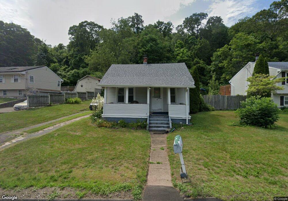
436 N High St East Haven, CT 06512
Estimated Value: $276,568 - $349,000
2
Beds
1
Bath
979
Sq Ft
$309/Sq Ft
Est. Value
About This Home
This home is located at 436 N High St, East Haven, CT 06512 and is currently estimated at $302,892, approximately $309 per square foot. 436 N High St is a home located in New Haven County with nearby schools including East Haven High School and Pathway School.
Ownership History
Date
Name
Owned For
Owner Type
Purchase Details
Closed on
Jun 4, 1999
Sold by
Thompson Paul and Werbiski Peter J
Bought by
Wambolt Cheryl A
Current Estimated Value
Purchase Details
Closed on
Jan 4, 1999
Sold by
Fhlmc
Bought by
Werbiski Peter J and Thompson Paul
Purchase Details
Closed on
Jul 14, 1988
Sold by
Renker David A
Bought by
Fournier Kenneth P
Create a Home Valuation Report for This Property
The Home Valuation Report is an in-depth analysis detailing your home's value as well as a comparison with similar homes in the area
Home Values in the Area
Average Home Value in this Area
Purchase History
| Date | Buyer | Sale Price | Title Company |
|---|---|---|---|
| Wambolt Cheryl A | $65,000 | -- | |
| Werbiski Peter J | $25,000 | -- | |
| Fournier Kenneth P | $113,000 | -- |
Source: Public Records
Mortgage History
| Date | Status | Borrower | Loan Amount |
|---|---|---|---|
| Open | Fournier Kenneth P | $63,014 | |
| Open | Fournier Kenneth P | $216,956 | |
| Closed | Fournier Kenneth P | $175,200 |
Source: Public Records
Tax History Compared to Growth
Tax History
| Year | Tax Paid | Tax Assessment Tax Assessment Total Assessment is a certain percentage of the fair market value that is determined by local assessors to be the total taxable value of land and additions on the property. | Land | Improvement |
|---|---|---|---|---|
| 2025 | $3,654 | $109,270 | $43,890 | $65,380 |
| 2024 | $3,654 | $109,270 | $43,890 | $65,380 |
| 2023 | $3,409 | $109,270 | $43,890 | $65,380 |
| 2022 | $3,409 | $109,270 | $43,890 | $65,380 |
| 2021 | $3,141 | $91,720 | $41,610 | $50,110 |
| 2020 | $3,141 | $91,720 | $41,610 | $50,110 |
| 2019 | $2,974 | $91,720 | $41,610 | $50,110 |
| 2018 | $2,976 | $91,720 | $41,610 | $50,110 |
| 2017 | $2,894 | $91,720 | $41,610 | $50,110 |
| 2016 | $3,119 | $98,850 | $42,590 | $56,260 |
| 2015 | $3,119 | $98,850 | $42,590 | $56,260 |
| 2014 | $3,168 | $98,850 | $42,590 | $56,260 |
Source: Public Records
Map
Nearby Homes
- 172 Laurel St
- 300 Bradley St
- 111 & 111A Laurel St
- 237 N High St
- 36 Ralphs Ln
- 547 Laurel St
- 83 Hudson St
- 83 View Terrace
- 93 Kimberly Ave
- 275 Grannis St
- 153 Grannis St
- 304 Golf Dr Unit 304
- 71 High St
- 17 Guilford Ct
- 211 Kimberly Ave
- 39 High St
- 74 Milton St
- 121 Lexington Ave Unit 21
- 83 Bradley Ave
- 216B Cosey Beach Ave