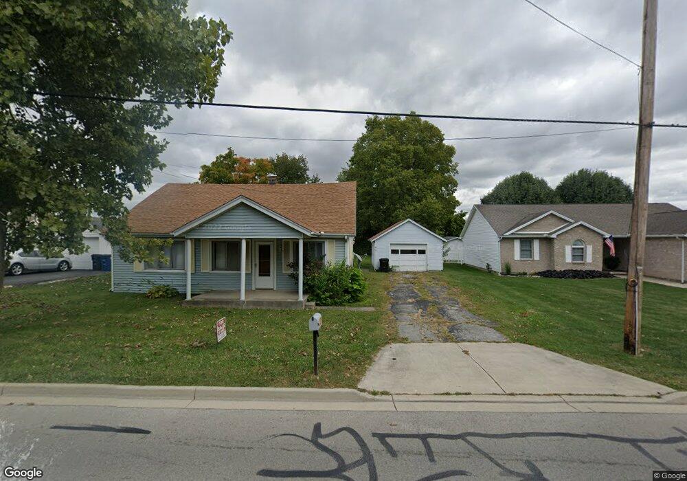
436 N Nelson Ave Wilmington, OH 45177
Estimated Value: $161,373 - $274,000
2
Beds
1
Bath
1,089
Sq Ft
$202/Sq Ft
Est. Value
About This Home
This home is located at 436 N Nelson Ave, Wilmington, OH 45177 and is currently estimated at $220,093, approximately $202 per square foot. 436 N Nelson Ave is a home located in Clinton County with nearby schools including East End Elementary School, Roy E. Holmes Elementary School, and Denver Place Elementary School.
Ownership History
Date
Name
Owned For
Owner Type
Purchase Details
Closed on
Feb 23, 2024
Sold by
Haught Family Trust and Haught Frederick E
Bought by
Wilmington Rentals Llc
Current Estimated Value
Home Financials for this Owner
Home Financials are based on the most recent Mortgage that was taken out on this home.
Original Mortgage
$1,545,093
Interest Rate
3%
Mortgage Type
Construction
Purchase Details
Closed on
Jan 1, 1990
Bought by
Haught Fred
Create a Home Valuation Report for This Property
The Home Valuation Report is an in-depth analysis detailing your home's value as well as a comparison with similar homes in the area
Home Values in the Area
Average Home Value in this Area
Purchase History
| Date | Buyer | Sale Price | Title Company |
|---|---|---|---|
| Wilmington Rentals Llc | $3,348,333 | None Listed On Document | |
| Haught Fred | -- | -- |
Source: Public Records
Mortgage History
| Date | Status | Borrower | Loan Amount |
|---|---|---|---|
| Closed | Wilmington Rentals Llc | $1,545,093 |
Source: Public Records
Tax History Compared to Growth
Tax History
| Year | Tax Paid | Tax Assessment Tax Assessment Total Assessment is a certain percentage of the fair market value that is determined by local assessors to be the total taxable value of land and additions on the property. | Land | Improvement |
|---|---|---|---|---|
| 2024 | $1,334 | $38,720 | $8,720 | $30,000 |
| 2023 | $1,334 | $38,720 | $8,720 | $30,000 |
| 2022 | $1,417 | $24,860 | $4,670 | $20,190 |
| 2021 | $921 | $24,860 | $4,670 | $20,190 |
| 2020 | $866 | $24,860 | $4,670 | $20,190 |
| 2019 | $817 | $21,410 | $4,030 | $17,380 |
| 2018 | $825 | $21,410 | $4,030 | $17,380 |
| 2017 | $401 | $21,410 | $4,030 | $17,380 |
| 2016 | $827 | $21,790 | $6,350 | $15,440 |
| 2015 | $814 | $21,790 | $6,350 | $15,440 |
| 2013 | $807 | $21,370 | $6,350 | $15,020 |
Source: Public Records
Map
Nearby Homes
- 1244 Mayfair Dr
- 585 Silverado Dr
- 629 Oakridge Dr
- 909 W Main St
- 987 N Nelson Ave
- 423 Howard St
- 12 Peterson Place
- 373 Thorne Ave
- 584 Howard St
- 360 Summit St
- 62 Gallup St
- 493 Mitchell Rd
- 49 S Wood St
- 146 N Spring St
- 136 N Spring St
- 157 Indiana Ave
- 0 US Route 68 Unit 1831183
- 1253 Us Route 68
- 0 US Route 68 Unit 1792385
- 149 W Truesdell St
- 424 N Nelson Ave
- 456 N Nelson Ave
- 1320 Peggy Ln
- 410 N Nelson Ave
- 1359 Lanyard Ln
- 1304 Peggy Ln
- 1349 Lanyard Ln
- 1707 Woodside Dr
- 465 N Nelson Ave
- 1325 Peggy Ln
- 1337 Peggy Ln
- 1335 Lanyard Ln
- 1311 Peggy Ln
- 1288 Peggy Ln
- 1299 Peggy Ln
- 1697 Woodside Dr
- 380 N Nelson Ave
- 485 N Nelson Ave
- 1323 Lanyard Ln
- 1677 Woodside Dr