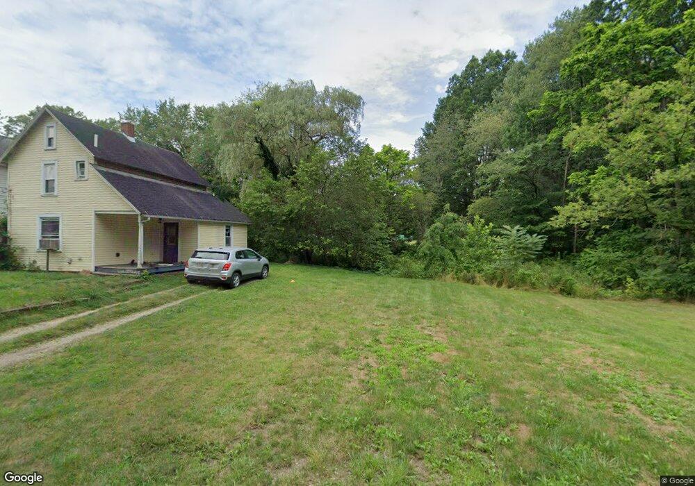
436 N Rockhill Ave Alliance, OH 44601
Estimated Value: $45,000
3
Beds
1
Bath
1,064
Sq Ft
$42/Sq Ft
Est. Value
About This Home
This home is located at 436 N Rockhill Ave, Alliance, OH 44601 and is currently priced at $45,000, approximately $42 per square foot. 436 N Rockhill Ave is a home located in Stark County with nearby schools including Alliance Early Learning School, Alliance Intermediate School at Northside, and Alliance Middle School.
Ownership History
Date
Name
Owned For
Owner Type
Purchase Details
Closed on
May 30, 2024
Sold by
Stark County Land Reutilization Corporat
Bought by
City Of Alliance Land Reutilization Program and Alliance Land Reutilizati
Current Estimated Value
Purchase Details
Closed on
Jun 21, 2019
Sold by
Stark County Land Reutilization Corp
Bought by
Stark Cnty Regional Planning Commission
Purchase Details
Closed on
Mar 12, 2018
Sold by
Brush Larry and Brush Larry
Bought by
Stark County Land Reutilization Corporat
Purchase Details
Closed on
Jan 11, 2005
Sold by
Household Finance Corp
Bought by
Brush Larry
Purchase Details
Closed on
Jul 2, 2004
Sold by
Marshall Bruce D
Bought by
Household Finance Corp
Purchase Details
Closed on
Dec 3, 1990
Create a Home Valuation Report for This Property
The Home Valuation Report is an in-depth analysis detailing your home's value as well as a comparison with similar homes in the area
Home Values in the Area
Average Home Value in this Area
Purchase History
| Date | Buyer | Sale Price | Title Company |
|---|---|---|---|
| City Of Alliance Land Reutilization Program | -- | None Listed On Document | |
| Stark Cnty Regional Planning Commission | -- | None Available | |
| Stark County Land Reutilization Corporat | -- | None Available | |
| Brush Larry | $16,500 | -- | |
| Household Finance Corp | $32,000 | -- | |
| -- | $9,300 | -- |
Source: Public Records
Tax History Compared to Growth
Tax History
| Year | Tax Paid | Tax Assessment Tax Assessment Total Assessment is a certain percentage of the fair market value that is determined by local assessors to be the total taxable value of land and additions on the property. | Land | Improvement |
|---|---|---|---|---|
| 2025 | -- | $4,100 | $4,100 | -- |
| 2024 | -- | $4,660 | $4,660 | -- |
| 2023 | $0 | $2,140 | $2,140 | $0 |
| 2022 | $181 | $2,140 | $2,140 | $0 |
| 2021 | $181 | $2,140 | $2,140 | $0 |
| 2020 | -- | $2,070 | $2,070 | $0 |
| 2019 | $279 | $8,970 | $4,100 | $4,870 |
| 2018 | $1,064 | $8,970 | $4,100 | $4,870 |
| 2017 | $6,440 | $8,050 | $3,990 | $4,060 |
| 2016 | $6,152 | $8,050 | $3,990 | $4,060 |
| 2015 | $533 | $11,130 | $3,990 | $7,140 |
| 2014 | $502 | $10,470 | $3,750 | $6,720 |
| 2013 | $500 | $10,470 | $3,750 | $6,720 |
Source: Public Records
Map
Nearby Homes
- 511 W Ely St
- 329 1/2 W Main St
- 432 Johnson Ave
- 345 W Market St
- 000 Meadowbrook Ave
- 163 W Market St
- 132 S Haines Ave
- 0 Meadowbrook Ave
- 000 Klinger Ave
- 710 N Freedom Ave
- 124 E Wayne St
- 608 N Freedom Ave
- 0 Homestead Ave NE
- 645 W Summit St
- 725 W Summit St
- 427 S Union Ave
- 734 Parkway Blvd
- 0 Johnson Ave NE Unit 5142926
- 140 W Summit St
- 361 E Main St
- 428 N Rockhill Ave
- 414 N Rockhill Ave
- 414 N Rockhill Ave
- 406 N Rockhill Ave
- 443 N Rockhill Ave
- 360 N Rockhill Ave
- 567 W Harrison St
- 588 W Harrison St
- 657 W Harrison St
- 354 N Rockhill Ave
- 351 N Rockhill Ave
- 545 W Harrison St
- 663 W Harrison St
- 335 N Rockhill Ave
- 554 W Harrison St
- 535 W Harrison St
- 506 N Rockhill Ave
- 538 W Wayne St
- 538 W Wayne St
- 687 W Harrison St