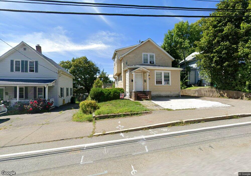
436 N Washington St North Attleboro, MA 02760
North Attleboro NeighborhoodEstimated Value: $432,000 - $490,000
3
Beds
2
Baths
1,529
Sq Ft
$302/Sq Ft
Est. Value
About This Home
This home is located at 436 N Washington St, North Attleboro, MA 02760 and is currently estimated at $461,092, approximately $301 per square foot. 436 N Washington St is a home located in Bristol County with nearby schools including North Attleboro High School.
Ownership History
Date
Name
Owned For
Owner Type
Purchase Details
Closed on
May 31, 2018
Sold by
Lml Realty Llc
Bought by
Britanis Edwin
Current Estimated Value
Home Financials for this Owner
Home Financials are based on the most recent Mortgage that was taken out on this home.
Original Mortgage
$216,015
Outstanding Balance
$186,394
Interest Rate
4.4%
Mortgage Type
FHA
Estimated Equity
$274,698
Purchase Details
Closed on
May 10, 2005
Sold by
Mulkern Henry L and Brennan Leo J
Bought by
Lml Realty Llc
Home Financials for this Owner
Home Financials are based on the most recent Mortgage that was taken out on this home.
Original Mortgage
$204,000
Interest Rate
5.95%
Mortgage Type
Purchase Money Mortgage
Purchase Details
Closed on
Apr 29, 2005
Sold by
Linnehan Heather A and Linnehan Thomas F
Bought by
Mulkern Henry L and Brennan Leo J
Home Financials for this Owner
Home Financials are based on the most recent Mortgage that was taken out on this home.
Original Mortgage
$204,000
Interest Rate
5.95%
Mortgage Type
Purchase Money Mortgage
Purchase Details
Closed on
Jan 10, 2005
Sold by
Linnehan Heather A
Bought by
Linnehan Heather A and Linnehan Thomas F
Home Financials for this Owner
Home Financials are based on the most recent Mortgage that was taken out on this home.
Original Mortgage
$182,000
Interest Rate
5.75%
Purchase Details
Closed on
Apr 30, 1998
Sold by
Sharples Daniel R and Sharples Jean M
Bought by
Enross Heather A
Home Financials for this Owner
Home Financials are based on the most recent Mortgage that was taken out on this home.
Original Mortgage
$117,500
Interest Rate
7.04%
Mortgage Type
Purchase Money Mortgage
Purchase Details
Closed on
Jul 27, 1989
Sold by
Fisher Stephen B
Bought by
Sharples Daniel R
Home Financials for this Owner
Home Financials are based on the most recent Mortgage that was taken out on this home.
Original Mortgage
$113,400
Interest Rate
9.9%
Mortgage Type
Purchase Money Mortgage
Create a Home Valuation Report for This Property
The Home Valuation Report is an in-depth analysis detailing your home's value as well as a comparison with similar homes in the area
Home Values in the Area
Average Home Value in this Area
Purchase History
| Date | Buyer | Sale Price | Title Company |
|---|---|---|---|
| Britanis Edwin | $220,000 | -- | |
| Lml Realty Llc | -- | -- | |
| Mulkern Henry L | $255,000 | -- | |
| Linnehan Heather A | -- | -- | |
| Enross Heather A | $123,750 | -- | |
| Sharples Daniel R | $126,000 | -- |
Source: Public Records
Mortgage History
| Date | Status | Borrower | Loan Amount |
|---|---|---|---|
| Open | Britanis Edwin | $216,015 | |
| Previous Owner | Mulkern Henry L | $204,000 | |
| Previous Owner | Linnehan Heather A | $182,000 | |
| Previous Owner | Sharples Daniel R | $160,000 | |
| Previous Owner | Sharples Daniel R | $150,000 | |
| Previous Owner | Sharples Daniel R | $117,500 | |
| Previous Owner | Sharples Daniel R | $113,400 |
Source: Public Records
Tax History Compared to Growth
Tax History
| Year | Tax Paid | Tax Assessment Tax Assessment Total Assessment is a certain percentage of the fair market value that is determined by local assessors to be the total taxable value of land and additions on the property. | Land | Improvement |
|---|---|---|---|---|
| 2025 | $3,981 | $337,700 | $99,200 | $238,500 |
| 2024 | $3,821 | $331,100 | $99,200 | $231,900 |
| 2023 | $3,659 | $286,100 | $99,200 | $186,900 |
| 2022 | $3,792 | $272,200 | $94,200 | $178,000 |
| 2021 | $4,616 | $255,400 | $89,200 | $166,200 |
| 2020 | $4,382 | $222,900 | $84,300 | $138,600 |
| 2019 | $3,126 | $219,500 | $76,600 | $142,900 |
| 2018 | $2,492 | $186,800 | $72,100 | $114,700 |
| 2017 | $2,410 | $182,300 | $67,600 | $114,700 |
| 2016 | $2,298 | $173,800 | $90,100 | $83,700 |
| 2015 | $2,284 | $173,800 | $90,100 | $83,700 |
| 2014 | $2,321 | $175,300 | $84,600 | $90,700 |
Source: Public Records
Map
Nearby Homes
- 35-R Whiting St
- 45 Moran St
- 64 Smith St
- 2 Franklin Ave
- 271 N Washington St
- 34 Hawthorne St
- 194 Smith St
- 157 Fisher St
- 39 Columbia St
- 633 E Washington St Unit 17
- 835 Mt Hope St Unit 39
- 68 N Washington St Unit 210
- 19 Church St Unit C9
- 0 Landry 2nd Unit 73350867
- 12 Houde St
- 29 Broad St
- 16 Richards Ave Unit 106
- 93 Bank St
- 19 Valerie Dr
- 711 Mount Hope St Unit 13
- 436 N Washington St
- 436 N Washington St Unit 1
- 440 N Washington St
- 432 N Washington St
- 179 Park St Unit 1
- 444 N Washington St
- 426 N Washington St
- 426 N Washington St Unit 2
- 193 Park St
- 424 N Washington St
- 424 N Washington St Unit 3
- 424 N Washington St Unit 2
- 199 Park St
- 437 N Washington St
- 437 N Washington St Unit R
- 437 N Washington St
- 437 N Washington St Unit 2
- 437 N Washington St Unit 1
- 173 Park St
- 420 N Washington St