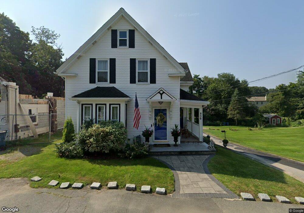
436 Sherman St Canton, MA 02021
Estimated Value: $586,458 - $672,000
3
Beds
2
Baths
1,493
Sq Ft
$421/Sq Ft
Est. Value
About This Home
This home is located at 436 Sherman St, Canton, MA 02021 and is currently estimated at $628,615, approximately $421 per square foot. 436 Sherman St is a home located in Norfolk County with nearby schools including Canton High School, St. John the Evangelist School, and Chabad Day School of School.
Ownership History
Date
Name
Owned For
Owner Type
Purchase Details
Closed on
Dec 10, 2015
Sold by
Grant Mirielle
Bought by
Grant Mirielle and Grant Ardre
Current Estimated Value
Purchase Details
Closed on
Jan 13, 2006
Sold by
Cottreau Mary
Bought by
Grant Andre and Bigot Mirielle
Home Financials for this Owner
Home Financials are based on the most recent Mortgage that was taken out on this home.
Original Mortgage
$352,200
Interest Rate
6.28%
Mortgage Type
Purchase Money Mortgage
Create a Home Valuation Report for This Property
The Home Valuation Report is an in-depth analysis detailing your home's value as well as a comparison with similar homes in the area
Home Values in the Area
Average Home Value in this Area
Purchase History
| Date | Buyer | Sale Price | Title Company |
|---|---|---|---|
| Grant Mirielle | -- | -- | |
| Grant Andre | $352,200 | -- |
Source: Public Records
Mortgage History
| Date | Status | Borrower | Loan Amount |
|---|---|---|---|
| Previous Owner | Grant Andre | $352,200 | |
| Previous Owner | Grant Andre | $421,123 |
Source: Public Records
Tax History
| Year | Tax Paid | Tax Assessment Tax Assessment Total Assessment is a certain percentage of the fair market value that is determined by local assessors to be the total taxable value of land and additions on the property. | Land | Improvement |
|---|---|---|---|---|
| 2025 | $5,101 | $515,800 | $261,200 | $254,600 |
| 2024 | $4,946 | $496,100 | $251,200 | $244,900 |
| 2023 | $4,770 | $451,300 | $251,200 | $200,100 |
| 2022 | $4,626 | $407,600 | $239,200 | $168,400 |
| 2021 | $4,505 | $369,300 | $217,400 | $151,900 |
| 2020 | $4,303 | $351,800 | $207,100 | $144,700 |
| 2019 | $4,006 | $323,100 | $177,800 | $145,300 |
| 2018 | $3,733 | $300,600 | $160,900 | $139,700 |
| 2017 | $3,770 | $294,800 | $157,700 | $137,100 |
| 2016 | $3,681 | $287,800 | $153,900 | $133,900 |
| 2015 | $3,568 | $278,300 | $149,400 | $128,900 |
Source: Public Records
Map
Nearby Homes
- 29 Maple St Unit G
- 16 Danforth St
- 12 Danforth St
- 865 Washington St Unit 6
- 8 Audubon Way
- 6 Audubon Way Unit 6
- 26 Pequit St
- 20 Audubon Way Unit 205
- 20 Audubon Way Unit 302
- 20 Audubon Way Unit 408
- 20 Audubon Way Unit 105
- 20 Audubon Way Unit 104
- 20 Audubon Way Unit 101
- 1 Revolution Way Unit 307
- 30 Coppersmith Way Unit 209
- 30 Coppersmith Way Unit 313
- 30 Coppersmith Way Unit 112
- 30 Coppersmith Way Unit 109
- 30 Coppersmith Way Unit 206
- 30 Coppersmith Way Unit 110
- 432 Sherman St
- 442 Sherman St
- 14 Cross St
- 448 Sherman St
- 425 Sherman St
- 6 Valley St
- 417 Sherman St
- 455 Sherman St
- 11 Valley St
- 460 Sherman St
- 38 Chapel St
- 16 Valley St
- 63 Maple St Unit J
- 63 Maple St Unit H
- 63 Maple St Unit G
- 63 Maple St Unit F
- 63 Maple St Unit E
- 63 Maple St Unit D
- 63 Maple St Unit C
- 63 Maple St Unit B
Your Personal Tour Guide
Ask me questions while you tour the home.