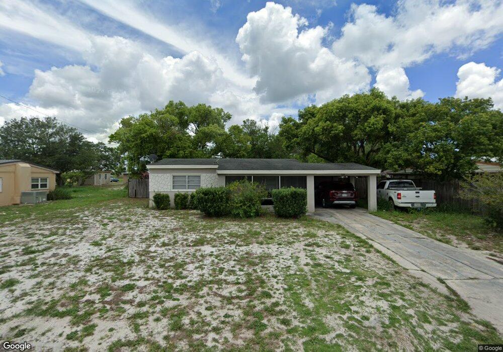
436 Stanley Ave Frostproof, FL 33843
Estimated Value: $156,443 - $172,000
2
Beds
1
Bath
939
Sq Ft
$173/Sq Ft
Est. Value
About This Home
This home is located at 436 Stanley Ave, Frostproof, FL 33843 and is currently estimated at $162,611, approximately $173 per square foot. 436 Stanley Ave is a home located in Polk County with nearby schools including Kruse Elementary School, Olander Elementary School, and Ben Hill Griffin Jr. Elementary School.
Ownership History
Date
Name
Owned For
Owner Type
Purchase Details
Closed on
Nov 14, 2001
Sold by
Saunders Raymond C and Saunders Carolyn S
Bought by
Mannis Jason E and Mannis Jessica A
Current Estimated Value
Home Financials for this Owner
Home Financials are based on the most recent Mortgage that was taken out on this home.
Original Mortgage
$43,812
Outstanding Balance
$16,934
Interest Rate
6.57%
Estimated Equity
$145,677
Purchase Details
Closed on
Mar 18, 1999
Sold by
Morey Marie
Bought by
Saunders Raymond C and Saunders Carolyn S
Home Financials for this Owner
Home Financials are based on the most recent Mortgage that was taken out on this home.
Original Mortgage
$20,742
Interest Rate
6.74%
Create a Home Valuation Report for This Property
The Home Valuation Report is an in-depth analysis detailing your home's value as well as a comparison with similar homes in the area
Home Values in the Area
Average Home Value in this Area
Purchase History
| Date | Buyer | Sale Price | Title Company |
|---|---|---|---|
| Mannis Jason E | $44,000 | -- | |
| Saunders Raymond C | $28,000 | -- |
Source: Public Records
Mortgage History
| Date | Status | Borrower | Loan Amount |
|---|---|---|---|
| Open | Saunders Raymond C | $43,812 | |
| Previous Owner | Saunders Raymond C | $20,742 |
Source: Public Records
Tax History Compared to Growth
Tax History
| Year | Tax Paid | Tax Assessment Tax Assessment Total Assessment is a certain percentage of the fair market value that is determined by local assessors to be the total taxable value of land and additions on the property. | Land | Improvement |
|---|---|---|---|---|
| 2025 | $862 | $40,298 | -- | -- |
| 2024 | $718 | $39,162 | -- | -- |
| 2023 | $718 | $38,021 | $0 | $0 |
| 2022 | $660 | $36,914 | $0 | $0 |
| 2021 | $644 | $35,839 | $0 | $0 |
| 2020 | $616 | $35,344 | $0 | $0 |
| 2018 | $549 | $33,905 | $0 | $0 |
| 2017 | $538 | $33,208 | $0 | $0 |
| 2016 | $489 | $32,525 | $0 | $0 |
| 2015 | $111 | $32,299 | $0 | $0 |
| 2014 | $438 | $32,043 | $0 | $0 |
Source: Public Records
Map
Nearby Homes
- 319 Thomas Ave
- The Roanoke II Plan at Sun Ray
- The Savannah Plan at Sun Ray
- The Cambridge Plan at Sun Ray
- 0 Joey Ln
- 508 Stanley Ave
- 262 Walter Ave
- 229 Raymond Ave
- 253 Walter Ave
- 202 Central Ave
- 624 Alice St
- 192 Freedom Dr
- 0 Hopson Rd
- 74 Oakridge Dr
- 129 Constitution Ln
- 54 Oakridge Dr
- 92 Yale Ave
- 2101 W Frostproof Rd
- 32 Oakridge Dr
- 686 Sandwedge Dr
- 434 Stanley Ave
- 438 Stanley Ave
- 419 Raymond Ave
- 423 Raymond Ave
- 415 Raymond Ave
- 432 Stanley Ave
- 440 Stanley Ave
- 435 Stanley Ave
- 433 Stanley Ave
- 437 Stanley Ave
- 411 Raymond Ave
- 427 Raymond Ave
- 422 Stanley Ave
- 442 Stanley Ave
- 431 Stanley Ave
- 439 Stanley Ave
- 431 Raymond Ave
- 322 Stanley Ave
- 441 Stanley Ave
- 406 Thomas Ave