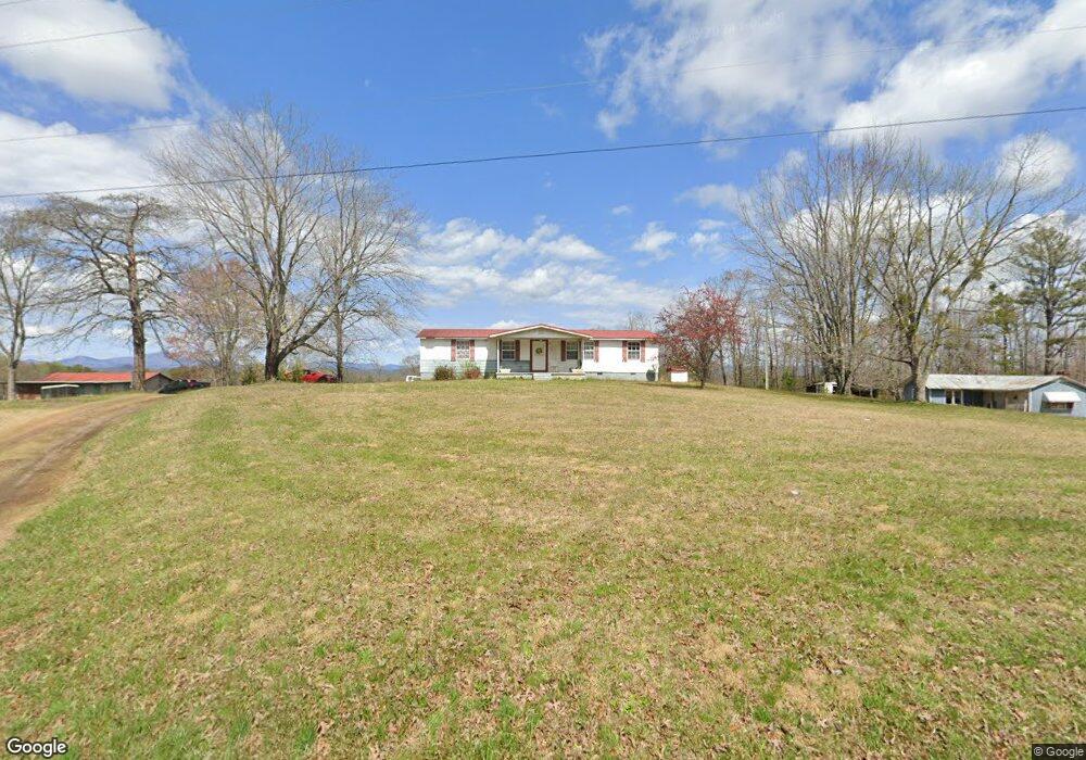
436 Whetstone Rd Mountain Rest, SC 29664
Estimated Value: $125,869 - $240,000
2
Beds
1
Bath
945
Sq Ft
$218/Sq Ft
Est. Value
About This Home
This home is located at 436 Whetstone Rd, Mountain Rest, SC 29664 and is currently estimated at $206,217, approximately $218 per square foot. 436 Whetstone Rd is a home located in Oconee County with nearby schools including James M. Brown Elementary School, Walhalla Middle School, and Walhalla High School.
Ownership History
Date
Name
Owned For
Owner Type
Purchase Details
Closed on
Jan 31, 2024
Sold by
Orr Annette B and Buchanan Janice D
Bought by
Butts Christopher and Butts Timothy Lee
Current Estimated Value
Purchase Details
Closed on
Nov 25, 2023
Sold by
Butts Timothy Lee
Bought by
Butts Christopher
Purchase Details
Closed on
Apr 30, 2007
Sold by
Butts Jabe S
Bought by
Brewer Curtis G
Home Financials for this Owner
Home Financials are based on the most recent Mortgage that was taken out on this home.
Original Mortgage
$97,650
Interest Rate
6.11%
Mortgage Type
FHA
Create a Home Valuation Report for This Property
The Home Valuation Report is an in-depth analysis detailing your home's value as well as a comparison with similar homes in the area
Purchase History
| Date | Buyer | Sale Price | Title Company |
|---|---|---|---|
| Butts Christopher | -- | None Listed On Document | |
| Orr Annette B | -- | None Listed On Document | |
| Buchanan Janice D | -- | None Listed On Document | |
| Butts Christopher | -- | None Listed On Document | |
| Orr Annette B | -- | None Listed On Document | |
| Brewer Curtis G | $99,275 | None Available |
Source: Public Records
Mortgage History
| Date | Status | Borrower | Loan Amount |
|---|---|---|---|
| Previous Owner | Brewer Curtis G | $97,650 |
Source: Public Records
Tax History
| Year | Tax Paid | Tax Assessment Tax Assessment Total Assessment is a certain percentage of the fair market value that is determined by local assessors to be the total taxable value of land and additions on the property. | Land | Improvement |
|---|---|---|---|---|
| 2025 | $163 | $1,770 | $1,600 | $170 |
| 2024 | $793 | $5,635 | $4,090 | $1,545 |
| 2023 | $793 | $5,635 | $4,090 | $1,545 |
| 2022 | $804 | $5,635 | $4,090 | $1,545 |
| 2021 | $371 | $5,515 | $4,010 | $1,505 |
| 2020 | $371 | $0 | $0 | $0 |
| 2019 | $371 | $0 | $0 | $0 |
| 2018 | $644 | $0 | $0 | $0 |
| 2017 | $200 | $0 | $0 | $0 |
| 2016 | $200 | $0 | $0 | $0 |
| 2015 | -- | $0 | $0 | $0 |
| 2014 | -- | $6,991 | $5,210 | $1,781 |
| 2013 | -- | $0 | $0 | $0 |
Source: Public Records
Map
Nearby Homes
- 00 Cassidy Bridge and Buckeye Ridge Rd
- 283 Cassidy Bridge Rd
- 614 Village Dr
- 00 Homeland Dr
- 260 Hickory Ridge
- 237 Hickory Ridge
- 251 Oak Haven Dr
- 00 Homeland (5 04 Acres) Dr
- 00 Dr
- 0 C H 68
- 8650 Highlands Hwy
- 31 A Bonner Rd
- 1418 Lake Jemiki Rd
- 686 W Cove Dr
- 1399 Lake Jemiki Rd
- 100 Strong St
- 105 Strong St
- 147 Lakeside Dr
- 225 Whetstone Mountain Rd
- 00 Mountain Rest Lake Rd
- 441 Whetstone Rd
- 305 Old Indian Trail
- 126 C H 25
- 314 Old Indian Trail
- 126 Bone Camp Rd
- 420 Whetstone Rd
- 420 Whetstone Rd
- 130 Harolds Dr
- 468 Whetstone Rd
- 156 Bone Camp Rd
- 108 Bone Camp Rd
- 161 Bone Camp Rd
- 439 Whetstone Rd
- 463 Whetstone Rd
- 151 Bone Camp Rd
- 339 Old Indian Trail
- 366 Whetstone Rd
- 122 Turpin Rd
- 476 Whetstone Rd
- 474 Whetstone Rd
Your Personal Tour Guide
Ask me questions while you tour the home.