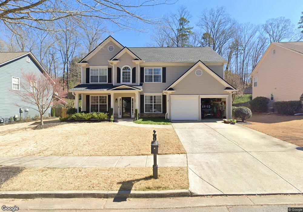
436 Windsong Way Woodstock, GA 30188
Estimated Value: $601,639 - $611,000
4
Beds
3
Baths
2,505
Sq Ft
$242/Sq Ft
Est. Value
About This Home
This home is located at 436 Windsong Way, Woodstock, GA 30188 and is currently estimated at $606,320, approximately $242 per square foot. 436 Windsong Way is a home located in Cherokee County with nearby schools including Woodstock Elementary School, Woodstock Middle School, and Woodstock High School.
Ownership History
Date
Name
Owned For
Owner Type
Purchase Details
Closed on
Jan 26, 2012
Sold by
Leblanc Charita
Bought by
Leblanc Joseph P
Current Estimated Value
Purchase Details
Closed on
Nov 26, 2002
Sold by
Mccar Dev Corp
Bought by
Leblanc Charito and Leblanc Joseph P
Home Financials for this Owner
Home Financials are based on the most recent Mortgage that was taken out on this home.
Original Mortgage
$88,000
Interest Rate
5.72%
Mortgage Type
New Conventional
Create a Home Valuation Report for This Property
The Home Valuation Report is an in-depth analysis detailing your home's value as well as a comparison with similar homes in the area
Home Values in the Area
Average Home Value in this Area
Purchase History
| Date | Buyer | Sale Price | Title Company |
|---|---|---|---|
| Leblanc Joseph P | $214,000 | -- | |
| Leblanc Charito | $214,000 | -- |
Source: Public Records
Mortgage History
| Date | Status | Borrower | Loan Amount |
|---|---|---|---|
| Previous Owner | Leblanc Charito | $88,000 |
Source: Public Records
Tax History Compared to Growth
Tax History
| Year | Tax Paid | Tax Assessment Tax Assessment Total Assessment is a certain percentage of the fair market value that is determined by local assessors to be the total taxable value of land and additions on the property. | Land | Improvement |
|---|---|---|---|---|
| 2024 | $4,413 | $199,124 | $44,800 | $154,324 |
| 2023 | $4,507 | $201,104 | $44,800 | $156,304 |
| 2022 | $3,836 | $161,728 | $40,000 | $121,728 |
| 2021 | $3,316 | $147,948 | $32,000 | $115,948 |
| 2020 | $3,811 | $134,368 | $22,000 | $112,368 |
| 2019 | $2,818 | $122,920 | $22,000 | $100,920 |
| 2018 | $2,612 | $111,920 | $22,000 | $89,920 |
| 2017 | $2,535 | $267,900 | $22,000 | $85,160 |
| 2016 | $2,351 | $242,900 | $20,000 | $77,160 |
| 2015 | $2,224 | $224,600 | $20,000 | $69,840 |
| 2014 | $2,152 | $206,700 | $20,000 | $62,680 |
Source: Public Records
Map
Nearby Homes
- 147 Hubbard Rd
- 304 Winchester Way
- 191 Fowler St
- 170 Fowler St Unit 100
- 170 Fowler St Unit 200
- The Barrington Plan at South on Main
- 9244 Main St Unit 102
- 719 Hammond Dr
- 1100 Thomas St
- 1104 Thomas St
- 967 S On Main Dr
- 963 S On Main Dr
- 202 Dawson Dr
- 108 Barnesdale Terrace
- 403 Village View
- 200 Dawson Dr
- 360 Chambers St Unit 155
- 360 Chambers St Unit 456
- 438 Windsong Way
- 434 Windsong Way
- 432 Windsong Way
- 440 Windsong Way
- 403 Windsong Way
- 405 Windsong Way
- 442 Windsong Way
- 721 Song Bird Way
- 717 Song Bird Way
- 407 Windsong Way
- 409 Windsong Way
- 430 Windsong Way
- 401 Windsong Way
- 719 Song Bird Way
- 411 Windsong Way
- 713 Song Bird Way
- 711 Song Bird Way
- 723 Song Bird Way
- 428 Windsong Way
- 504 Melody Place