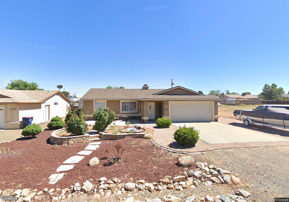
4360 N Noel Dr Prescott Valley, AZ 86314
Estimated Value: $366,186 - $385,000
3
Beds
2
Baths
1,330
Sq Ft
$284/Sq Ft
Est. Value
About This Home
This home is located at 4360 N Noel Dr, Prescott Valley, AZ 86314 and is currently estimated at $377,297, approximately $283 per square foot. 4360 N Noel Dr is a home located in Yavapai County with nearby schools including Granville Elementary School, Bradshaw Mountain Middle School, and Bradshaw Mountain High School.
Ownership History
Date
Name
Owned For
Owner Type
Purchase Details
Closed on
Mar 11, 2025
Sold by
Hernandez Maria G
Bought by
Hernandez-Juarez Juan and Hernandez Juan J
Current Estimated Value
Purchase Details
Closed on
Sep 26, 1997
Sold by
De Jong Corp
Bought by
Hernandez Juan J and Hernandez Maria G
Home Financials for this Owner
Home Financials are based on the most recent Mortgage that was taken out on this home.
Original Mortgage
$84,000
Interest Rate
7.36%
Purchase Details
Closed on
Jan 27, 1997
Sold by
Stark Judy L
Bought by
De Jong Corp
Purchase Details
Closed on
May 19, 1994
Sold by
Mlacker Judith L
Bought by
Stark William J and Reineccius Donna J
Purchase Details
Closed on
Apr 25, 1988
Sold by
Mlacker Donald M
Bought by
Mlacker Judith L
Create a Home Valuation Report for This Property
The Home Valuation Report is an in-depth analysis detailing your home's value as well as a comparison with similar homes in the area
Home Values in the Area
Average Home Value in this Area
Purchase History
| Date | Buyer | Sale Price | Title Company |
|---|---|---|---|
| Hernandez-Juarez Juan | -- | Yavapai Title Agency | |
| Hernandez Juan J | $82,900 | Capital Title Agency | |
| De Jong Corp | $7,500 | Capital Title Agency | |
| Stark William J | $750 | -- | |
| Mlacker Judith L | -- | -- |
Source: Public Records
Mortgage History
| Date | Status | Borrower | Loan Amount |
|---|---|---|---|
| Previous Owner | Hernandez Juan J | $84,000 |
Source: Public Records
Tax History Compared to Growth
Tax History
| Year | Tax Paid | Tax Assessment Tax Assessment Total Assessment is a certain percentage of the fair market value that is determined by local assessors to be the total taxable value of land and additions on the property. | Land | Improvement |
|---|---|---|---|---|
| 2026 | $1,306 | $30,508 | -- | -- |
| 2024 | $1,197 | $31,565 | -- | -- |
| 2023 | $1,197 | $26,311 | $4,168 | $22,143 |
| 2022 | $1,178 | $21,364 | $2,868 | $18,496 |
| 2021 | $1,231 | $19,563 | $2,883 | $16,680 |
| 2020 | $1,183 | $0 | $0 | $0 |
| 2019 | $1,168 | $0 | $0 | $0 |
| 2018 | $1,111 | $0 | $0 | $0 |
| 2017 | $1,089 | $0 | $0 | $0 |
| 2016 | $1,052 | $0 | $0 | $0 |
| 2015 | $1,037 | $0 | $0 | $0 |
| 2014 | -- | $0 | $0 | $0 |
Source: Public Records
Map
Nearby Homes
- 4461 N Phillip Dr
- 4500 N Phillip Dr Unit 4
- 4441 N Tonto Way
- 7940 E Loos Dr
- 4112 N Edith Ct
- 4148 N Jay Ct
- 4395 N Katie Cir W
- 4096 N Jay Ct
- 7316 Spouse Dr
- 7869 E Spouse Dr
- 547 N Vermillion Dr
- 3965 N Robert Rd
- 7764 E Cocopah Dr
- 7855 E Larkspur Ln
- 7874 E Siesta Ln
- 7959 E Las Flores Ave
- 3860 E Teri (Plus Full Basement) Ct
- 3850 N Joan Ct
- 3840 N Joan Ct
- 38-A1 N Norman Rd
- 4354 N Noel Dr
- 4319 N Sauter Dr W
- 4313 N Sauter Dr W
- 4348 N Noel Dr
- 4348 N Noel Dr Unit 1
- 4325 N Sauter Dr W
- 4307 N Sauter Dr W
- 4307 N Sauter Dr W Unit 3
- 4372 N Noel Dr
- 4372 N Noel Dr Unit 3
- 4361 N Noel Dr Unit 3
- 4361 N Noel Dr
- 4355 N Noel Dr Unit 1
- 4375 N Noel Dr
- 4342 N Noel Dr Unit 3
- 4342 N Noel Dr
- 4331 N Sauter Dr W
- 4349 N Noel Dr
- 4391 Noel Dr
- 4301 N Sauter Dr W