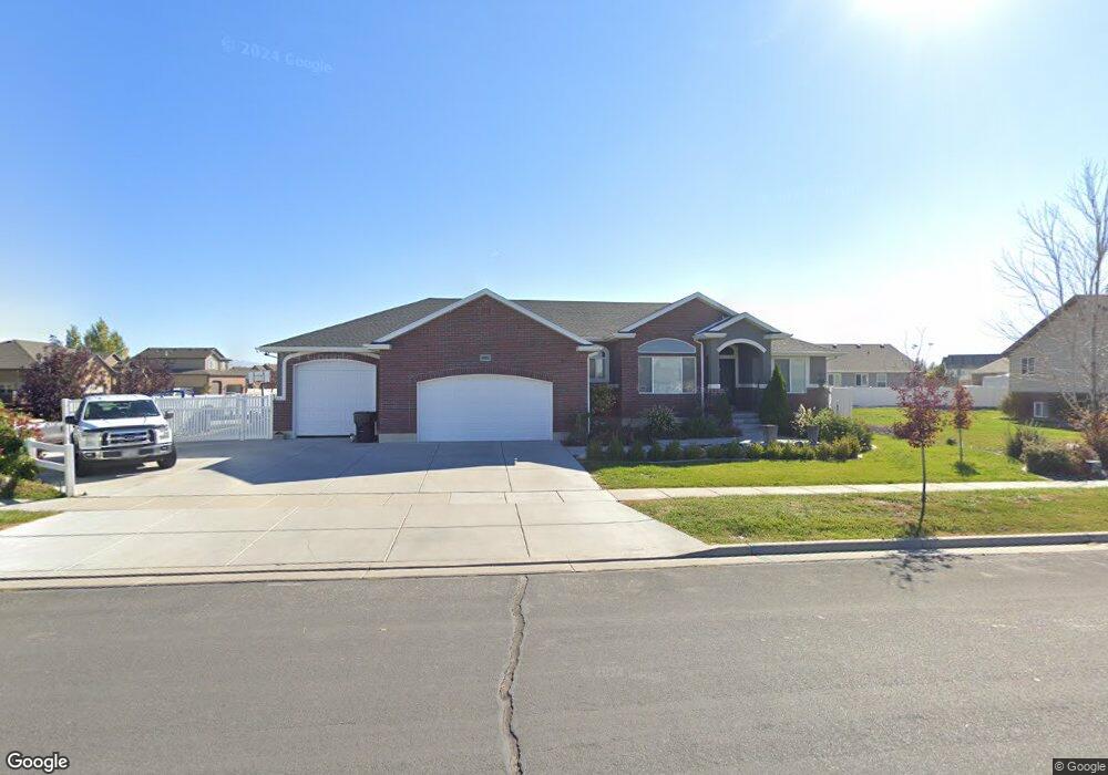
4361 W 1315 S Syracuse, UT 84075
Estimated Value: $637,000 - $677,000
3
Beds
2
Baths
1,760
Sq Ft
$372/Sq Ft
Est. Value
About This Home
This home is located at 4361 W 1315 S, Syracuse, UT 84075 and is currently estimated at $655,305, approximately $372 per square foot. 4361 W 1315 S is a home located in Davis County with nearby schools including Buffalo Point School, Syracuse Junior High School, and Syracuse High School.
Ownership History
Date
Name
Owned For
Owner Type
Purchase Details
Closed on
Nov 23, 2013
Sold by
Shepherd Jake
Bought by
Manning Jared R and Manning Tiffany F
Current Estimated Value
Home Financials for this Owner
Home Financials are based on the most recent Mortgage that was taken out on this home.
Original Mortgage
$288,674
Outstanding Balance
$215,449
Interest Rate
4.25%
Mortgage Type
FHA
Estimated Equity
$439,856
Purchase Details
Closed on
Jun 28, 2013
Sold by
Thurgood Custom Excavators Inc
Bought by
Shepherd Jake
Purchase Details
Closed on
Jun 26, 2009
Sold by
Bridgeway Island Llc
Bought by
Thurgood Custom Excavators Inc
Create a Home Valuation Report for This Property
The Home Valuation Report is an in-depth analysis detailing your home's value as well as a comparison with similar homes in the area
Home Values in the Area
Average Home Value in this Area
Purchase History
| Date | Buyer | Sale Price | Title Company |
|---|---|---|---|
| Manning Jared R | -- | Hickman Land Title Co | |
| Shepherd Jake | -- | None Available | |
| Thurgood Custom Excavators Inc | -- | Accommodation |
Source: Public Records
Mortgage History
| Date | Status | Borrower | Loan Amount |
|---|---|---|---|
| Open | Manning Jared R | $288,674 |
Source: Public Records
Tax History Compared to Growth
Tax History
| Year | Tax Paid | Tax Assessment Tax Assessment Total Assessment is a certain percentage of the fair market value that is determined by local assessors to be the total taxable value of land and additions on the property. | Land | Improvement |
|---|---|---|---|---|
| 2025 | $3,249 | $313,500 | $103,624 | $209,876 |
| 2024 | $3,114 | $302,500 | $82,818 | $219,682 |
| 2023 | $3,000 | $531,000 | $125,847 | $405,153 |
| 2022 | $3,322 | $322,300 | $63,050 | $259,250 |
| 2021 | $2,850 | $428,000 | $91,921 | $336,079 |
| 2020 | $2,537 | $369,000 | $74,108 | $294,892 |
| 2019 | $2,452 | $352,000 | $77,772 | $274,228 |
| 2018 | $2,281 | $325,000 | $75,670 | $249,330 |
| 2016 | $2,182 | $163,020 | $31,457 | $131,563 |
| 2015 | $2,144 | $152,570 | $31,711 | $120,859 |
| 2014 | $1,997 | $144,813 | $31,711 | $113,102 |
| 2013 | -- | $47,000 | $47,000 | $0 |
Source: Public Records
Map
Nearby Homes
- 1238 S 4290 W
- 1157 S 4425 W
- 1155 S 4475 W
- 1139 S 4475 W
- 4578 W 1150 S
- Bradford Plan at Harvest Fields
- Avery Plan at Harvest Fields
- Sullivan Plan at Harvest Fields
- Presley Plan at Harvest Fields
- Ashmore Plan at Harvest Fields
- Bridgeport Plan at Harvest Fields
- Malan Plan at Harvest Fields
- Havenwood Plan at Harvest Fields
- Hamilton Plan at Harvest Fields
- Havenwood with Loft Plan at Harvest Fields
- 4468 W 1050 S
- 4191 W 1425 S
- 1039 S 4250 W
- 1141 S 4700 W
- 964 S 4475 W Unit 123
- 1342 S 4350 W Unit 435
- 4391 W 1315 S
- 4364 W 1350 S
- 4392 W 1350 S
- 4392 W 1350 S Unit 235
- 1331 S 4350 W
- 1302 S 4350 W Unit 220
- 4420 W 1350 S Unit 234
- 4420 W 1350 S Unit 30
- 1343 S 4350 W
- 1301 S 4465 W
- 1276 S 4350 W
- 1333 S 4465 W
- 4429 W 1315 S Unit 223
- 1299 S 4350 W Unit 219
- 1364 S 4350 W Unit 436
- 4337 W 1315 S
- 1359 S 4350 W
- 1359 S 4350 W Unit 433
- 4383 W 1350 S Unit 236