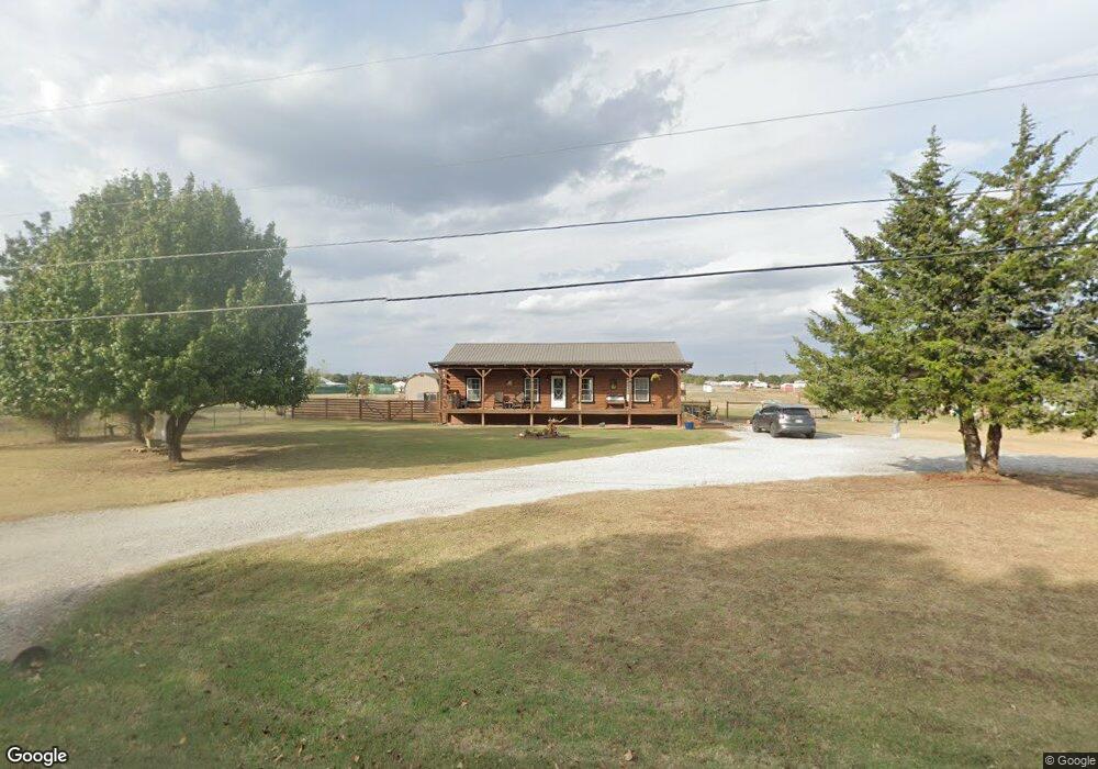
43612 Wolverine Rd Shawnee, OK 74804
Estimated Value: $166,000 - $236,000
3
Beds
2
Baths
1,600
Sq Ft
$124/Sq Ft
Est. Value
About This Home
This home is located at 43612 Wolverine Rd, Shawnee, OK 74804 and is currently estimated at $197,617, approximately $123 per square foot. 43612 Wolverine Rd is a home located in Pottawatomie County.
Ownership History
Date
Name
Owned For
Owner Type
Purchase Details
Closed on
Sep 19, 2013
Sold by
Miskell William O and Miskell Mary Elizabeth
Bought by
Underwood Brandy and Underwood Ann
Current Estimated Value
Home Financials for this Owner
Home Financials are based on the most recent Mortgage that was taken out on this home.
Original Mortgage
$112,244
Outstanding Balance
$83,416
Interest Rate
4.45%
Mortgage Type
New Conventional
Estimated Equity
$114,201
Purchase Details
Closed on
Mar 30, 2007
Sold by
Hoffman Patricia K and Hoffman Patti K
Bought by
Miskell William O
Home Financials for this Owner
Home Financials are based on the most recent Mortgage that was taken out on this home.
Original Mortgage
$93,120
Interest Rate
6.3%
Mortgage Type
Purchase Money Mortgage
Purchase Details
Closed on
Oct 13, 2005
Sold by
Milburn Paul M and Paul M Milburn Trust
Bought by
Hoffman Patrick K
Create a Home Valuation Report for This Property
The Home Valuation Report is an in-depth analysis detailing your home's value as well as a comparison with similar homes in the area
Purchase History
| Date | Buyer | Sale Price | Title Company |
|---|---|---|---|
| Underwood Brandy | $110,000 | First American Title | |
| Miskell William O | $96,000 | None Available | |
| Hoffman Patrick K | $8,500 | None Available |
Source: Public Records
Mortgage History
| Date | Status | Borrower | Loan Amount |
|---|---|---|---|
| Open | Underwood Brandy | $112,244 | |
| Previous Owner | Miskell William O | $93,120 |
Source: Public Records
Tax History
| Year | Tax Paid | Tax Assessment Tax Assessment Total Assessment is a certain percentage of the fair market value that is determined by local assessors to be the total taxable value of land and additions on the property. | Land | Improvement |
|---|---|---|---|---|
| 2025 | $1,455 | $13,794 | $1,200 | $12,594 |
| 2024 | $1,422 | $13,392 | $1,200 | $12,192 |
| 2023 | $1,422 | $13,392 | $1,200 | $12,192 |
| 2022 | $1,405 | $13,392 | $1,200 | $12,192 |
| 2021 | $1,448 | $13,392 | $1,200 | $12,192 |
| 2020 | $1,503 | $13,679 | $1,200 | $12,479 |
| 2019 | $1,510 | $13,822 | $1,200 | $12,622 |
| 2018 | $1,465 | $13,866 | $1,200 | $12,666 |
| 2017 | $1,477 | $13,939 | $1,200 | $12,739 |
| 2016 | $1,180 | $13,532 | $1,200 | $12,332 |
| 2015 | $1,141 | $13,139 | $1,200 | $11,939 |
| 2014 | $1,146 | $13,200 | $1,020 | $12,180 |
Source: Public Records
Map
Nearby Homes
- 43304 Belle Brook Cir
- 43259 Prairie Ranch Rd
- 43159 Prairie Ranch Rd
- 43165 Prairie Ranch Rd
- 43177 Prairie Ranch Rd
- 43171 Prairie Ranch Rd
- 43153 Prairie Ranch Rd
- 43107 Wagon Trail
- 43160 Prairie Ranch Rd
- 43166 Prairie Ranch Rd
- 43147 Prairie Ranch Rd
- 43189 Prairie Ranch Rd
- 43067 Wagon Trail
- 43172 Prairie Ranch Rd
- 43142 Prairie Ranch Rd
- 43201 Prairie Ranch Rd
- 43088 Green Grass Cir
- 23 Lake Ln
- 7110 Brangus Rd
- 17 Rustic Oak Dr
- 103 Surrey Dr
- 101 Surrey Dr
- 43608 Wolverine Rd
- 43508 Wolverine Rd
- 43510 Wolverine Rd
- 102 Surrey Dr
- 43504 Wolverine Rd
- 107 Butterfly Dr
- 103 Butterfly Dr
- 43502 Wolverine Rd
- 101 Cotton Tail Dr
- 203 Butterfly Dr
- 207 Butterfly Dr
- 107 Cotton Tail Dr
- 109 Cotton Tail Dr
- 106 Cotton Tail Dr
- 43301 Belle Brook Cir
- 111 Cotton Tail Dr
- 108 Cotton Tail Dr
- 43305 Belle Brook Cir
Your Personal Tour Guide
Ask me questions while you tour the home.