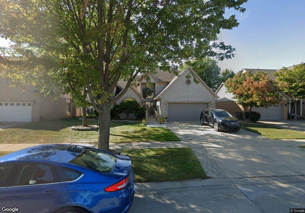
43617 Hillsboro Dr Clinton Township, MI 48038
Estimated Value: $453,763 - $487,000
4
Beds
3
Baths
2,645
Sq Ft
$178/Sq Ft
Est. Value
About This Home
This home is located at 43617 Hillsboro Dr, Clinton Township, MI 48038 and is currently estimated at $469,691, approximately $177 per square foot. 43617 Hillsboro Dr is a home located in Macomb County with nearby schools including Cherokee Elementary School, Wyandot Middle School, and Chippewa Valley High School.
Ownership History
Date
Name
Owned For
Owner Type
Purchase Details
Closed on
Aug 25, 2021
Sold by
Mccarthy Joseph and Mccarthy Monica
Bought by
Mccarthy Joseph and Mccarthy Monica
Current Estimated Value
Purchase Details
Closed on
Nov 15, 2018
Sold by
Sayegh Sari Emad
Bought by
Sayegh Sari Emad and Sari Emad Sayegh Trust
Purchase Details
Closed on
Dec 7, 2016
Sold by
Mccarthy Joseph
Bought by
Mccarthy Joseph and Mccarthy Monica
Home Financials for this Owner
Home Financials are based on the most recent Mortgage that was taken out on this home.
Original Mortgage
$145,000
Outstanding Balance
$21,048
Interest Rate
3.54%
Mortgage Type
New Conventional
Estimated Equity
$448,643
Purchase Details
Closed on
Jun 2, 1995
Sold by
White Lake Dev Ltd
Bought by
Mccarthy Joseph L and Mccarthy Susan T
Create a Home Valuation Report for This Property
The Home Valuation Report is an in-depth analysis detailing your home's value as well as a comparison with similar homes in the area
Home Values in the Area
Average Home Value in this Area
Purchase History
| Date | Buyer | Sale Price | Title Company |
|---|---|---|---|
| Mccarthy Joseph | -- | None Available | |
| Sayegh Sari Emad | -- | None Available | |
| Mccarthy Joseph | -- | Ata National Title Group Llc | |
| Mccarthy Joseph L | $219,900 | -- |
Source: Public Records
Mortgage History
| Date | Status | Borrower | Loan Amount |
|---|---|---|---|
| Open | Mccarthy Joseph | $145,000 |
Source: Public Records
Tax History Compared to Growth
Tax History
| Year | Tax Paid | Tax Assessment Tax Assessment Total Assessment is a certain percentage of the fair market value that is determined by local assessors to be the total taxable value of land and additions on the property. | Land | Improvement |
|---|---|---|---|---|
| 2025 | $6,031 | $229,900 | $0 | $0 |
| 2024 | $3,593 | $216,200 | $0 | $0 |
| 2023 | $3,408 | $189,500 | $0 | $0 |
| 2022 | $5,465 | $170,100 | $0 | $0 |
| 2021 | $5,315 | $160,200 | $0 | $0 |
| 2020 | $3,127 | $158,400 | $0 | $0 |
| 2019 | $4,950 | $153,400 | $0 | $0 |
| 2018 | $4,863 | $142,800 | $0 | $0 |
| 2017 | $4,805 | $136,700 | $25,000 | $111,700 |
| 2016 | $4,775 | $136,700 | $0 | $0 |
| 2015 | -- | $128,800 | $0 | $0 |
| 2014 | -- | $121,200 | $0 | $0 |
| 2011 | -- | $111,800 | $20,300 | $91,500 |
Source: Public Records
Map
Nearby Homes
- 43673 Welland Dr
- 43373 Brooks Dr
- 43363 Herring Dr
- 19118 Killeen Dr
- 43274 Hillsboro Dr
- 43377 Rivergate Dr
- 43852 Columbia Dr
- 44192 Rivergate Dr
- 44130 Cadburry Dr
- 20465 Saint Laurence Dr
- 20561 Longwood Dr Unit 64
- 44340 Thunder Bay Dr
- 0 Clinton River Rd Unit 20251013874
- 20387 Villa Grande Cir Unit 19
- 20194 Calumet Dr
- 20654 Dunham Rd Unit 24
- 19790 Westchester Dr Unit 11
- 42680 Chippewa Dr Unit 28
- 20445 Villa Grande Cir Unit 48
- 44808 Rivergate Dr
- 43597 Hillsboro Dr
- 43637 Hillsboro Dr
- 43640 Welland Dr
- 43577 Hillsboro Dr
- 43657 Hillsboro Dr
- 43618 Welland Dr
- 43684 Welland Dr
- 43596 Welland Dr
- 43557 Hillsboro Dr
- 43616 Hillsboro Dr
- 43677 Hillsboro Dr
- 43596 Hillsboro Dr
- 43636 Hillsboro Dr
- 43720 Welland Dr
- 43576 Hillsboro Dr
- 43572 Welland Dr
- 43656 Hillsboro Dr
- 43537 Hillsboro Dr
- 43556 Hillsboro Dr
- 43676 Hillsboro Dr