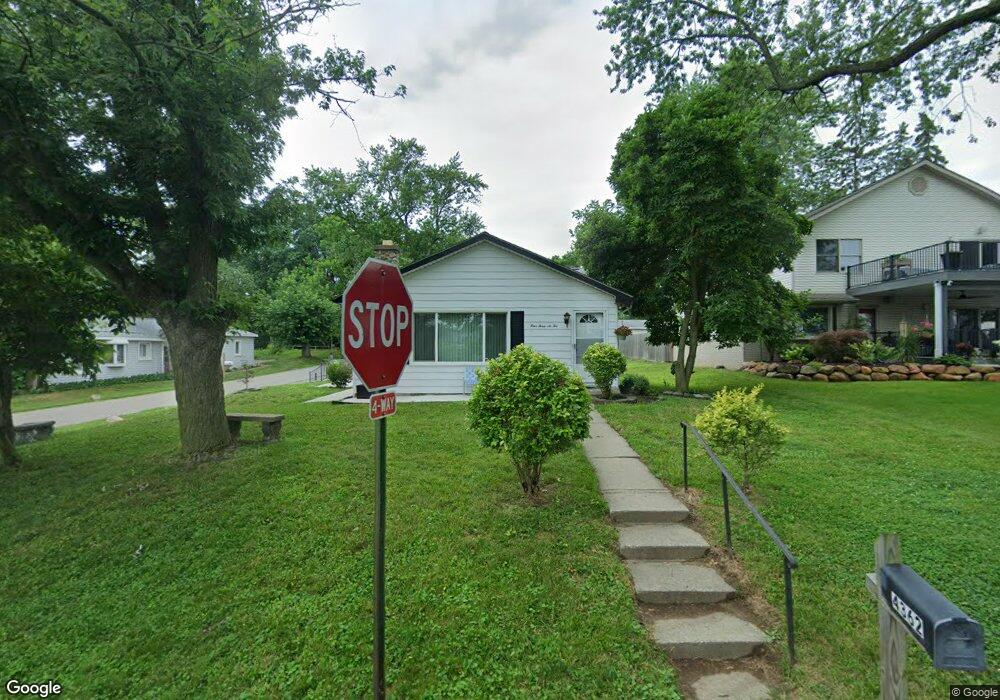
4362 Welland Dr West Bloomfield, MI 48323
Estimated Value: $259,540 - $367,000
3
Beds
2
Baths
1,290
Sq Ft
$231/Sq Ft
Est. Value
About This Home
This home is located at 4362 Welland Dr, West Bloomfield, MI 48323 and is currently estimated at $298,385, approximately $231 per square foot. 4362 Welland Dr is a home located in Oakland County with nearby schools including Walled Lake Central High School, The Susan And Rabbi Harold Loss Ecc, and Brookfield Academy - West Bloomfield.
Ownership History
Date
Name
Owned For
Owner Type
Purchase Details
Closed on
Aug 24, 2010
Sold by
Dunning Robert R and Dunning Sheryl A
Bought by
Tyson Properties Llc
Current Estimated Value
Purchase Details
Closed on
Oct 26, 1995
Sold by
Eagle Eileen
Bought by
Dunning Robert R
Home Financials for this Owner
Home Financials are based on the most recent Mortgage that was taken out on this home.
Original Mortgage
$115,400
Interest Rate
7.61%
Create a Home Valuation Report for This Property
The Home Valuation Report is an in-depth analysis detailing your home's value as well as a comparison with similar homes in the area
Home Values in the Area
Average Home Value in this Area
Purchase History
| Date | Buyer | Sale Price | Title Company |
|---|---|---|---|
| Tyson Properties Llc | $34,851 | None Available | |
| Dunning Robert R | $119,000 | -- |
Source: Public Records
Mortgage History
| Date | Status | Borrower | Loan Amount |
|---|---|---|---|
| Previous Owner | Dunning Robert R | $115,400 |
Source: Public Records
Tax History Compared to Growth
Tax History
| Year | Tax Paid | Tax Assessment Tax Assessment Total Assessment is a certain percentage of the fair market value that is determined by local assessors to be the total taxable value of land and additions on the property. | Land | Improvement |
|---|---|---|---|---|
| 2024 | $1,337 | $93,060 | $0 | $0 |
| 2022 | $1,261 | $86,680 | $36,940 | $49,740 |
| 2021 | $2,073 | $83,140 | $0 | $0 |
| 2020 | $1,246 | $79,730 | $36,940 | $42,790 |
| 2018 | $2,018 | $71,290 | $36,940 | $34,350 |
| 2015 | -- | $60,680 | $0 | $0 |
| 2014 | -- | $57,080 | $0 | $0 |
| 2011 | -- | $52,900 | $0 | $0 |
Source: Public Records
Map
Nearby Homes
- 4442 Borland St
- 4066 Green Lake Rd
- 0000 Langtoft
- 6675 Langtoft St
- 6978 Colony Dr
- 6980 Hambro St
- 4540 Rolling Pine Ct
- 4335 Crestdale Ave
- 3991 Fieldview Ave
- 4245 Bunker Ave
- 3965 Carrick Ave
- 3950 Bradmore Ave
- 6903 Dandison Blvd
- 4212 Greendale Ave
- 7337 Richardson Rd
- 6768 Buckland Ave
- 7381 Crestmore St
- 7359 Woodlore Dr
- 3632 Fieldview Ave
- 3641 Green Lake Rd
- 4352 Welland Dr
- 6874 Manderson Terrace
- 4372 Welland Dr
- 6874 Manderson Trc
- 6821 Playfair Terrace
- 4344 Welland Dr
- 6885 Playfair Terrace
- 4368 Borland St
- 4332 Welland Dr
- 4408 Welland Dr
- 0000 Borland St
- 0 Borland Unit 4956871
- 0 Borland Unit 215124858
- 4385 Welland Dr
- 0000 Colony Dr
- 6908 Manderson Trc
- 6908 Manderson Terrace
- 6890 Playfair Terrace