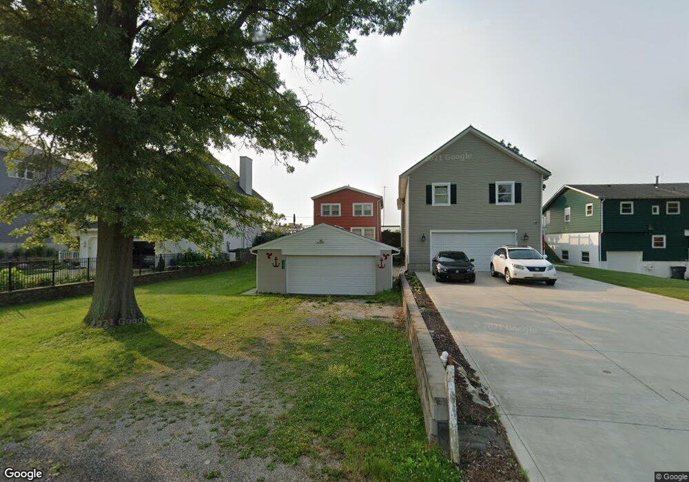
4363 N Bank Rd NE Millersport, OH 43046
Estimated Value: $494,076 - $678,000
3
Beds
1
Bath
1,280
Sq Ft
$467/Sq Ft
Est. Value
About This Home
This home is located at 4363 N Bank Rd NE, Millersport, OH 43046 and is currently estimated at $597,269, approximately $466 per square foot. 4363 N Bank Rd NE is a home located in Fairfield County with nearby schools including Millersport Elementary School and Millersport Jr/Sr High School.
Ownership History
Date
Name
Owned For
Owner Type
Purchase Details
Closed on
May 31, 2018
Sold by
Getreu Robert L and Getreu Rebecca
Bought by
Fire 4 Shooty Llc
Current Estimated Value
Purchase Details
Closed on
May 30, 2018
Sold by
Yonnotti Valerie A and Yonnotti Michael A
Bought by
Fire 4 Shooty Llc
Purchase Details
Closed on
Mar 22, 2018
Sold by
Getreu David E and Getreu Paula
Bought by
Yonnotti Valerie A and Hoffman Mary F
Purchase Details
Closed on
Jan 1, 1991
Bought by
Getreu James P
Create a Home Valuation Report for This Property
The Home Valuation Report is an in-depth analysis detailing your home's value as well as a comparison with similar homes in the area
Home Values in the Area
Average Home Value in this Area
Purchase History
| Date | Buyer | Sale Price | Title Company |
|---|---|---|---|
| Fire 4 Shooty Llc | -- | None Available | |
| Fire 4 Shooty Llc | -- | None Available | |
| Fire 4 Shooty Llc | -- | None Available | |
| Fire 4 Shooty Llc | -- | None Available | |
| Yonnotti Valerie A | $45,000 | Sas Title Agency Ltd | |
| Getreu James P | $79,000 | -- |
Source: Public Records
Tax History Compared to Growth
Tax History
| Year | Tax Paid | Tax Assessment Tax Assessment Total Assessment is a certain percentage of the fair market value that is determined by local assessors to be the total taxable value of land and additions on the property. | Land | Improvement |
|---|---|---|---|---|
| 2024 | $6,594 | $109,720 | $75,380 | $34,340 |
| 2023 | $4,430 | $109,720 | $75,380 | $34,340 |
| 2022 | $4,453 | $109,720 | $75,380 | $34,340 |
| 2021 | $3,913 | $86,800 | $62,820 | $23,980 |
| 2020 | $3,927 | $86,800 | $62,820 | $23,980 |
| 2019 | $3,927 | $86,800 | $62,820 | $23,980 |
| 2018 | $3,733 | $74,920 | $59,430 | $15,490 |
| 2017 | $3,657 | $74,650 | $59,430 | $15,220 |
| 2016 | $3,368 | $74,650 | $59,430 | $15,220 |
| 2015 | $3,396 | $74,030 | $59,430 | $14,600 |
| 2014 | $2,742 | $74,030 | $59,430 | $14,600 |
| 2013 | $2,742 | $74,030 | $59,430 | $14,600 |
Source: Public Records
Map
Nearby Homes
- 4255 N Bank Rd NE
- 4468 N Bank Rd NE
- 4135 Walnut Rd
- 3863 N Bank Rd NE
- 4881 Decker Ave NE
- 4711 Walnut Rd Unit F2
- 102 Leroy St
- 5102 Bateson Beach Dr NE
- 0 Beaver Rd NE
- 13309 Aspen Rd NE
- 5130 Bateson Dr NE
- 65 Stewart Ave
- 13310 Shell Beach Rd NE
- 3483 N Bank Rd
- 48 Rosebraugh Cir
- 0 Forrest Rd NE
- 13200 Elm Rd NE
- 3308 Shepard Ave
- 13556 Richards St NE
- 11116 Hebron Rd
- 4357 N Bank Rd NE
- 4369 N Bank Rd NE
- 4351 N Bank Rd NE
- 4375 N Bank Rd NE
- 4381 N Bank Rd NE
- 4345 N Bank Rd NE
- 4387 N Bank Rd NE
- 4350 N Bank Rd NE
- 4333 N Bank Rd NE
- 4393 N Bank Rd NE
- 4399 N Bank Rd NE
- 4327 N Bank Rd NE
- 4405 N Bank Rd NE
- 4321 N Bank Rd NE
- 4340 N Bank Rd NE
- 4340 N Bank Rd NE
- 4340 N Bank Rd NE
- 4340 N Bank Rd NE
- 4340 N Bank Rd NE
- 4411 N Bank Rd NE