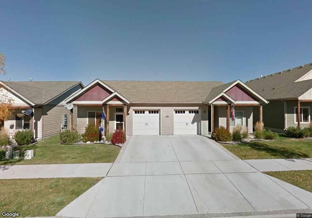
4369 Brookside Ln Unit A Bozeman, MT 59718
Flanders Creek NeighborhoodEstimated Value: $360,544 - $416,000
2
Beds
2
Baths
1,008
Sq Ft
$377/Sq Ft
Est. Value
About This Home
This home is located at 4369 Brookside Ln Unit A, Bozeman, MT 59718 and is currently estimated at $379,636, approximately $376 per square foot. 4369 Brookside Ln Unit A is a home located in Gallatin County with nearby schools including Meadowlark Elementary School, Chief Joseph Middle School, and Gallatin High School.
Ownership History
Date
Name
Owned For
Owner Type
Purchase Details
Closed on
Mar 8, 2017
Sold by
Msrp Llc
Bought by
Brookside Lane Llc
Current Estimated Value
Purchase Details
Closed on
Aug 20, 2015
Sold by
Nedrud Donald V
Bought by
Msrp Llc
Create a Home Valuation Report for This Property
The Home Valuation Report is an in-depth analysis detailing your home's value as well as a comparison with similar homes in the area
Home Values in the Area
Average Home Value in this Area
Purchase History
| Date | Buyer | Sale Price | Title Company |
|---|---|---|---|
| Brookside Lane Llc | -- | None Available | |
| Msrp Llc | $152,293 | First American Title Ins Co |
Source: Public Records
Tax History
| Year | Tax Paid | Tax Assessment Tax Assessment Total Assessment is a certain percentage of the fair market value that is determined by local assessors to be the total taxable value of land and additions on the property. | Land | Improvement |
|---|---|---|---|---|
| 2025 | $1,508 | $390,800 | $0 | $0 |
| 2024 | $2,601 | $390,700 | $0 | $0 |
| 2023 | $2,519 | $393,600 | $0 | $0 |
| 2022 | $2,049 | $267,300 | $0 | $0 |
| 2021 | $2,261 | $267,300 | $0 | $0 |
| 2020 | $1,954 | $228,300 | $0 | $0 |
| 2019 | $1,998 | $228,300 | $0 | $0 |
| 2018 | $1,752 | $185,400 | $0 | $0 |
| 2017 | $1,638 | $185,400 | $0 | $0 |
| 2016 | $1,328 | $140,400 | $0 | $0 |
| 2015 | $271 | $140,400 | $0 | $0 |
| 2014 | $273 | $83,793 | $0 | $0 |
Source: Public Records
Map
Nearby Homes
- 4348 Glenwood Dr Unit C
- 853 Rookery Ln
- 878 Rookery Ln
- 852,853,878,881 Rookery
- 881 Rookery Ln
- 886 Flanders Creek Ave
- 4689 Bembrick St Unit 1A
- 4665 Bembrick St Unit 2D
- 4665 Bembrick St Unit 1C
- 4454 Shadowglen Dr
- 926 Abigail Ln Unit A
- 5350 Delft Way
- 1097 Cassandra Ln Unit A
- 4563 Ethan Way
- TBD (Lot 2) N Cottonwood Rd
- TBD (Lot 3) N Cottonwood Rd
- TBD (Lot 5) N Cottonwood Rd
- 1811 N Cottonwood Rd
- 332 N Cottonwood Rd Unit F
- 5442 Annie St Unit A
- 4369 Brookside Ln Unit B
- 4365 Brookside Ln Unit A
- 4365 Brookside Ln Unit B
- 4365 Brookside Ln
- 4375 Brookside Ln
- 4375 Brookside Ln
- 4375 Brookside Ln Unit B
- 4379 Brookside Ln Unit B
- 4379 Brookside Ln Unit A
- 4379 Brookside Ln
- 4379 Brookside Ln Unit B
- 4365A Brookside Ln
- 4365B Brookside
- 4370 Glenwood Dr
- 4372 Glenwood Dr
- 4368 Glenwood Dr
- 4374 Glenwood Dr
- 4366 Glenwood Dr
- 4376 Glenwood Dr
- 4389 Brookside Ln
Your Personal Tour Guide
Ask me questions while you tour the home.