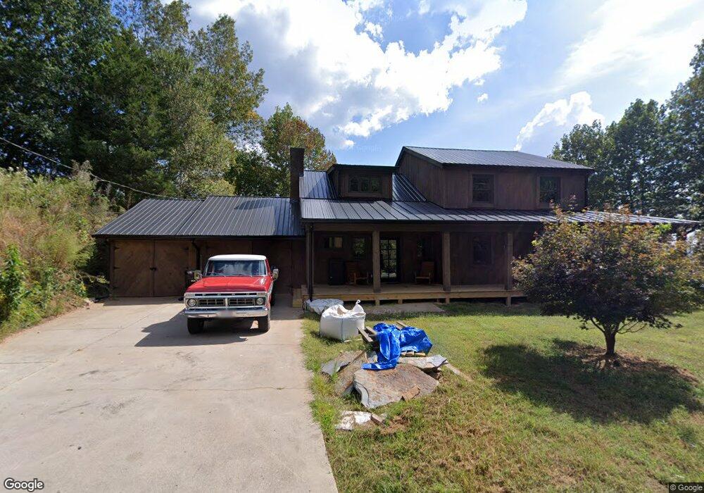
437 Calhoun Rd Dahlonega, GA 30533
Estimated Value: $502,532 - $621,000
--
Bed
2
Baths
2,674
Sq Ft
$208/Sq Ft
Est. Value
About This Home
This home is located at 437 Calhoun Rd, Dahlonega, GA 30533 and is currently estimated at $555,883, approximately $207 per square foot. 437 Calhoun Rd is a home located in Lumpkin County with nearby schools including Clay County Middle School and Lumpkin County High School.
Ownership History
Date
Name
Owned For
Owner Type
Purchase Details
Closed on
Nov 21, 2022
Sold by
Lunsford Fannie R
Bought by
Payne Zachary Thomas
Current Estimated Value
Home Financials for this Owner
Home Financials are based on the most recent Mortgage that was taken out on this home.
Original Mortgage
$300,000
Outstanding Balance
$290,697
Interest Rate
6.95%
Mortgage Type
New Conventional
Estimated Equity
$265,186
Purchase Details
Closed on
Jan 30, 2004
Sold by
Pandres Dave
Bought by
Lunsford Fannie R
Purchase Details
Closed on
Aug 1, 1984
Bought by
Pandres Dave
Create a Home Valuation Report for This Property
The Home Valuation Report is an in-depth analysis detailing your home's value as well as a comparison with similar homes in the area
Home Values in the Area
Average Home Value in this Area
Purchase History
| Date | Buyer | Sale Price | Title Company |
|---|---|---|---|
| Payne Zachary Thomas | $375,000 | -- | |
| Lunsford Fannie R | $185,000 | -- | |
| Pandres Dave | -- | -- |
Source: Public Records
Mortgage History
| Date | Status | Borrower | Loan Amount |
|---|---|---|---|
| Open | Payne Zachary Thomas | $300,000 |
Source: Public Records
Tax History Compared to Growth
Tax History
| Year | Tax Paid | Tax Assessment Tax Assessment Total Assessment is a certain percentage of the fair market value that is determined by local assessors to be the total taxable value of land and additions on the property. | Land | Improvement |
|---|---|---|---|---|
| 2024 | $5,041 | $182,904 | $16,000 | $166,904 |
| 2023 | $3,755 | $160,455 | $16,000 | $144,455 |
| 2022 | $346 | $87,523 | $16,000 | $71,523 |
| 2021 | $62 | $69,066 | $10,000 | $59,066 |
| 2020 | $42 | $67,328 | $10,000 | $57,328 |
| 2019 | $106 | $71,328 | $14,000 | $57,328 |
| 2018 | $30 | $64,657 | $14,000 | $50,657 |
| 2017 | $37 | $65,631 | $14,000 | $51,631 |
| 2016 | $6 | $60,864 | $14,000 | $46,864 |
| 2015 | $8 | $60,864 | $14,000 | $46,864 |
| 2014 | $8 | $61,716 | $14,000 | $47,716 |
| 2013 | -- | $63,420 | $14,000 | $49,420 |
Source: Public Records
Map
Nearby Homes
- 0 Crown Mountain Unit 7682225
- 0 Crown Mountain Unit 10644759
- 735 Calhoun Rd
- 99 Madeline Anthony Rd
- 99 Madeline Anthony Road Lots 44 and 45
- LOT 13 Crown Mountain Way
- Lot 28 Crown Mountain Way
- Lot 30 Crown Mountain Way
- Lot 20 Crown Mountain Way
- 0 Crown Mountain Way Unit 7666031
- 0 Calhoun Rd Unit 7643314
- 0 Calhoun Rd Unit 10598012
- 00 Calhoun Rd
- 567 Crown Mountain Way
- 0 Alicia Ln
- 1170 Calhoun Rd
- 168 W Main St
- 0 Highway 9 S Unit 10487179
- 0 Highway 9 S Unit 7548614
- 1392 S Chestatee St
- 00 Crown Mountain Dr
- 1 Crown Mountain Dr
- 48 Crown Mountain Dr
- 7 Crown Mountain Dr
- 0 Crown Mountain #C Way Unit LOT C 10288350
- 0 Crown Mountain #C Way
- 501 Calhoun Rd
- 494 Calhoun Rd
- 4 Crown Mountain
- 0 (LOT 21) Calhoun Rd
- 73 Crown Mountain Dr
- LOT 16 Calhoun Rd
- 364 Calhoun Rd
- 542 Calhoun Rd
- 3 Crown Mountain Dr
- 83 Crown Mountain Dr
- 11 Crown Mountain Dr
- 559 Calhoun Rd
- 80 Timber Oak Ln
- 172 Madeline Anthony Rd