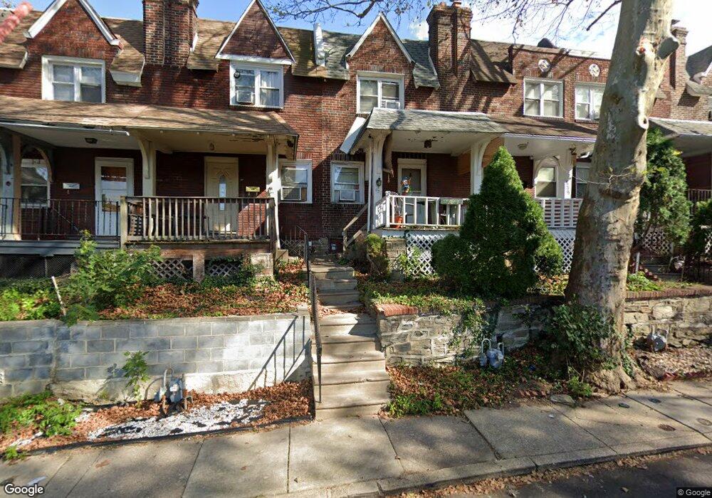
437 Copley Rd Upper Darby, PA 19082
Estimated Value: $137,000 - $174,000
3
Beds
1
Bath
1,112
Sq Ft
$143/Sq Ft
Est. Value
About This Home
This home is located at 437 Copley Rd, Upper Darby, PA 19082 and is currently estimated at $159,000, approximately $142 per square foot. 437 Copley Rd is a home located in Delaware County with nearby schools including Upper Darby Kdg Center, Upper Darby High School, and Lansdowne Friends School.
Ownership History
Date
Name
Owned For
Owner Type
Purchase Details
Closed on
Nov 16, 2021
Sold by
Ari Llc
Bought by
Centric Bank
Current Estimated Value
Home Financials for this Owner
Home Financials are based on the most recent Mortgage that was taken out on this home.
Original Mortgage
$275,000
Outstanding Balance
$252,060
Interest Rate
3.01%
Mortgage Type
Future Advance Clause Open End Mortgage
Estimated Equity
-$93,060
Purchase Details
Closed on
Feb 14, 2020
Sold by
Delfranco Barbara Jeanne and Gamber Rodger Edward
Bought by
Ari Llc
Home Financials for this Owner
Home Financials are based on the most recent Mortgage that was taken out on this home.
Original Mortgage
$1,120,000
Interest Rate
3.6%
Mortgage Type
New Conventional
Purchase Details
Closed on
Dec 10, 1986
Sold by
Terry James J and Terry Nancy B
Bought by
Gamber Rodger E and Gamber Barbara A
Create a Home Valuation Report for This Property
The Home Valuation Report is an in-depth analysis detailing your home's value as well as a comparison with similar homes in the area
Home Values in the Area
Average Home Value in this Area
Purchase History
| Date | Buyer | Sale Price | Title Company |
|---|---|---|---|
| Centric Bank | -- | None Listed On Document | |
| Ari Llc | $1,075,000 | Horizon Abstract Company Inc | |
| Gamber Rodger E | $47,000 | -- | |
| Centric Bank | -- | None Listed On Document |
Source: Public Records
Mortgage History
| Date | Status | Borrower | Loan Amount |
|---|---|---|---|
| Open | Centric Bank | $275,000 | |
| Previous Owner | Ari Llc | $1,120,000 | |
| Closed | Centric Bank | $275,000 |
Source: Public Records
Tax History
| Year | Tax Paid | Tax Assessment Tax Assessment Total Assessment is a certain percentage of the fair market value that is determined by local assessors to be the total taxable value of land and additions on the property. | Land | Improvement |
|---|---|---|---|---|
| 2025 | $2,093 | $49,500 | $13,410 | $36,090 |
| 2024 | $2,093 | $49,500 | $13,410 | $36,090 |
| 2023 | $2,074 | $49,500 | $13,410 | $36,090 |
| 2022 | $2,018 | $49,500 | $13,410 | $36,090 |
| 2021 | $2,721 | $49,500 | $13,410 | $36,090 |
| 2020 | $2,716 | $41,990 | $12,190 | $29,800 |
| 2019 | $2,668 | $41,990 | $12,190 | $29,800 |
| 2018 | $2,638 | $41,990 | $0 | $0 |
| 2017 | $2,569 | $41,990 | $0 | $0 |
| 2016 | $230 | $41,990 | $0 | $0 |
| 2015 | $235 | $41,990 | $0 | $0 |
| 2014 | $230 | $41,990 | $0 | $0 |
Source: Public Records
Map
Nearby Homes
- 418 Hampden Rd
- 418 Littlecroft Rd Unit 6A
- 337 Copley Rd
- 7273 Guilford Rd
- 424 Woodcliffe Rd
- 91 Lamport Rd
- 513 Woodcliffe Rd
- 43 Springton Rd
- 641 Copley Rd
- 7261 Calvin Rd
- 7210 Spruce St
- 7265 Calvin Rd
- 279 Copley Rd
- 243 Coverly Rd
- 247 Coverly Rd
- 6997 Guilford Rd
- 540 Snowden Rd
- 7218 Radbourne Rd
- 234 Hampden Rd
- 7042 Clinton Rd
Your Personal Tour Guide
Ask me questions while you tour the home.