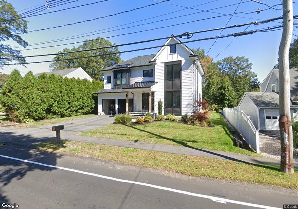
437 High Rock St Needham, MA 02492
Estimated Value: $2,426,000 - $2,680,000
5
Beds
6
Baths
2,036
Sq Ft
$1,282/Sq Ft
Est. Value
About This Home
This home is located at 437 High Rock St, Needham, MA 02492 and is currently estimated at $2,609,685, approximately $1,281 per square foot. 437 High Rock St is a home located in Norfolk County with nearby schools including Newman Elementary School, High Rock Middle School, and Pollard Middle School.
Ownership History
Date
Name
Owned For
Owner Type
Purchase Details
Closed on
Jun 17, 2016
Sold by
Linton Cecil C
Bought by
Linton Margaret J
Current Estimated Value
Purchase Details
Closed on
Oct 13, 1972
Bought by
Linton Cecil C and Linton Margaret J
Create a Home Valuation Report for This Property
The Home Valuation Report is an in-depth analysis detailing your home's value as well as a comparison with similar homes in the area
Home Values in the Area
Average Home Value in this Area
Purchase History
| Date | Buyer | Sale Price | Title Company |
|---|---|---|---|
| Linton Margaret J | -- | -- | |
| Linton Cecil C | $50,000 | -- |
Source: Public Records
Mortgage History
| Date | Status | Borrower | Loan Amount |
|---|---|---|---|
| Previous Owner | Linton Cecil C | $75,000 |
Source: Public Records
Tax History Compared to Growth
Tax History
| Year | Tax Paid | Tax Assessment Tax Assessment Total Assessment is a certain percentage of the fair market value that is determined by local assessors to be the total taxable value of land and additions on the property. | Land | Improvement |
|---|---|---|---|---|
| 2025 | $25,369 | $2,393,300 | $729,000 | $1,664,300 |
| 2024 | $29,307 | $2,340,800 | $531,900 | $1,808,900 |
| 2023 | $28,661 | $2,197,900 | $531,900 | $1,666,000 |
| 2022 | $7,177 | $536,800 | $502,100 | $34,700 |
| 2021 | $9,456 | $725,700 | $502,100 | $223,600 |
| 2020 | $9,360 | $749,400 | $502,100 | $247,300 |
| 2019 | $8,690 | $701,400 | $457,000 | $244,400 |
| 2018 | $8,333 | $701,400 | $457,000 | $244,400 |
| 2017 | $7,976 | $670,800 | $457,000 | $213,800 |
| 2016 | $7,769 | $673,200 | $457,000 | $216,200 |
| 2015 | $7,600 | $673,200 | $457,000 | $216,200 |
| 2014 | $7,299 | $627,100 | $416,000 | $211,100 |
Source: Public Records
Map
Nearby Homes
- 443 High Rock St
- 431 High Rock St
- 15 Birchwood Rd
- 449 High Rock St
- 43 Fairview Rd
- 37 Fairview Rd
- 455 High Rock St
- 455 High Rock St Unit 455
- 6 Frances St
- 7 Birchwood Rd
- 24 Birchwood Rd
- 3 Frances St
- 430 High Rock St
- 31 Fairview Rd
- 16 Birchwood Rd
- 452 High Rock St
- 424 High Rock St
- 27 Fairview Rd
- 10 Birchwood Rd
- 456 High Rock St