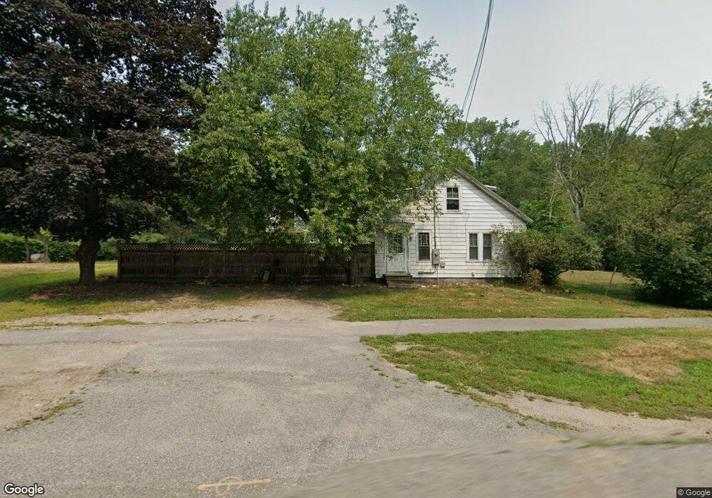
437 Littleton Rd Westford, MA 01886
Estimated Value: $550,203 - $734,000
3
Beds
1
Bath
1,499
Sq Ft
$416/Sq Ft
Est. Value
About This Home
This home is located at 437 Littleton Rd, Westford, MA 01886 and is currently estimated at $624,301, approximately $416 per square foot. 437 Littleton Rd is a home located in Middlesex County with nearby schools including Col John Robinson, John A. Crisafulli Elementary School, and Blanchard Middle School.
Ownership History
Date
Name
Owned For
Owner Type
Purchase Details
Closed on
Aug 28, 2017
Sold by
Kimball T 1 and Kimball Michael S
Bought by
Paysage De Glace Llc
Current Estimated Value
Home Financials for this Owner
Home Financials are based on the most recent Mortgage that was taken out on this home.
Original Mortgage
$31,000,000
Outstanding Balance
$25,977,099
Interest Rate
4.03%
Mortgage Type
Purchase Money Mortgage
Estimated Equity
-$25,352,798
Create a Home Valuation Report for This Property
The Home Valuation Report is an in-depth analysis detailing your home's value as well as a comparison with similar homes in the area
Home Values in the Area
Average Home Value in this Area
Purchase History
| Date | Buyer | Sale Price | Title Company |
|---|---|---|---|
| Paysage De Glace Llc | $180,000 | -- |
Source: Public Records
Mortgage History
| Date | Status | Borrower | Loan Amount |
|---|---|---|---|
| Open | Paysage De Glace Llc | $31,000,000 |
Source: Public Records
Tax History Compared to Growth
Tax History
| Year | Tax Paid | Tax Assessment Tax Assessment Total Assessment is a certain percentage of the fair market value that is determined by local assessors to be the total taxable value of land and additions on the property. | Land | Improvement |
|---|---|---|---|---|
| 2025 | $6,688 | $496,500 | $329,300 | $167,200 |
| 2024 | $6,512 | $472,900 | $313,600 | $159,300 |
| 2023 | $6,562 | $444,600 | $299,200 | $145,400 |
| 2022 | $6,309 | $391,400 | $247,500 | $143,900 |
| 2021 | $0 | $369,200 | $247,500 | $121,700 |
| 2020 | $410 | $369,600 | $247,500 | $122,100 |
| 2019 | $5,816 | $351,200 | $237,500 | $113,700 |
| 2018 | $5,498 | $339,800 | $227,500 | $112,300 |
| 2017 | $5,374 | $327,500 | $227,500 | $100,000 |
| 2016 | $5,609 | $344,100 | $227,500 | $116,600 |
| 2015 | $5,561 | $342,400 | $227,500 | $114,900 |
| 2014 | $5,448 | $328,200 | $218,800 | $109,400 |
Source: Public Records
Map
Nearby Homes
- 55 Jennifer St
- 115 Goldsmith St
- 12 Paula Beth St
- 10 Baldwin Hill Rd
- 125 Concord Rd
- 34 Baldwin Hill Rd
- 8 Edsel Rd
- 4 Mars Place
- 336 King St Unit 105
- 16 Fletcher Ln
- 91 Jimney Dr Unit 91
- 92 Jimney Dr
- 5 Mill Park Place
- 5 Mill Park Place Unit 5
- 3 Mill Park Place
- 3 Mill Park Place Unit 3
- 28 Monadnock Dr
- 18 Long Lake Rd
- 41 Flagg Rd
- 84 Powers Rd
- 432 Littleton Rd
- 434 Littleton Rd
- 434 Littleton Rd
- 434 Littleton Rd
- 434 Littleton Rd Unit 8
- 434 Littleton Rd Unit 7 & 8
- 434 Littleton Rd Unit 1-6
- 434 Littleton Rd Unit 4
- 434 Littleton Rd Unit 3B
- 434 Littleton Rd Unit 3A
- 434 Littleton Rd Unit 1&2
- 434 Littleton Rd Unit S
- 434 Littleton Rd Unit 1-8
- 434 Littleton Rd Unit 7
- 434 Littleton Rd Unit 5
- 434 Littleton Rd Unit 2
- 434 Littleton Rd Unit 3
- 434 Littleton Rd Unit 6
- 434 Littleton Rd Unit 100
- 434 Littleton Rd