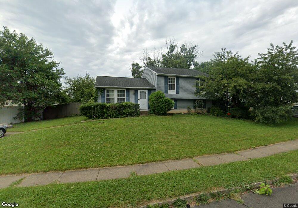
437 Musket Dr Morrisville, PA 19067
Estimated Value: $439,330 - $497,000
3
Beds
2
Baths
1,152
Sq Ft
$409/Sq Ft
Est. Value
About This Home
This home is located at 437 Musket Dr, Morrisville, PA 19067 and is currently estimated at $471,333, approximately $409 per square foot. 437 Musket Dr is a home located in Bucks County with nearby schools including Eleanor Roosevelt Elementary School, Pennwood Middle School, and Pennsbury High School.
Ownership History
Date
Name
Owned For
Owner Type
Purchase Details
Closed on
May 26, 2009
Sold by
Hough Douglas R and Hough Jean B
Bought by
Hough Scott D and Hough Jennifer L
Current Estimated Value
Home Financials for this Owner
Home Financials are based on the most recent Mortgage that was taken out on this home.
Original Mortgage
$214,692
Outstanding Balance
$136,375
Interest Rate
4.87%
Mortgage Type
FHA
Estimated Equity
$334,958
Purchase Details
Closed on
Aug 19, 1988
Bought by
Hough Douglas R and Hough Jean B
Create a Home Valuation Report for This Property
The Home Valuation Report is an in-depth analysis detailing your home's value as well as a comparison with similar homes in the area
Home Values in the Area
Average Home Value in this Area
Purchase History
| Date | Buyer | Sale Price | Title Company |
|---|---|---|---|
| Hough Scott D | $225,000 | None Available | |
| Hough Douglas R | $154,500 | -- |
Source: Public Records
Mortgage History
| Date | Status | Borrower | Loan Amount |
|---|---|---|---|
| Open | Hough Scott D | $214,692 |
Source: Public Records
Tax History Compared to Growth
Tax History
| Year | Tax Paid | Tax Assessment Tax Assessment Total Assessment is a certain percentage of the fair market value that is determined by local assessors to be the total taxable value of land and additions on the property. | Land | Improvement |
|---|---|---|---|---|
| 2025 | $6,414 | $28,800 | $5,640 | $23,160 |
| 2024 | $6,414 | $28,800 | $5,640 | $23,160 |
| 2023 | $6,145 | $28,800 | $5,640 | $23,160 |
| 2022 | $5,954 | $28,800 | $5,640 | $23,160 |
| 2021 | $5,839 | $28,800 | $5,640 | $23,160 |
| 2020 | $5,839 | $28,800 | $5,640 | $23,160 |
| 2019 | $5,737 | $28,800 | $5,640 | $23,160 |
| 2018 | $5,666 | $28,800 | $5,640 | $23,160 |
| 2017 | $5,523 | $28,800 | $5,640 | $23,160 |
| 2016 | $5,523 | $28,800 | $5,640 | $23,160 |
| 2015 | $5,062 | $28,800 | $5,640 | $23,160 |
| 2014 | $5,062 | $28,800 | $5,640 | $23,160 |
Source: Public Records
Map
Nearby Homes
- 113 Juliet Rd
- 10 Makefield Rd
- 115 Winding Way
- 413 Alden Ave
- 404 Alden Ave
- 5 Patrick Ln
- 229 Walton Dr
- 199 Share Dr
- 494 Keating Dr
- 670 Lincoln Hwy
- LOT 021-003 W M Y Ln
- 581 Nottingham Dr
- 329 Sherwood Dr
- 120 Vermont Ln
- 320 Melvin Ave N
- 184 Crestview Way
- 79 Sutphin Pines
- 554 Doloro Dr
- 46 Moon Dr
- 505 Carmela Way
- 435 Musket Dr
- 148 Independence Dr
- 146 Independence Dr
- 433 Musket Dr
- 144 Independence Dr
- 430 Musket Dr
- 428 Musket Dr
- 432 Musket Dr
- 150 Independence Dr
- 426 Musket Dr
- 142 Independence Dr
- 431 Musket Dr
- 424 Musket Dr
- 140 Independence Dr
- 163 Independence Dr
- 429 Musket Dr
- 165 Independence Dr
- 422 Musket Dr
- 161 Independence Dr
- 421 Centennial Dr