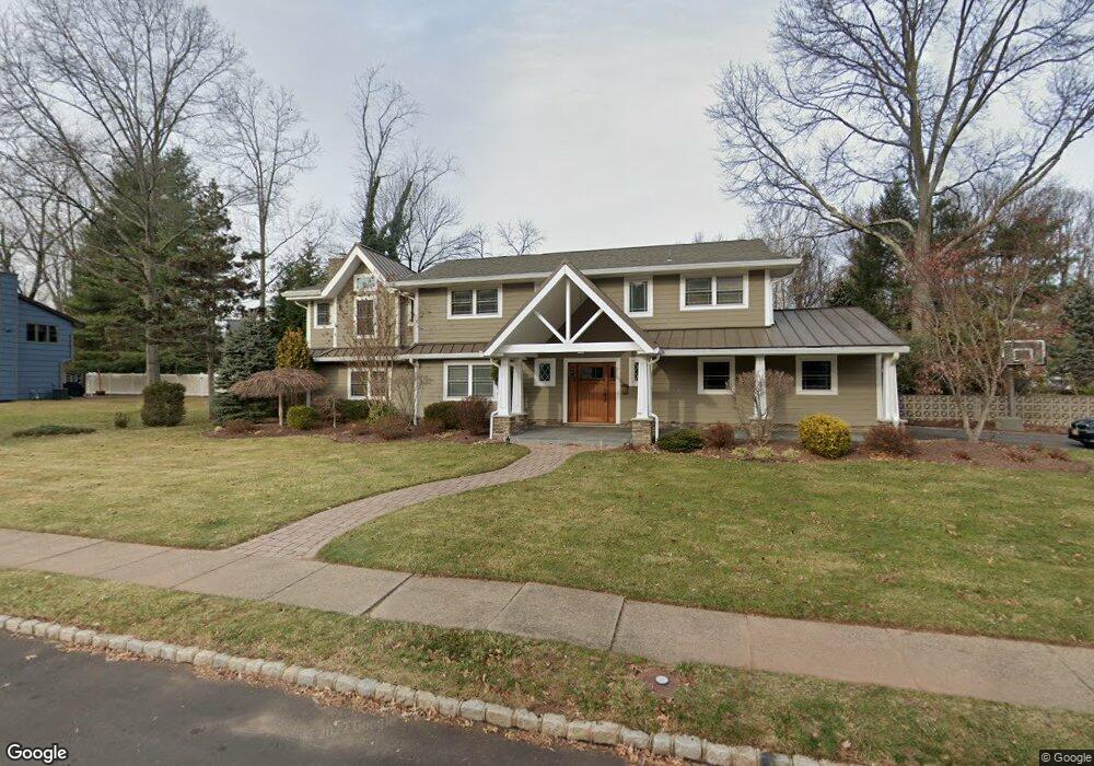
437 Roanoke Rd Westfield, NJ 07090
Estimated Value: $1,491,000 - $2,150,000
--
Bed
--
Bath
3,462
Sq Ft
$520/Sq Ft
Est. Value
About This Home
This home is located at 437 Roanoke Rd, Westfield, NJ 07090 and is currently estimated at $1,800,137, approximately $519 per square foot. 437 Roanoke Rd is a home located in Union County with nearby schools including Franklin Elementary School, Roosevelt Intermediate School, and Westfield Senior High School.
Ownership History
Date
Name
Owned For
Owner Type
Purchase Details
Closed on
Jul 14, 1997
Sold by
Powell Clara
Bought by
Hertzberg David and Hertzberg Lisa
Current Estimated Value
Home Financials for this Owner
Home Financials are based on the most recent Mortgage that was taken out on this home.
Original Mortgage
$252,000
Outstanding Balance
$37,043
Interest Rate
7.79%
Estimated Equity
$1,763,094
Purchase Details
Closed on
Jul 8, 1997
Sold by
437 Roanoke Road Inc
Bought by
Powell Clara
Home Financials for this Owner
Home Financials are based on the most recent Mortgage that was taken out on this home.
Original Mortgage
$252,000
Outstanding Balance
$37,043
Interest Rate
7.79%
Estimated Equity
$1,763,094
Create a Home Valuation Report for This Property
The Home Valuation Report is an in-depth analysis detailing your home's value as well as a comparison with similar homes in the area
Home Values in the Area
Average Home Value in this Area
Purchase History
| Date | Buyer | Sale Price | Title Company |
|---|---|---|---|
| Hertzberg David | $315,000 | Chicago Title Insurance Co | |
| Powell Clara | -- | -- |
Source: Public Records
Mortgage History
| Date | Status | Borrower | Loan Amount |
|---|---|---|---|
| Open | Hertzberg David | $252,000 |
Source: Public Records
Tax History Compared to Growth
Tax History
| Year | Tax Paid | Tax Assessment Tax Assessment Total Assessment is a certain percentage of the fair market value that is determined by local assessors to be the total taxable value of land and additions on the property. | Land | Improvement |
|---|---|---|---|---|
| 2025 | $24,164 | $1,073,000 | $520,500 | $552,500 |
| 2024 | $23,670 | $1,073,000 | $520,500 | $552,500 |
| 2023 | $23,670 | $1,073,000 | $520,500 | $552,500 |
| 2022 | $23,177 | $1,073,000 | $520,500 | $552,500 |
| 2021 | $23,209 | $1,073,000 | $520,500 | $552,500 |
| 2020 | $23,155 | $1,073,000 | $520,500 | $552,500 |
| 2019 | $23,070 | $1,073,000 | $520,500 | $552,500 |
| 2018 | $20,156 | $216,800 | $102,300 | $114,500 |
| 2017 | $20,045 | $216,800 | $102,300 | $114,500 |
| 2016 | $18,509 | $205,000 | $102,300 | $102,700 |
| 2015 | $18,140 | $205,000 | $102,300 | $102,700 |
| 2014 | $17,542 | $205,000 | $102,300 | $102,700 |
Source: Public Records
Map
Nearby Homes
- 1460 Dunn Pkwy
- 657 Hillside Ave
- 445 Hillside Ave
- 869 Standish Ave
- 1163 Lawrence Ave
- 2 Barchester Way
- 103 Echo Ridge Way
- 825 Lawrence Ave
- 900 Minisink Way
- 286 Indian Trail
- 242 Juniper Way
- 740 Lawrence Ave
- 249 Meetinghouse Ln
- 765 Belvidere Ave
- 824 Grant Ave
- 301 Meetinghouse Ln
- 1256 Poplar Ave
- 345 Creek Bed Rd
- 559 Lawrence Ave
- 359 Dogwood Way
- 353 Orenda Cir
- 433 Roanoke Rd
- 350 Orenda Cir
- 348 Orenda Cir
- 352 Orenda Cir
- 346 Orenda Cir
- 440 Roanoke Rd
- 436 Roanoke Rd
- 355 Orenda Cir
- 344 Orenda Cir
- 354 Orenda Cir
- 432 Roanoke Rd
- 429 Roanoke Rd
- 342 Orenda Cir
- 356 Orenda Cir
- 357 Orenda Cir
- 430 Roanoke Rd
- 425 Quantuck Ln
- 337 Orenda Cir
- 340 Orenda Cir