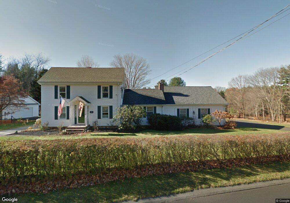
437 Rock Valley Rd Holyoke, MA 01040
Estimated Value: $426,000 - $562,107
3
Beds
2
Baths
2,140
Sq Ft
$223/Sq Ft
Est. Value
About This Home
This home is located at 437 Rock Valley Rd, Holyoke, MA 01040 and is currently estimated at $476,277, approximately $222 per square foot. 437 Rock Valley Rd is a home located in Hampden County with nearby schools including Harriet Bishop Elementary School, Lt. Elmer J. McMahon Elementary School, and Holyoke High School.
Ownership History
Date
Name
Owned For
Owner Type
Purchase Details
Closed on
Dec 22, 2014
Sold by
Drapeau Susan L and Drapeau Susan
Bought by
Susan L Drapeau T
Current Estimated Value
Purchase Details
Closed on
Jun 2, 1997
Sold by
Hoar Francis K and Hoar Diane L
Bought by
Drapeau Michael A and Drapeau Susan
Create a Home Valuation Report for This Property
The Home Valuation Report is an in-depth analysis detailing your home's value as well as a comparison with similar homes in the area
Home Values in the Area
Average Home Value in this Area
Purchase History
| Date | Buyer | Sale Price | Title Company |
|---|---|---|---|
| Susan L Drapeau T | -- | -- | |
| Drapeau Michael A | $20,000 | -- |
Source: Public Records
Mortgage History
| Date | Status | Borrower | Loan Amount |
|---|---|---|---|
| Previous Owner | Drapeau Michael A | $140,000 | |
| Previous Owner | Drapeau Michael A | $140,000 | |
| Previous Owner | Drapeau Michael A | $100,000 | |
| Previous Owner | Drapeau Michael A | $75,000 |
Source: Public Records
Tax History Compared to Growth
Tax History
| Year | Tax Paid | Tax Assessment Tax Assessment Total Assessment is a certain percentage of the fair market value that is determined by local assessors to be the total taxable value of land and additions on the property. | Land | Improvement |
|---|---|---|---|---|
| 2025 | $8,185 | $468,800 | $96,100 | $372,700 |
| 2024 | $7,815 | $412,400 | $91,400 | $321,000 |
| 2023 | $7,481 | $398,800 | $91,400 | $307,400 |
| 2022 | $7,224 | $375,100 | $91,400 | $283,700 |
| 2021 | $6,877 | $356,900 | $88,300 | $268,600 |
| 2020 | $6,520 | $341,700 | $88,300 | $253,400 |
| 2019 | $6,561 | $340,100 | $88,300 | $251,800 |
| 2018 | $6,254 | $326,900 | $88,300 | $238,600 |
| 2017 | $6,267 | $326,900 | $88,300 | $238,600 |
| 2016 | $6,105 | $319,300 | $90,500 | $228,800 |
| 2015 | $6,079 | $319,300 | $90,500 | $228,800 |
Source: Public Records
Map
Nearby Homes
- 405 Rock Valley Rd
- 4 Fitch Farm Way
- 103 Dupuis Rd
- 36 County Rd
- Lot 57 White Loaf Rd
- 94 Pequot Rd (Rear)
- 150 Middle Rd
- 7 Western View Rd
- Lot A Homestead Ave
- 33 Maple Crest Cir Unit D
- 15 Maple Crest Cir Unit D
- 34 Maple Crest Cir Unit B
- 794 Homestead Ave
- 64 Old Stage Rd
- 56 Pomeroy St
- 59 Campbell Dr
- 23 Scott Hollow Dr
- 43 King St
- 6 Emily Ln
- 84 Woodland St
- 430 Rock Valley Rd
- 436 Rock Valley Rd
- 426 Rock Valley Rd
- 427 Rock Valley Rd
- 450 Rock Valley Rd
- 412 Rock Valley Rd
- 408 Rock Valley Rd
- 459 Rock Valley Rd
- 417 Rock Valley Rd
- 470 Rock Valley Rd
- 467 Rock Valley Rd
- 400 Rock Valley Rd
- 20 Pheasant Dr
- 486 Rock Valley Rd
- 18 Pheasant Dr
- 461 Mountain Rd
- 19 Pheasant Dr
- 395 Rock Valley Rd
- 20 Keyes Rd
- 475 Mountain Rd