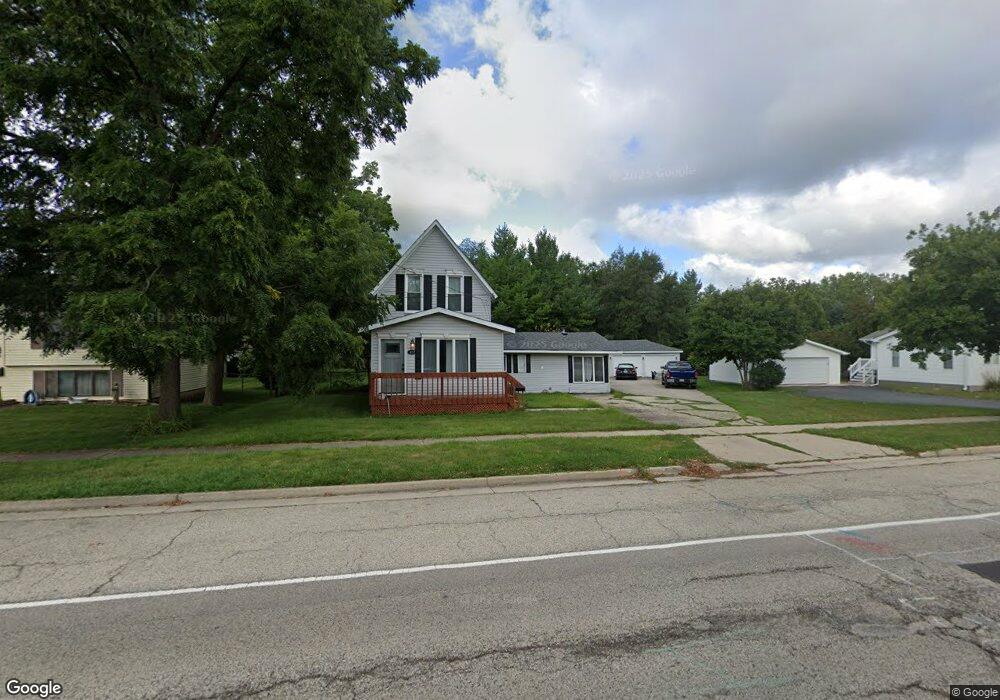
437 S Main St Wauconda, IL 60084
Estimated Value: $257,000 - $380,000
4
Beds
2
Baths
--
Sq Ft
0.27
Acres
About This Home
This home is located at 437 S Main St, Wauconda, IL 60084 and is currently estimated at $321,564. 437 S Main St is a home located in Lake County with nearby schools including Wauconda Grade School, Wauconda Middle School, and Wauconda High School.
Ownership History
Date
Name
Owned For
Owner Type
Purchase Details
Closed on
Jul 25, 2024
Sold by
Albert Mark Edward
Bought by
Flagship Development Llc
Current Estimated Value
Purchase Details
Closed on
Jan 17, 2019
Sold by
Fannie Mae
Bought by
Albert Mark Edward
Purchase Details
Closed on
Oct 16, 2018
Sold by
Quicken Loans Inc
Bought by
Federal National Mortgage Association
Purchase Details
Closed on
Mar 31, 2016
Sold by
Space Catherine A and Space Michael F
Bought by
Space F Michael
Create a Home Valuation Report for This Property
The Home Valuation Report is an in-depth analysis detailing your home's value as well as a comparison with similar homes in the area
Home Values in the Area
Average Home Value in this Area
Purchase History
| Date | Buyer | Sale Price | Title Company |
|---|---|---|---|
| Flagship Development Llc | -- | None Listed On Document | |
| Albert Mark Edward | $101,500 | Real Estate Title Co Llc | |
| Federal National Mortgage Association | -- | Attorney | |
| Space F Michael | -- | Attorney |
Source: Public Records
Tax History Compared to Growth
Tax History
| Year | Tax Paid | Tax Assessment Tax Assessment Total Assessment is a certain percentage of the fair market value that is determined by local assessors to be the total taxable value of land and additions on the property. | Land | Improvement |
|---|---|---|---|---|
| 2024 | $7,353 | $81,866 | $19,620 | $62,246 |
| 2023 | $7,998 | $74,832 | $17,934 | $56,898 |
| 2022 | $7,998 | $73,295 | $19,422 | $53,873 |
| 2021 | $7,666 | $69,257 | $18,352 | $50,905 |
| 2020 | $7,448 | $66,009 | $17,491 | $48,518 |
| 2019 | $6,639 | $62,385 | $16,531 | $45,854 |
| 2018 | $5,791 | $56,380 | $21,491 | $34,889 |
| 2017 | $5,785 | $55,728 | $21,242 | $34,486 |
| 2016 | $4,841 | $52,773 | $20,116 | $32,657 |
| 2015 | $4,478 | $48,447 | $18,467 | $29,980 |
| 2014 | $4,882 | $51,902 | $20,640 | $31,262 |
| 2012 | $4,919 | $52,811 | $19,747 | $33,064 |
Source: Public Records
Map
Nearby Homes
- 25721 W Lakeview Ave
- 300 Barrington Rd
- 107 Hammond Ave
- 146 E Mill St
- 25586 W High St
- 25578 W High St
- 25570 W High St
- 131 E Mill St Unit B104
- 125 E Mill St Unit D103
- 136 Hubbard Ct
- 325 Sundown Ct Unit B
- 25235 W Hermosa Ave
- 315 Hill St Unit A
- 26587 N Cherrywood Ln
- 303 Stillwater Ct Unit 1106
- 309 Stillwater Ct Unit 1101
- 450 N Main St Unit S307A
- 450 N Main St Unit S208A
- 26220 N Hill Ave
- 311 Brown St