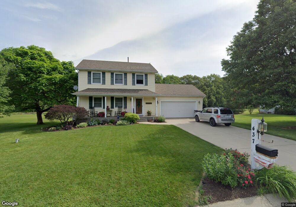
437 Sandy Ridge Dr Valparaiso, IN 46383
Porter County NeighborhoodEstimated Value: $290,000 - $332,000
3
Beds
3
Baths
1,400
Sq Ft
$223/Sq Ft
Est. Value
About This Home
This home is located at 437 Sandy Ridge Dr, Valparaiso, IN 46383 and is currently estimated at $311,877, approximately $222 per square foot. 437 Sandy Ridge Dr is a home located in Porter County with nearby schools including Morgan Township Elementary School and Morgan Township Middle/High School.
Ownership History
Date
Name
Owned For
Owner Type
Purchase Details
Closed on
Jun 15, 2006
Sold by
Todd Blair and Todd Chelsea
Bought by
Sims Russell D and Sims Cheryl
Current Estimated Value
Home Financials for this Owner
Home Financials are based on the most recent Mortgage that was taken out on this home.
Original Mortgage
$127,920
Outstanding Balance
$75,878
Interest Rate
6.73%
Mortgage Type
Purchase Money Mortgage
Estimated Equity
$235,999
Create a Home Valuation Report for This Property
The Home Valuation Report is an in-depth analysis detailing your home's value as well as a comparison with similar homes in the area
Home Values in the Area
Average Home Value in this Area
Purchase History
| Date | Buyer | Sale Price | Title Company |
|---|---|---|---|
| Sims Russell D | -- | Multiple |
Source: Public Records
Mortgage History
| Date | Status | Borrower | Loan Amount |
|---|---|---|---|
| Open | Sims Russell D | $127,920 |
Source: Public Records
Tax History Compared to Growth
Tax History
| Year | Tax Paid | Tax Assessment Tax Assessment Total Assessment is a certain percentage of the fair market value that is determined by local assessors to be the total taxable value of land and additions on the property. | Land | Improvement |
|---|---|---|---|---|
| 2024 | $1,751 | $303,500 | $39,200 | $264,300 |
| 2023 | $1,611 | $281,000 | $35,600 | $245,400 |
| 2022 | $1,576 | $258,000 | $35,600 | $222,400 |
| 2021 | $1,518 | $228,000 | $35,600 | $192,400 |
| 2020 | $1,315 | $205,200 | $30,900 | $174,300 |
| 2019 | $1,240 | $191,600 | $30,900 | $160,700 |
| 2018 | $1,140 | $182,600 | $30,900 | $151,700 |
| 2017 | $1,155 | $186,300 | $30,900 | $155,400 |
| 2016 | $917 | $161,700 | $28,400 | $133,300 |
| 2014 | $876 | $158,400 | $27,500 | $130,900 |
| 2013 | -- | $151,100 | $27,800 | $123,300 |
Source: Public Records
Map
Nearby Homes
- 421 Amy Rose Ln
- 83 Kaper Ln
- 87 Kaper Ln
- 323 E 124 S
- 168 Jamestown Ave
- 0 Parcel B 325 E
- 0 Parcel A 325 E
- 0 Porters Vale Blvd Unit GNR544918
- 0 St Road 2 Unit GNR544911
- 197 Appaloosa Ln
- 3353 Field Hawk Dr
- 3905 Colonial Dr
- 1802 Meadow Glen Dr
- 232 E 250 S
- 0 Silhavy Rd
- 627 E 300 S
- 279 S State Road 49
- 3359 Blue Jay Dr
- 206 Parkwood Dr
- 501 Eagle Ct
- 439 Sandy Ridge Dr
- 435 Sandy Ridge Dr
- 436 E Sandy Dr
- 436 Sandy Ridge Dr
- 438 Sandy Ridge Dr
- 441 Sandy Ridge Dr
- 434 Sandy Ridge Dr
- 431 Sandy Ridge Dr
- 432 Sandy Ridge Dr
- 445 Sandy Ridge Dr
- 437 Oak Breeze Dr
- 441 Oak Breeze Dr
- 429 Sandy Ridge Dr
- 433 Oak Breeze Dr
- 430 Sandy Ridge Dr
- 443 Oak Breeze Dr
- 447 Sandy Ridge Dr
- 429 Oak Breeze Dr
- 427 Sandy Ridge Dr
- 428 Sandy Ridge Dr