Estimated Value: $503,000 - $600,000
3
Beds
1
Bath
2,268
Sq Ft
$239/Sq Ft
Est. Value
About This Home
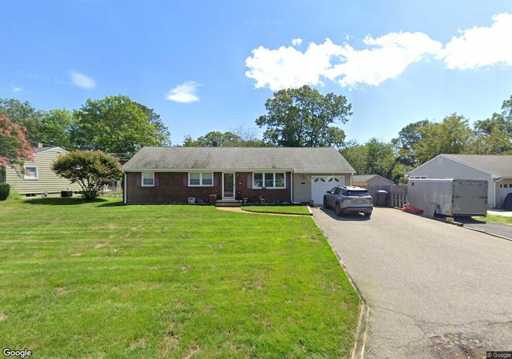
This home is located at 437 the Esplanade, Brick, NJ 08724 and is currently estimated at $541,251, approximately $238 per square foot. 437 the Esplanade is a home located in Ocean County with nearby schools including Midstreams Elementary School, Veterans Memorial Middle School, and Brick Township Memorial High School.
Ownership History
Date
Name
Owned For
Owner Type
Purchase Details
Closed on
Mar 31, 1999
Sold by
Squilanti Ted and Squilanti Theodore
Bought by
Mitchell Donald and Mitchell Janet
Current Estimated Value
Home Financials for this Owner
Home Financials are based on the most recent Mortgage that was taken out on this home.
Original Mortgage
$14,490
Outstanding Balance
$3,663
Interest Rate
7.02%
Mortgage Type
Credit Line Revolving
Estimated Equity
$537,588
Create a Home Valuation Report for This Property
The Home Valuation Report is an in-depth analysis detailing your home's value as well as a comparison with similar homes in the area
Home Values in the Area
Average Home Value in this Area
Purchase History
| Date | Buyer | Sale Price | Title Company |
|---|---|---|---|
| Mitchell Donald | $144,900 | -- |
Source: Public Records
Mortgage History
| Date | Status | Borrower | Loan Amount |
|---|---|---|---|
| Open | Mitchell Donald | $14,490 | |
| Open | Mitchell Donald | $115,920 |
Source: Public Records
Tax History
| Year | Tax Paid | Tax Assessment Tax Assessment Total Assessment is a certain percentage of the fair market value that is determined by local assessors to be the total taxable value of land and additions on the property. | Land | Improvement |
|---|---|---|---|---|
| 2025 | $6,781 | $259,800 | $146,500 | $113,300 |
| 2024 | $6,435 | $259,800 | $146,500 | $113,300 |
Source: Public Records
Map
Nearby Homes
- 412 Bella Vista Rd
- 511 Robinhood Rd
- 515 Carroll Fox Rd
- 118 Solar Dr
- 470 Princeton Ave
- 173 Cliff Rd
- 49 Stratford Dr
- 500 Princeton Ave
- 49 N Cherokee Ln
- 556 Parker Ave
- 36 Lenape Trail
- 140 Meridian Dr
- 546 Princeton Ave
- 153 Natick Trail
- 354 Rancocas Dr
- 157 Natick Trail
- 158 Harriot Dr
- 1621 Northstream Pkwy
- 599 Parker Ave
- 665 Bancroft Rd
- 439 the Esplanade
- 433 the Esplanade
- 493 Bella Vista Rd
- 443 the Esplanade
- 436 the Esplanade
- 760 Midstreams Rd
- 430 the Esplanade
- 489 Bella Vista Rd
- 766 Midstreams Rd
- 438 the Esplanade
- 440 Tremont Place
- 752 Midstreams Rd
- 445 the Esplanade
- 485 Bella Vista Rd
- 431 Sedge Place
- 435 Sedge Place
- 442 the Esplanade
- 761 Midstreams Rd
- 748 Midstreams Rd
- 494 Bella Vista Rd
Your Personal Tour Guide
Ask me questions while you tour the home.