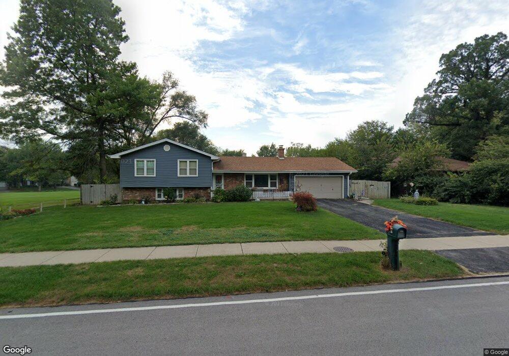
437 Woodland Hills Rd Batavia, IL 60510
Woodland Hills NeighborhoodEstimated Value: $462,842 - $530,000
4
Beds
--
Bath
2,164
Sq Ft
$230/Sq Ft
Est. Value
About This Home
This home is located at 437 Woodland Hills Rd, Batavia, IL 60510 and is currently estimated at $498,461, approximately $230 per square foot. 437 Woodland Hills Rd is a home located in Kane County with nearby schools including J B Nelson Elementary School, Sam Rotolo Middle School, and Batavia Sr High School.
Ownership History
Date
Name
Owned For
Owner Type
Purchase Details
Closed on
Dec 11, 2000
Sold by
First Midwest Trust Company Natl Assn
Bought by
Suwanski Marianne and Desimone Angeline
Current Estimated Value
Home Financials for this Owner
Home Financials are based on the most recent Mortgage that was taken out on this home.
Original Mortgage
$60,000
Outstanding Balance
$22,222
Interest Rate
7.77%
Estimated Equity
$476,239
Create a Home Valuation Report for This Property
The Home Valuation Report is an in-depth analysis detailing your home's value as well as a comparison with similar homes in the area
Home Values in the Area
Average Home Value in this Area
Purchase History
| Date | Buyer | Sale Price | Title Company |
|---|---|---|---|
| Suwanski Marianne | $243,000 | Advanced Title Services Inc |
Source: Public Records
Mortgage History
| Date | Status | Borrower | Loan Amount |
|---|---|---|---|
| Open | Suwanski Marianne | $60,000 | |
| Closed | Suwanski Marianne | $158,700 |
Source: Public Records
Tax History Compared to Growth
Tax History
| Year | Tax Paid | Tax Assessment Tax Assessment Total Assessment is a certain percentage of the fair market value that is determined by local assessors to be the total taxable value of land and additions on the property. | Land | Improvement |
|---|---|---|---|---|
| 2024 | $10,204 | $145,055 | $21,151 | $123,904 |
| 2023 | $9,924 | $131,653 | $19,197 | $112,456 |
| 2022 | $9,346 | $118,035 | $17,941 | $100,094 |
| 2021 | $8,325 | $104,913 | $17,015 | $87,898 |
| 2020 | $8,110 | $102,896 | $16,688 | $86,208 |
| 2019 | $7,959 | $99,253 | $16,097 | $83,156 |
| 2018 | $7,622 | $95,472 | $15,484 | $79,988 |
| 2017 | $7,419 | $92,323 | $14,973 | $77,350 |
| 2016 | $7,246 | $89,634 | $14,537 | $75,097 |
| 2015 | -- | $87,593 | $14,206 | $73,387 |
| 2014 | -- | $84,836 | $13,759 | $71,077 |
| 2013 | -- | $86,986 | $17,296 | $69,690 |
Source: Public Records
Map
Nearby Homes
- 1267 Foxglove Dr
- 1273 Foxglove Dr
- 1277 Foxglove Dr
- 1283 Foxglove Dr
- 1285 Foxglove Dr
- 1384 Foxglove Dr
- 133 Mayflower Dr
- 817 Woodland Hills Rd
- 1136 Pine Ct
- 4 Mayflower Dr
- 943 Orchard Ct
- 1025 E Wilson St
- 1017 Willow Ln Unit 2
- Lot 1 Center St
- 621 Young Ave
- 637 E Wilson St
- 1332 Giese Rd Unit 2
- 428 E Wilson St
- 129 S Prairie St
- Lot 4 Manchester Ave
- 427 Woodland Hills Rd
- 438 Meadowrue Ln
- 417 Woodland Hills Rd
- 428 Meadowrue Ln
- 430 Woodland Hills Rd
- 504 Woodland Hills Rd
- 416 Meadowrue Ln
- 407 Woodland Hills Rd
- 518 Woodland Hills Rd
- 1304 Bluebell Ln
- 410 Meadowrue Ln
- 1305 Wintergreen Terrace
- 1314 Aster Ct
- 359 Woodland Hills Rd
- 1232 Wintergreen Terrace
- 1315 Wintergreen Terrace
- 435 Meadowrue Ln
- 1242 Wintergreen Terrace
- 1312 Bluebell Ln
- 1224 Wintergreen Terrace