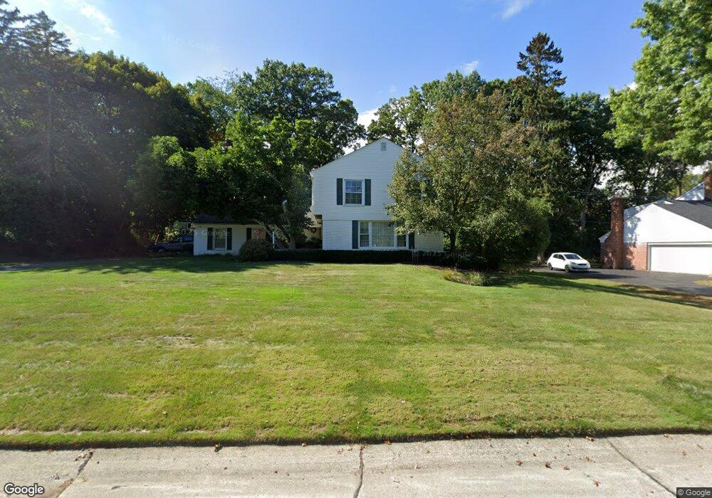
4370 Covered Bridge Rd Unit Bldg-Unit Bloomfield Hills, MI 48302
Estimated Value: $643,000 - $728,000
4
Beds
3
Baths
2,553
Sq Ft
$268/Sq Ft
Est. Value
About This Home
This home is located at 4370 Covered Bridge Rd Unit Bldg-Unit, Bloomfield Hills, MI 48302 and is currently estimated at $684,338, approximately $268 per square foot. 4370 Covered Bridge Rd Unit Bldg-Unit is a home located in Oakland County with nearby schools including Conant Elementary School, South Hills Middle School, and Bloomfield Hills High School.
Ownership History
Date
Name
Owned For
Owner Type
Purchase Details
Closed on
Jul 31, 2018
Sold by
Kogiso Azuma and Kogiso Kumiko
Bought by
Bargren Erik and Chan Linda
Current Estimated Value
Purchase Details
Closed on
Jul 14, 1999
Sold by
Kathleen H Latimer Tr
Bought by
Blake Craig D
Create a Home Valuation Report for This Property
The Home Valuation Report is an in-depth analysis detailing your home's value as well as a comparison with similar homes in the area
Home Values in the Area
Average Home Value in this Area
Purchase History
| Date | Buyer | Sale Price | Title Company |
|---|---|---|---|
| Bargren Erik | $419,125 | None Available | |
| Blake Craig D | $295,000 | -- |
Source: Public Records
Tax History Compared to Growth
Tax History
| Year | Tax Paid | Tax Assessment Tax Assessment Total Assessment is a certain percentage of the fair market value that is determined by local assessors to be the total taxable value of land and additions on the property. | Land | Improvement |
|---|---|---|---|---|
| 2024 | $4,000 | $269,260 | $0 | $0 |
| 2023 | $3,871 | $253,660 | $0 | $0 |
| 2022 | $7,275 | $241,040 | $0 | $0 |
| 2021 | $7,223 | $222,420 | $0 | $0 |
| 2020 | $3,541 | $191,010 | $0 | $0 |
| 2019 | $6,797 | $182,660 | $0 | $0 |
| 2018 | $6,875 | $179,060 | $0 | $0 |
| 2017 | $7,588 | $174,660 | $0 | $0 |
| 2016 | $7,565 | $189,640 | $0 | $0 |
| 2015 | -- | $173,590 | $0 | $0 |
| 2014 | -- | $150,520 | $0 | $0 |
| 2011 | -- | $147,670 | $0 | $0 |
Source: Public Records
Map
Nearby Homes
- 1732 Blair House Ct
- 4123 Chimney Point Dr
- 4535 Grindley Ct
- 1715 Lone Pine Rd
- 5148 Crest Knolls Ct
- 1907 Raymond Place
- 1795 Golf Ridge Dr Unit 19
- 1462 Sodon Ct
- 5190 Clarendon Crest St
- 1347 N Carillon Ct
- 1992 Bent Tree Trail
- 4297 Wabeek Lake Dr S Unit 26
- 5118 Vincennes Ct
- 5340 Franklin Rd
- 1567 Island Ln
- 4033 Fox Lake Dr
- 1651 Hoit Tower Dr
- 1214 Copperwood Dr
- 00 Mohawk Ct
- 2668 Turtle Lake
- 4370 Covered Bridge Rd
- 4500 Covered Bridge Rd
- 4348 Covered Bridge Rd
- 1749 Ascot Ct
- 1753 Ascot Ct
- 4326 Covered Bridge Rd
- 1745 Ascot Ct
- 4514 Covered Bridge Rd
- 1694 Trading Post Ln
- 4353 Covered Bridge Rd
- 1757 Ascot Ct
- 4331 Covered Bridge Rd
- 1697 Trading Post Ln
- 4304 Covered Bridge Rd
- 4528 Covered Bridge Rd
- 1668 Trading Post Ln
- 1761 Ascot Ct
- 4307 Covered Bridge Rd
- 1741 Golf Ridge Dr S
- 4344 Antique Ln