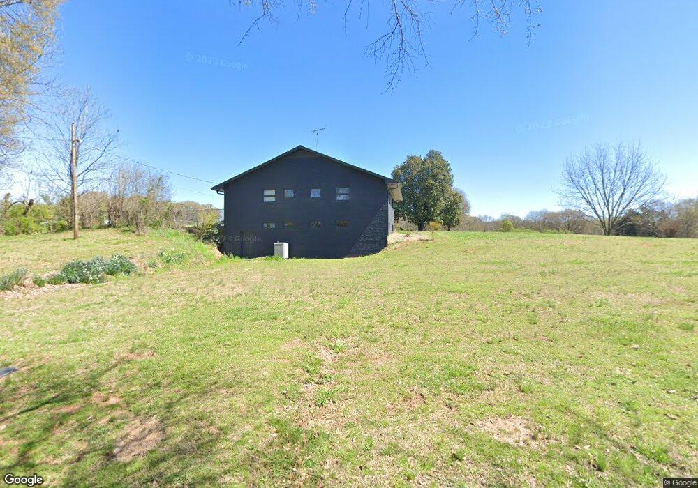
4370 Highway 326 Carnesville, GA 30521
Estimated Value: $478,000
3
Beds
3
Baths
2,370
Sq Ft
$202/Sq Ft
Est. Value
About This Home
This home is located at 4370 Highway 326, Carnesville, GA 30521 and is currently estimated at $478,000, approximately $201 per square foot. 4370 Highway 326 is a home located in Franklin County with nearby schools including Franklin County High School.
Ownership History
Date
Name
Owned For
Owner Type
Purchase Details
Closed on
Feb 27, 2025
Sold by
Hall E Kent
Bought by
Hall Guerry B
Current Estimated Value
Purchase Details
Closed on
Jan 4, 2022
Sold by
Hall Guerry B
Bought by
Hall David Benton Estate
Purchase Details
Closed on
Oct 1, 2021
Sold by
Hall David Benton
Bought by
Hall Guerry B and Kent Hall E
Purchase Details
Closed on
Dec 29, 2012
Sold by
Hall Lanelle B
Bought by
Hall Guerry B and Kent Hall E
Create a Home Valuation Report for This Property
The Home Valuation Report is an in-depth analysis detailing your home's value as well as a comparison with similar homes in the area
Home Values in the Area
Average Home Value in this Area
Purchase History
| Date | Buyer | Sale Price | Title Company |
|---|---|---|---|
| Hall Guerry B | -- | -- | |
| Hall E Kent | -- | -- | |
| Hall David Benton Estate | -- | -- | |
| Hall Guerry B | -- | -- | |
| Hall Guerry B | -- | -- |
Source: Public Records
Tax History Compared to Growth
Tax History
| Year | Tax Paid | Tax Assessment Tax Assessment Total Assessment is a certain percentage of the fair market value that is determined by local assessors to be the total taxable value of land and additions on the property. | Land | Improvement |
|---|---|---|---|---|
| 2024 | $657 | $160,544 | $160,544 | $0 |
| 2023 | $692 | $145,666 | $145,666 | $0 |
| 2022 | $3,004 | $203,382 | $116,320 | $87,062 |
| 2021 | $2,746 | $190,087 | $116,320 | $73,767 |
| 2020 | $2,006 | $153,775 | $96,933 | $56,842 |
| 2019 | $1,918 | $153,775 | $96,933 | $56,842 |
| 2018 | $1,728 | $127,164 | $76,684 | $50,480 |
| 2017 | $1,764 | $126,677 | $76,684 | $49,993 |
| 2016 | $1,660 | $121,060 | $76,684 | $44,376 |
| 2015 | -- | $121,060 | $76,684 | $44,376 |
| 2014 | -- | $121,060 | $76,684 | $44,376 |
| 2013 | -- | $121,789 | $76,684 | $45,105 |
Source: Public Records
Map
Nearby Homes
- 775 Riverbend Rd
- 1020 Riverbend Rd
- 24 Tomlin Way
- 0 Varner Rd
- 1000 Nails Creek Crossing
- 7527 Highway 326
- 9 Dons Ct
- 31 Dons Ct
- 41 Manley Terrace
- 689 Riverside Ct
- 2100 Westbrook Rd
- 166 Timberlane Dr
- 0 Nails Creek Crossing Unit 10584678
- HWY 51 Owl Hollow Rd
- 1065 Hebron Rd
- 161 Meadow Lake Dr
- 139 Meadow Lake Dr
- 8188 Sandy Cross Rd
- 4308 Athens Rd
- 731 Borders Rd
- 4366 Highway 326
- 4263 Highway 326
- 95 Holbrook Ln
- 4559 Highway 326
- 4364 Highway 326
- 211 Holbrook Rd
- 212 Labrador Ln
- 344 Labrador Ln
- 000 Bold Springs Rd
- 0 Bold Springs Rd Unit 7074321
- 0 Bold Springs Rd Unit 7139353
- 0 Bold Springs Rd
- 3171 Bold Springs Rd
- 3067 Bold Springs Rd
- 3170 Georgia 326
- 3311 Bold Springs Rd
- 255 Labrador Ln
- 2930 Bold Springs Rd
- 4950 Highway 326
- 4970 Highway 326