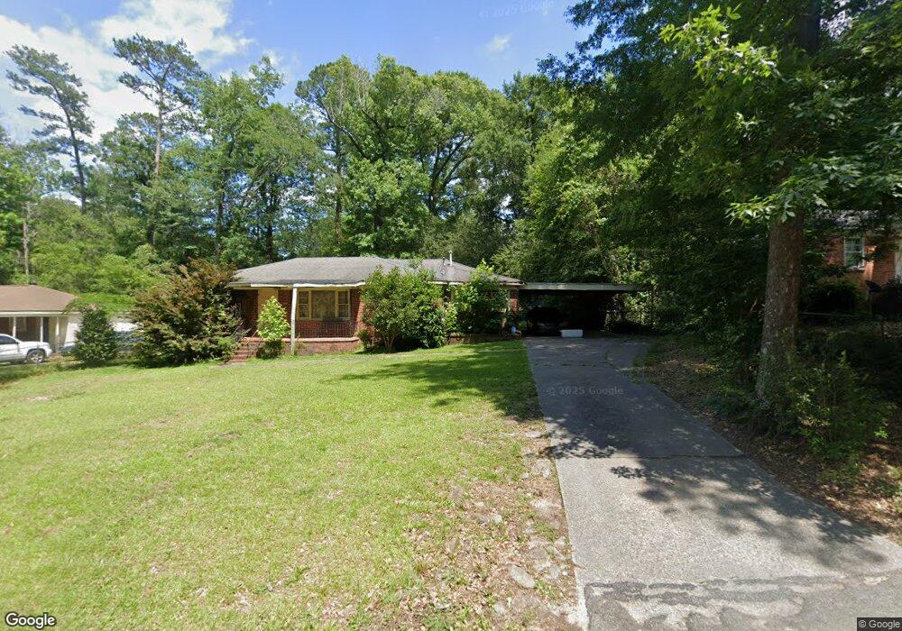
4370 Pharr Ave Macon, GA 31204
Estimated Value: $99,000 - $129,000
3
Beds
2
Baths
1,434
Sq Ft
$79/Sq Ft
Est. Value
About This Home
This home is located at 4370 Pharr Ave, Macon, GA 31204 and is currently estimated at $113,616, approximately $79 per square foot. 4370 Pharr Ave is a home located in Bibb County with nearby schools including Union Elementary School, Weaver Middle School, and Westside High School.
Ownership History
Date
Name
Owned For
Owner Type
Purchase Details
Closed on
Sep 27, 2005
Sold by
Latham Jennifer K
Bought by
Goodrum Diane W
Current Estimated Value
Home Financials for this Owner
Home Financials are based on the most recent Mortgage that was taken out on this home.
Original Mortgage
$77,140
Outstanding Balance
$40,809
Interest Rate
5.77%
Mortgage Type
FHA
Estimated Equity
$72,807
Purchase Details
Closed on
Aug 10, 2005
Home Financials for this Owner
Home Financials are based on the most recent Mortgage that was taken out on this home.
Original Mortgage
$77,140
Outstanding Balance
$40,809
Interest Rate
5.77%
Mortgage Type
FHA
Estimated Equity
$72,807
Create a Home Valuation Report for This Property
The Home Valuation Report is an in-depth analysis detailing your home's value as well as a comparison with similar homes in the area
Purchase History
| Date | Buyer | Sale Price | Title Company |
|---|---|---|---|
| Goodrum Diane W | $80,000 | None Available | |
| -- | $1,000 | -- |
Source: Public Records
Mortgage History
| Date | Status | Borrower | Loan Amount |
|---|---|---|---|
| Open | Goodrum Diane W | $77,140 |
Source: Public Records
Tax History
| Year | Tax Paid | Tax Assessment Tax Assessment Total Assessment is a certain percentage of the fair market value that is determined by local assessors to be the total taxable value of land and additions on the property. | Land | Improvement |
|---|---|---|---|---|
| 2025 | $867 | $35,274 | $2,500 | $32,774 |
| 2024 | $647 | $25,465 | $2,000 | $23,465 |
| 2023 | $588 | $23,138 | $2,000 | $21,138 |
| 2022 | $430 | $12,429 | $1,802 | $10,627 |
| 2021 | $472 | $12,429 | $1,802 | $10,627 |
| 2020 | $483 | $12,429 | $1,802 | $10,627 |
| 2019 | $695 | $13,548 | $1,802 | $11,746 |
| 2018 | $1,510 | $22,182 | $1,802 | $20,380 |
| 2017 | $916 | $24,447 | $1,802 | $22,645 |
| 2016 | $846 | $24,447 | $1,802 | $22,645 |
| 2015 | $1,197 | $24,447 | $1,802 | $22,645 |
| 2014 | $1,377 | $24,447 | $1,802 | $22,645 |
Source: Public Records
Map
Nearby Homes
- 4367 Pharr Ave
- 4453 Pharr Ave
- 4506 Ebenezer Church Rd
- 4064 W Oak Dr
- 4158 Log Cabin Dr
- 3980 W Oak Dr
- 4141 Briarwood Dr
- 4527 Wilson Rd
- 1467 New Castle Dr
- 3941 Log Cabin Dr
- 114 Emily St
- 3908 Log Cabin Dr
- 1508 N Atwood Dr
- 115 Emily St
- 1588 N Atwood Dr
- 4450 Bluebird Terrace
- 3846 Log Cabin Dr
- 1171 Washington St
- 3816 Log Cabin Dr
- 4941 Log Cabin Dr
Your Personal Tour Guide
Ask me questions while you tour the home.