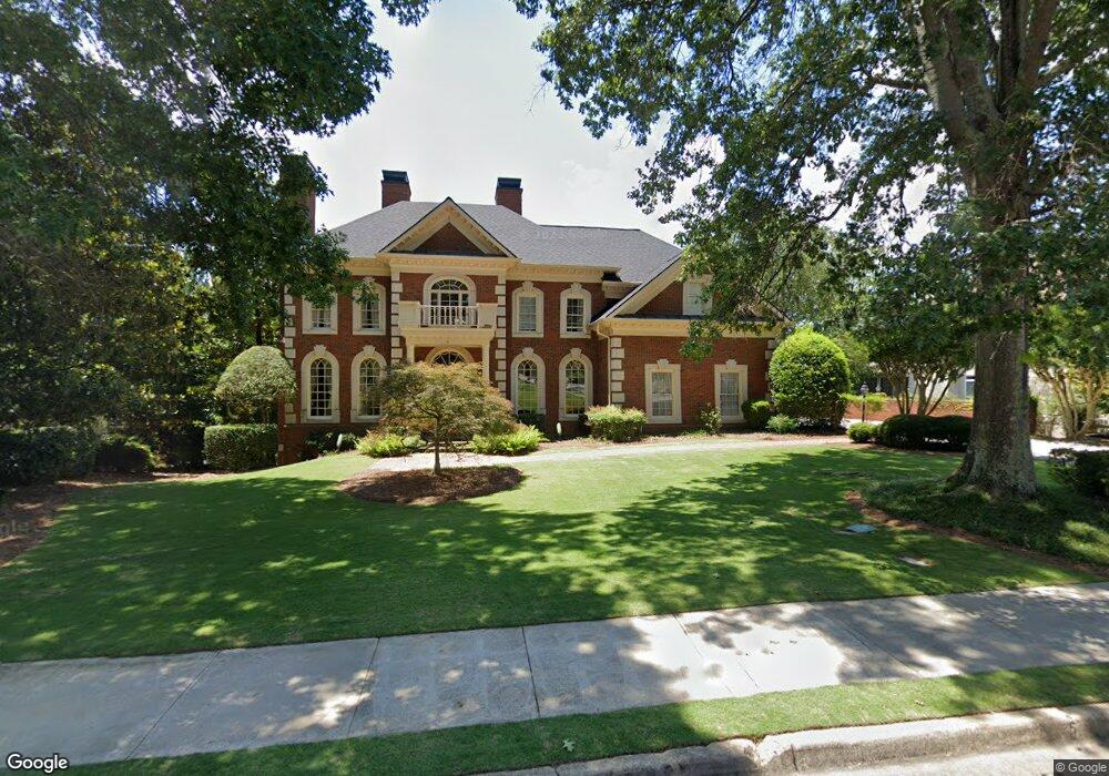
4370 River Bottom Dr Unit 5 Norcross, GA 30092
Estimated Value: $1,251,000 - $1,574,860
6
Beds
5
Baths
4,704
Sq Ft
$299/Sq Ft
Est. Value
About This Home
This home is located at 4370 River Bottom Dr Unit 5, Norcross, GA 30092 and is currently estimated at $1,407,215, approximately $299 per square foot. 4370 River Bottom Dr Unit 5 is a home located in Gwinnett County with nearby schools including Simpson Elementary School, Pinckneyville Middle School, and Norcross High School.
Ownership History
Date
Name
Owned For
Owner Type
Purchase Details
Closed on
Jun 1, 1999
Sold by
Matheny Robert G
Bought by
Matheny Robert G and Matheny Caroline R
Current Estimated Value
Home Financials for this Owner
Home Financials are based on the most recent Mortgage that was taken out on this home.
Original Mortgage
$652,500
Outstanding Balance
$165,224
Interest Rate
7.04%
Mortgage Type
New Conventional
Estimated Equity
$1,241,991
Purchase Details
Closed on
Aug 2, 1996
Sold by
Haroz Pinhas Stefanie
Bought by
Spiegel Kathryn
Create a Home Valuation Report for This Property
The Home Valuation Report is an in-depth analysis detailing your home's value as well as a comparison with similar homes in the area
Home Values in the Area
Average Home Value in this Area
Purchase History
| Date | Buyer | Sale Price | Title Company |
|---|---|---|---|
| Matheny Robert G | -- | -- | |
| Matheny Robert G | $825,000 | -- | |
| Spiegel Kathryn | $650,000 | -- |
Source: Public Records
Mortgage History
| Date | Status | Borrower | Loan Amount |
|---|---|---|---|
| Open | Matheny Robert G | $652,500 |
Source: Public Records
Tax History Compared to Growth
Tax History
| Year | Tax Paid | Tax Assessment Tax Assessment Total Assessment is a certain percentage of the fair market value that is determined by local assessors to be the total taxable value of land and additions on the property. | Land | Improvement |
|---|---|---|---|---|
| 2025 | $13,739 | $583,640 | $133,920 | $449,720 |
| 2024 | $14,917 | $541,600 | $130,560 | $411,040 |
| 2023 | $14,917 | $457,800 | $121,560 | $336,240 |
| 2022 | $11,375 | $368,000 | $113,680 | $254,320 |
| 2021 | $11,655 | $368,000 | $113,680 | $254,320 |
| 2020 | $10,951 | $389,880 | $113,680 | $276,200 |
| 2019 | $11,275 | $362,320 | $104,120 | $258,200 |
| 2018 | $10,715 | $334,320 | $95,760 | $238,560 |
| 2016 | $10,327 | $318,600 | $95,760 | $222,840 |
| 2015 | $10,441 | $318,600 | $95,760 | $222,840 |
| 2014 | $10,360 | $318,600 | $95,760 | $222,840 |
Source: Public Records
Map
Nearby Homes
- 4405 River Trail Dr
- 4410 River Trail Dr Unit 383
- 4291 River Bottom Dr
- 6040 Neely Farm Dr Unit 3
- 0 Hawk Run Unit 7571401
- 0 Hawk Run
- 4575 Dairy Way
- 5970 Rachel Ridge Unit 2
- 6169 Poplar Bluff Cir
- 5961 Ranger Ct
- 5885 Match Point
- 4053 Spalding Hollow NW
- 3922 Glen Meadow Dr
- 8103 Lawnview
- 3156 E Addison Dr
- 3910 Spalding Bluff Dr
- 225 Brassy Ct
- 6425 Deerings Ln Unit 6425
- 4360 River Bottom Dr
- 4380 River Bottom Dr Unit 5
- 4371 River Bottom Dr
- 4350 River Bottom Dr
- 4390 River Bottom Dr
- 4391 River Bottom Dr
- 4340 River Bottom Dr Unit 5
- 0 River Bottom Dr Unit 7364407
- 0 River Bottom Dr Unit 7093739
- 0 River Bottom Dr Unit 7071124
- 0 River Bottom Dr Unit 7073806
- 0 River Bottom Dr Unit 8658049
- 0 River Bottom Dr Unit 8489633
- 0 River Bottom Dr Unit 8333579
- 0 River Bottom Dr Unit 8264114
- 0 River Bottom Dr Unit 7547156
- 0 River Bottom Dr Unit 8303633
- 0 River Bottom Dr Unit 8165255
- 0 River Bottom Dr Unit 7468050
- 0 River Bottom Dr Unit 8741061