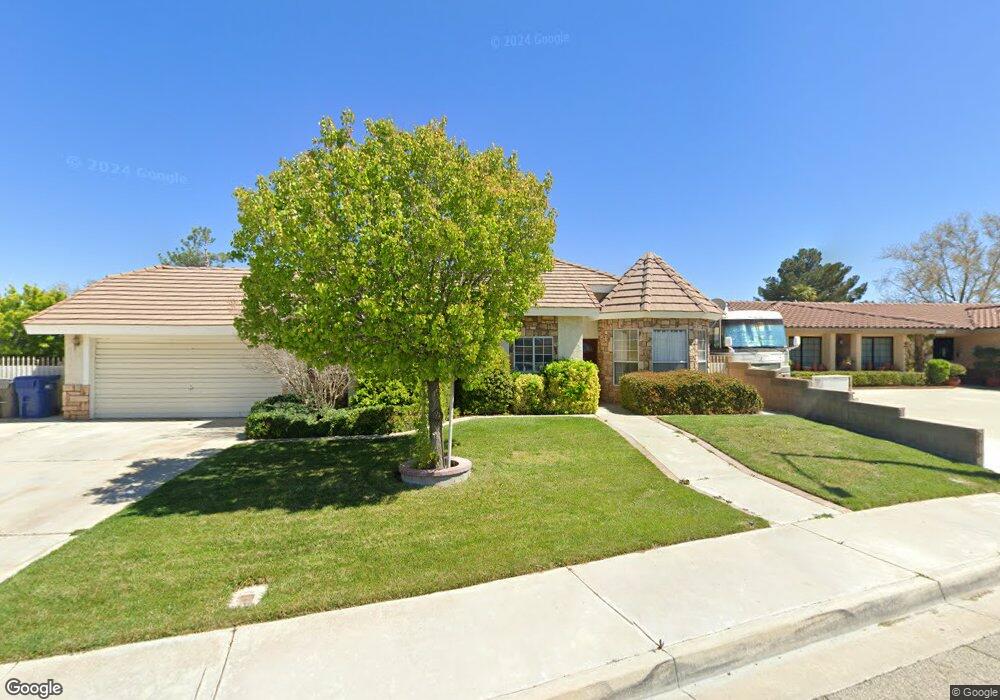
43708 Colony Dr Lancaster, CA 93536
West Lancaster NeighborhoodEstimated Value: $486,000 - $525,000
3
Beds
3
Baths
1,924
Sq Ft
$263/Sq Ft
Est. Value
About This Home
This home is located at 43708 Colony Dr, Lancaster, CA 93536 and is currently estimated at $505,342, approximately $262 per square foot. 43708 Colony Dr is a home located in Los Angeles County with nearby schools including West Wind Elementary School, Amargosa Creek Middle School, and Lancaster High School.
Ownership History
Date
Name
Owned For
Owner Type
Purchase Details
Closed on
Jun 17, 1998
Sold by
Hud
Bought by
Perovich Roberto Ettore and Perovich Andrea Kae
Current Estimated Value
Home Financials for this Owner
Home Financials are based on the most recent Mortgage that was taken out on this home.
Original Mortgage
$46,150
Outstanding Balance
$9,192
Interest Rate
7%
Estimated Equity
$496,150
Purchase Details
Closed on
Jul 22, 1997
Sold by
Homeside Lending Inc
Bought by
Hud
Purchase Details
Closed on
Jul 16, 1997
Sold by
Hayes Claire A and Homeside Lending Inc
Bought by
Homeside Lending Inc
Purchase Details
Closed on
Mar 29, 1995
Sold by
Mobaldi John M
Bought by
Hayes Claire A
Home Financials for this Owner
Home Financials are based on the most recent Mortgage that was taken out on this home.
Original Mortgage
$142,434
Interest Rate
8.32%
Mortgage Type
FHA
Create a Home Valuation Report for This Property
The Home Valuation Report is an in-depth analysis detailing your home's value as well as a comparison with similar homes in the area
Home Values in the Area
Average Home Value in this Area
Purchase History
| Date | Buyer | Sale Price | Title Company |
|---|---|---|---|
| Perovich Roberto Ettore | $90,000 | First American Title Co | |
| Hud | -- | First Southwestern Title Co | |
| Homeside Lending Inc | $161,725 | First Southwestern Title Co | |
| Hayes Claire A | $145,000 | -- |
Source: Public Records
Mortgage History
| Date | Status | Borrower | Loan Amount |
|---|---|---|---|
| Open | Perovich Roberto Ettore | $46,150 | |
| Previous Owner | Hayes Claire A | $142,434 |
Source: Public Records
Tax History
| Year | Tax Paid | Tax Assessment Tax Assessment Total Assessment is a certain percentage of the fair market value that is determined by local assessors to be the total taxable value of land and additions on the property. | Land | Improvement |
|---|---|---|---|---|
| 2025 | $3,903 | $211,611 | $42,311 | $169,300 |
| 2024 | $3,903 | $207,463 | $41,482 | $165,981 |
| 2023 | $3,823 | $203,396 | $40,669 | $162,727 |
| 2022 | $3,623 | $199,409 | $39,872 | $159,537 |
| 2021 | $3,229 | $195,500 | $39,091 | $156,409 |
| 2019 | $3,140 | $189,704 | $37,933 | $151,771 |
| 2018 | $3,085 | $185,986 | $37,190 | $148,796 |
| 2016 | $2,921 | $178,766 | $35,747 | $143,019 |
| 2015 | $2,885 | $176,082 | $35,211 | $140,871 |
| 2014 | $2,869 | $172,634 | $34,522 | $138,112 |
Source: Public Records
Map
Nearby Homes
- 43648 Colony Dr
- 3832 W Avenue j11
- 4019 W Avenue j9
- 44047 Colony Ct
- 0 35th Stw Vic Lancaster B Unit 26002816
- 4225 Vahan Ct
- 44108 Countryside Dr
- 0 Cor Avenue K4 and 42nd Stw Unit 25004028
- 43890 Moccasin Place
- 43929 44th St W
- 44137 37th St W
- 3273 W Avenue j10
- 43834 Firewood Way
- 43948 Spring St
- 43864 Firewood Way
- 4517 Vahan Ct
- 4103 W Avenue j3
- 4103 W Avenue J 3
- 43920 Bobby Jones Dr Unit 20
- 4036 Via Rebecca
- 43700 Colony Dr
- 3842 W Avenue j13
- 3834 W Avenue j13
- 43715 Countryside Dr
- 3826 W Avenue j13
- 3843 W Avenue j15
- 43711 Colony Dr
- 43707 Countryside Dr
- 3851 W Avenue j15
- 43701 Colony Dr
- 43719 Colony Dr
- 43725 Colony Dr
- 43659 Countryside Dr
- 3859 W Avenue j15
- 43654 Colony Dr
- 3841 W Avenue j13
- 3833 W Avenue j13
- 43716 Countryside Dr
- 43724 Countryside Dr
Your Personal Tour Guide
Ask me questions while you tour the home.