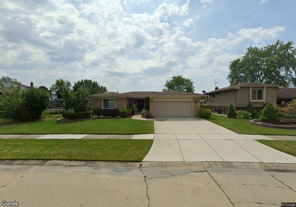
43735 Cranford Ave Canton, MI 48187
Estimated Value: $346,000 - $436,000
Studio
2
Baths
1,544
Sq Ft
$241/Sq Ft
Est. Value
About This Home
This home is located at 43735 Cranford Ave, Canton, MI 48187 and is currently estimated at $371,909, approximately $240 per square foot. 43735 Cranford Ave is a home located in Wayne County with nearby schools including Canton High School, Discovery Middle School, and Salem High School.
Ownership History
Date
Name
Owned For
Owner Type
Purchase Details
Closed on
Aug 6, 2025
Sold by
Whipple Robert L and Whipple Sally E
Bought by
Whipple Robert L and Whipple Sally E
Current Estimated Value
Purchase Details
Closed on
Jul 28, 2003
Sold by
Whipple Robert L and Whipple Sally E
Bought by
Whipple Robert L
Purchase Details
Closed on
Jun 14, 2002
Sold by
Shaw Larry
Bought by
Whipple Robert L
Home Financials for this Owner
Home Financials are based on the most recent Mortgage that was taken out on this home.
Original Mortgage
$180,400
Interest Rate
6.7%
Mortgage Type
Purchase Money Mortgage
Purchase Details
Closed on
Apr 11, 2001
Sold by
Mafie Kammoosh
Bought by
Shaw Larry
Create a Home Valuation Report for This Property
The Home Valuation Report is an in-depth analysis detailing your home's value as well as a comparison with similar homes in the area
Home Values in the Area
Average Home Value in this Area
Purchase History
| Date | Buyer | Sale Price | Title Company |
|---|---|---|---|
| Whipple Robert L | -- | None Listed On Document | |
| Whipple Robert L | -- | First American Title Ins Co | |
| Whipple Robert L | $189,900 | -- | |
| Shaw Larry | $182,000 | -- |
Source: Public Records
Mortgage History
| Date | Status | Borrower | Loan Amount |
|---|---|---|---|
| Previous Owner | Whipple Robert L | $180,400 |
Source: Public Records
Tax History
| Year | Tax Paid | Tax Assessment Tax Assessment Total Assessment is a certain percentage of the fair market value that is determined by local assessors to be the total taxable value of land and additions on the property. | Land | Improvement |
|---|---|---|---|---|
| 2025 | $1,547 | $167,700 | $0 | $0 |
| 2024 | $1,502 | $153,400 | $0 | $0 |
| 2023 | $1,953 | $136,200 | $0 | $0 |
| 2022 | $3,200 | $119,600 | $0 | $0 |
| 2021 | $1,782 | $118,100 | $0 | $0 |
| 2020 | $3,064 | $112,900 | $0 | $0 |
| 2019 | $3,009 | $103,280 | $0 | $0 |
| 2018 | $1,217 | $95,210 | $0 | $0 |
| 2017 | $3,125 | $94,200 | $0 | $0 |
| 2016 | $2,744 | $96,400 | $0 | $0 |
| 2015 | $6,690 | $86,380 | $0 | $0 |
| 2013 | $6,481 | $67,340 | $0 | $0 |
| 2010 | -- | $74,700 | $42,945 | $31,755 |
Source: Public Records
Map
Nearby Homes
- 321 Cherry Grove Rd
- 1399 Elmhurst St
- 446 Cherry Stone Dr Unit 54
- 42789 Lilley Pointe Dr Unit 146
- 42739 Lilley Pointe Dr Unit 119
- 1567 Marlowe St
- 241 Edington Cir
- 407 Fairfield Ct
- 1399 Copeland Cir
- 802 Cherry Stone Dr
- 1680 Manton Blvd
- 45005 Saltz Rd
- 1822 N Sheldon Rd
- 215 Edington Cir
- 58560 Stuart Dr
- 44528 Whitman Ave
- 43935 Marne Ct
- 42216 Metaline Dr
- 45246 Gerald Ct
- 44447 Savery Dr Unit 126
- 43747 Cranford Ave
- 451 N Corrine Blvd
- 43746 Palisades Dr
- 43734 Palisades Dr
- 437 N Corrine Blvd
- 43759 Cranford Ave
- 43758 Palisades Dr
- 613 N Corrine Blvd
- 425 N Corrine Blvd
- 43775 Cranford Ave
- 43770 Palisades Dr
- 43740 Cranford Ave
- 625 N Corrine Blvd
- 43752 Cranford Ave
- 43801 Cranford Ave
- 43806 Palisades Dr
- 43764 Cranford Ave
- 402 Nassau Ct
- 448 N Corrine Blvd
- 432 N Corrine Blvd
Your Personal Tour Guide
Ask me questions while you tour the home.