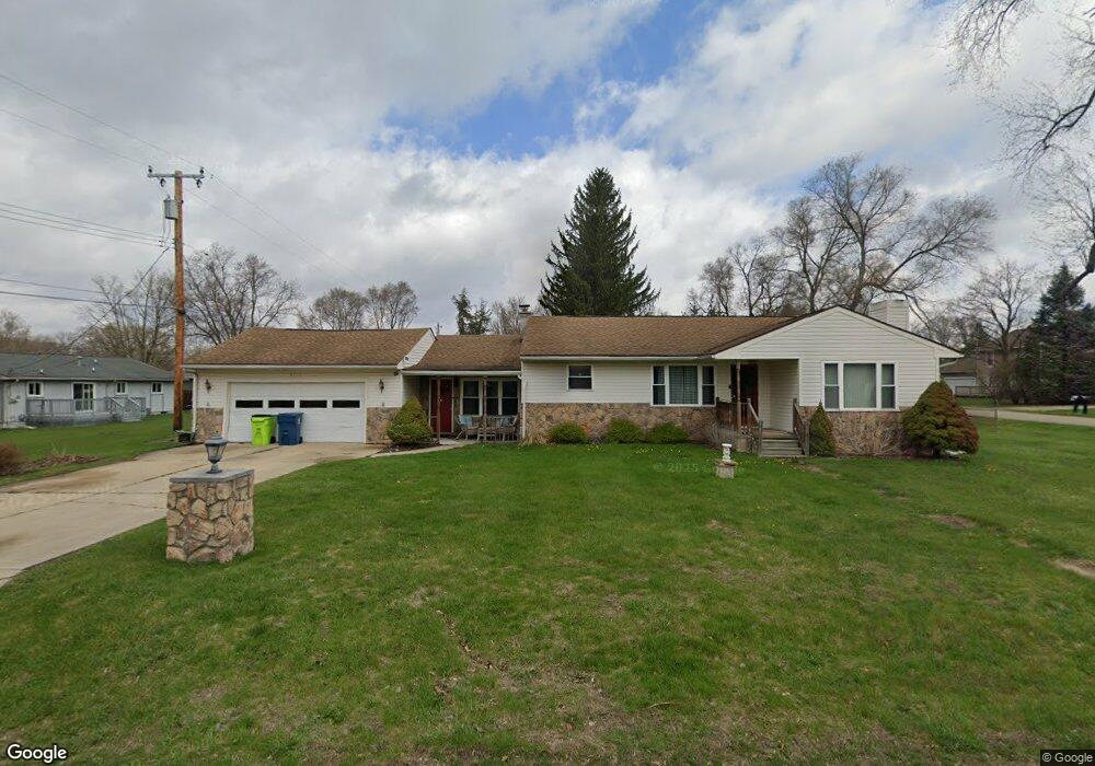
4375 Brookfield Dr Unit Bldg-Unit White Lake, MI 48383
Estimated Value: $252,000 - $293,000
2
Beds
3
Baths
1,440
Sq Ft
$194/Sq Ft
Est. Value
About This Home
This home is located at 4375 Brookfield Dr Unit Bldg-Unit, White Lake, MI 48383 and is currently estimated at $279,755, approximately $194 per square foot. 4375 Brookfield Dr Unit Bldg-Unit is a home located in Oakland County with nearby schools including Holly High School.
Ownership History
Date
Name
Owned For
Owner Type
Purchase Details
Closed on
Jun 5, 2018
Sold by
Hagedon Drew
Bought by
Esshaki Joseph
Current Estimated Value
Home Financials for this Owner
Home Financials are based on the most recent Mortgage that was taken out on this home.
Original Mortgage
$147,250
Outstanding Balance
$127,347
Interest Rate
4.5%
Mortgage Type
New Conventional
Estimated Equity
$152,408
Purchase Details
Closed on
Jul 1, 2016
Sold by
Fannie Mae
Bought by
Hagedon Drew
Purchase Details
Closed on
Jun 9, 2015
Sold by
Stokes Isabell and Onewest Bank Na
Bought by
Fannie Mae and Federal National Mortgage Association
Create a Home Valuation Report for This Property
The Home Valuation Report is an in-depth analysis detailing your home's value as well as a comparison with similar homes in the area
Home Values in the Area
Average Home Value in this Area
Purchase History
| Date | Buyer | Sale Price | Title Company |
|---|---|---|---|
| Esshaki Joseph | $155,000 | None Available | |
| Hagedon Drew | $72,000 | Best Homes Title Agency Llc | |
| Fannie Mae | $80,000 | Attorney |
Source: Public Records
Mortgage History
| Date | Status | Borrower | Loan Amount |
|---|---|---|---|
| Open | Esshaki Joseph | $147,250 |
Source: Public Records
Tax History Compared to Growth
Tax History
| Year | Tax Paid | Tax Assessment Tax Assessment Total Assessment is a certain percentage of the fair market value that is determined by local assessors to be the total taxable value of land and additions on the property. | Land | Improvement |
|---|---|---|---|---|
| 2024 | $2,313 | $129,810 | $0 | $0 |
| 2023 | $2,206 | $117,230 | $0 | $0 |
| 2022 | $3,426 | $117,050 | $0 | $0 |
| 2021 | $3,210 | $98,390 | $0 | $0 |
| 2020 | $2,018 | $93,310 | $0 | $0 |
| 2019 | $3,110 | $85,140 | $0 | $0 |
| 2018 | $2,459 | $64,820 | $0 | $0 |
| 2017 | $2,373 | $64,820 | $0 | $0 |
| 2016 | $2,182 | $53,930 | $0 | $0 |
| 2015 | -- | $46,670 | $0 | $0 |
| 2014 | -- | $39,540 | $0 | $0 |
| 2011 | -- | $45,340 | $0 | $0 |
Source: Public Records
Map
Nearby Homes
- 5115 Allingham Dr
- 4694 Lakeborn Dr
- 5355 Lake Grove Dr
- 4491 Ormond Rd
- 3734 Navarra Ave
- N/A Giddings Blvd
- 4200 Stockemer
- 3453 Ormond Rd
- 4031 Hillcrest
- 3201 Lester Dr
- 3660 Bentwood Cir W Unit 149
- 3667 Falcons Nest
- 3831 Woodland Dr
- 3155 Ridge Rd
- 2895 Golfers Dr
- 5744 Hidden Lane Ct
- 5550 McKeachie Rd
- 4640 Melanie Ln
- 6090 Raphael Ct Unit 47
- 2880 Steeple Hill Rd
- 4375 Brookfield Dr
- 5040 Lakeborn Dr
- 5020 Allingham Dr
- 5050 Lakeborn Dr
- 5050 Allingham Dr
- 5073 Allingham Dr
- 4975 Allingham Dr
- 4980 Allingham Dr
- 5070 Lakeborn Dr
- VAC A Brookfield
- VAC-B Brookfield
- VAC B Brookfield Dr
- 5092 Allingham Dr
- 5011 Ormond Rd
- 4982 Lakeborn Dr
- 5090 Lakeborn Dr
- 5051 Ormond Rd
- 4940 Allingham Dr
- 5105 Allingham Dr
- 5100 Allingham Dr