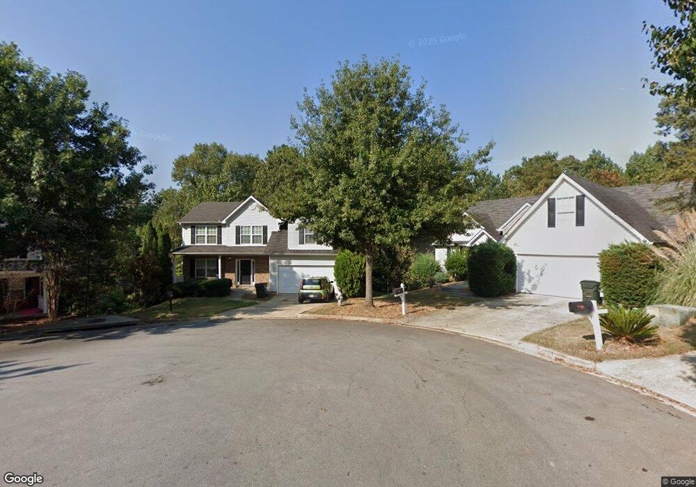
4377 Shoreside Cir Unit 2 Snellville, GA 30039
Estimated Value: $331,107 - $364,000
4
Beds
3
Baths
2,114
Sq Ft
$162/Sq Ft
Est. Value
About This Home
This home is located at 4377 Shoreside Cir Unit 2, Snellville, GA 30039 and is currently estimated at $342,777, approximately $162 per square foot. 4377 Shoreside Cir Unit 2 is a home located in Gwinnett County with nearby schools including Anderson-Livsey Elementary School, Shiloh Middle School, and Shiloh High School.
Ownership History
Date
Name
Owned For
Owner Type
Purchase Details
Closed on
Apr 10, 2014
Sold by
Colfin Ai Ga 1 Llc
Bought by
Cah 2014 A Borrower Llc
Current Estimated Value
Purchase Details
Closed on
Nov 6, 2012
Sold by
Jeter Rodney O
Bought by
Colfin Ai Ga I Llc
Purchase Details
Closed on
Sep 14, 2005
Sold by
Damascus Homes Llc
Bought by
Jeter Rodney O
Home Financials for this Owner
Home Financials are based on the most recent Mortgage that was taken out on this home.
Original Mortgage
$173,734
Interest Rate
7.75%
Mortgage Type
New Conventional
Create a Home Valuation Report for This Property
The Home Valuation Report is an in-depth analysis detailing your home's value as well as a comparison with similar homes in the area
Home Values in the Area
Average Home Value in this Area
Purchase History
| Date | Buyer | Sale Price | Title Company |
|---|---|---|---|
| Cah 2014 A Borrower Llc | -- | -- | |
| Colfin Ai Ga I Llc | $110,000 | -- | |
| Jeter Rodney O | $169,900 | -- |
Source: Public Records
Mortgage History
| Date | Status | Borrower | Loan Amount |
|---|---|---|---|
| Previous Owner | Jeter Rodney O | $173,734 |
Source: Public Records
Tax History Compared to Growth
Tax History
| Year | Tax Paid | Tax Assessment Tax Assessment Total Assessment is a certain percentage of the fair market value that is determined by local assessors to be the total taxable value of land and additions on the property. | Land | Improvement |
|---|---|---|---|---|
| 2024 | $5,379 | $142,360 | $25,800 | $116,560 |
| 2023 | $5,379 | $130,320 | $26,000 | $104,320 |
| 2022 | $3,262 | $83,560 | $13,840 | $69,720 |
| 2021 | $3,301 | $83,560 | $13,840 | $69,720 |
| 2020 | $2,624 | $86,680 | $13,840 | $72,840 |
| 2019 | $2,529 | $64,400 | $10,000 | $54,400 |
| 2018 | $2,528 | $64,400 | $10,000 | $54,400 |
| 2016 | $2,097 | $51,600 | $8,000 | $43,600 |
| 2015 | $2,120 | $51,600 | $8,000 | $43,600 |
| 2014 | $1,554 | $35,440 | $6,000 | $29,440 |
Source: Public Records
Map
Nearby Homes
- 4237 Shoreside Cir Unit 1
- 3909 Laurens Ln
- 4211 Crestside Ridge
- 3992 Wrexham Dr
- 4111 Wrexham Dr
- 3885 Laurens Ln
- 4331 Wrexham Ct
- 3915 Laurel Brook Way Unit 2
- 4107 Round Stone Trail
- 4262 Mountain Glen Trace
- 4184 Red Laurel Way
- 4341 Horder Ct
- 4212 Medlock River Ct
- 3845 Laurel Brook Ln
- 4357 James Wade Dr
- 4216 Preserve Trail
- 3926 Yosemite Park Ln
- 4367 Shoreside Cir Unit 2
- 4366 Shoreside Cir Unit 2
- 4356 Shoreside Cir
- 4357 Shoreside Cir
- 4347 Shoreside Cir Unit 2
- 4042 Shoreside Ln
- 4336 Shoreside Cir Unit 2
- 4337 Shoreside Cir SW
- 4032 Shoreside Ln
- 4052 Shoreside Ln
- 4337 Shoreside Cir
- 4022 Shoreside Ln
- 4326 Shoreside Cir
- 4012 Shoreside Ln
- 4145 Waters End Ln Unit 2
- 4125 Waters End Ln
- 4125 Waters End Ln Unit 2
- 0 Shoreside Ln Unit 8370838
- 0 Shoreside Ln Unit 8283492
- 0 Shoreside Ln Unit 9034257