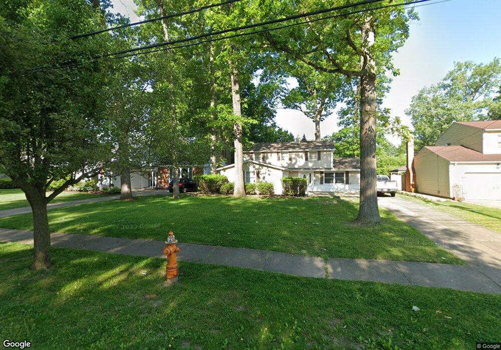
4378 Michael Ave North Olmsted, OH 44070
Estimated Value: $327,434 - $351,000
4
Beds
3
Baths
2,296
Sq Ft
$147/Sq Ft
Est. Value
About This Home
This home is located at 4378 Michael Ave, North Olmsted, OH 44070 and is currently estimated at $337,609, approximately $147 per square foot. 4378 Michael Ave is a home located in Cuyahoga County with nearby schools including Maple Intermediate Elementary School, Pine Intermediate School, and North Olmsted Middle School.
Ownership History
Date
Name
Owned For
Owner Type
Purchase Details
Closed on
May 18, 1987
Sold by
Pagedar Ajitkumar R
Bought by
Maher Timothy J
Current Estimated Value
Purchase Details
Closed on
Mar 29, 1976
Sold by
Woodhouse Allen G and Woodhouse Sandra L
Bought by
Pagedar Ajitkumar R
Purchase Details
Closed on
Jan 1, 1975
Bought by
Woodhouse Allen G and Woodhouse Sandra L
Create a Home Valuation Report for This Property
The Home Valuation Report is an in-depth analysis detailing your home's value as well as a comparison with similar homes in the area
Home Values in the Area
Average Home Value in this Area
Purchase History
| Date | Buyer | Sale Price | Title Company |
|---|---|---|---|
| Maher Timothy J | $97,000 | -- | |
| Pagedar Ajitkumar R | $56,800 | -- | |
| Woodhouse Allen G | -- | -- |
Source: Public Records
Tax History Compared to Growth
Tax History
| Year | Tax Paid | Tax Assessment Tax Assessment Total Assessment is a certain percentage of the fair market value that is determined by local assessors to be the total taxable value of land and additions on the property. | Land | Improvement |
|---|---|---|---|---|
| 2024 | $6,826 | $99,610 | $17,850 | $81,760 |
| 2023 | $6,075 | $74,380 | $16,520 | $57,860 |
| 2022 | $6,043 | $74,380 | $16,520 | $57,860 |
| 2021 | $5,469 | $74,380 | $16,520 | $57,860 |
| 2020 | $5,020 | $60,480 | $13,440 | $47,040 |
| 2019 | $4,885 | $172,800 | $38,400 | $134,400 |
| 2018 | $4,955 | $60,480 | $13,440 | $47,040 |
| 2017 | $4,605 | $51,740 | $11,030 | $40,710 |
| 2016 | $4,565 | $51,740 | $11,030 | $40,710 |
| 2015 | $4,500 | $51,740 | $11,030 | $40,710 |
| 2014 | $4,500 | $50,720 | $10,820 | $39,900 |
Source: Public Records
Map
Nearby Homes
- 4505 Oak Cir
- 4590 Brendan Ln
- 4666 Brendan Cir
- 4849 Grace Rd Unit 121
- 22934 Mastick Rd Unit 102
- 22895 Mastick Rd
- 22537 Lenox Dr
- 4187 Columbia Rd Unit 126
- 22534 Bard Ave
- 0 Mastick Rd Unit 5112571
- 23993 Fairlawn Dr
- 22503 Sandy Ln
- 22506 Sharon Ln
- 22247 Mastick Rd
- 4514 Orchard Rd
- 0 V L Clareshire Dr
- 3463 Clague Rd
- 24326 Mastick Rd
- 24300 Mastick Rd
- 23245 Woodview Dr
- 4366 Michael Ave
- 4392 Michael Ave
- 4352 Michael Ave
- 4404 Michael Ave
- 4379 Georgette Ave
- 4367 Georgette Ave
- 4393 Georgette Ave
- 4340 Michael Ave
- 4416 Michael Ave
- 4405 Georgette Ave
- 4355 Georgette Ave
- 4377 Michael Ave
- 4391 Michael Ave
- 4365 Michael Ave
- 4417 Georgette Ave
- 4430 Michael Ave
- 4333 Georgette Ave
- 4403 Michael Ave
- 4351 Michael Ave
- 4429 Georgette Ave