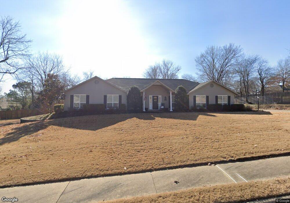
4379 Tahoe Circle Dr Springdale, AR 72762
Shady Grove NeighborhoodEstimated Value: $498,000 - $557,000
--
Bed
3
Baths
2,671
Sq Ft
$194/Sq Ft
Est. Value
About This Home
This home is located at 4379 Tahoe Circle Dr, Springdale, AR 72762 and is currently estimated at $518,601, approximately $194 per square foot. 4379 Tahoe Circle Dr is a home located in Washington County with nearby schools including John Tyson Elementary School, Southwest Junior High School, and Helen Tyson Middle School.
Ownership History
Date
Name
Owned For
Owner Type
Purchase Details
Closed on
May 31, 2016
Sold by
Venable Matthew Abram and Venable Kathleen Denice
Bought by
Venable Family Revocable Trust
Current Estimated Value
Purchase Details
Closed on
Mar 26, 2004
Sold by
Venable Matthew Abram and Venable Kathleen Denice
Bought by
Venable Matthew Abram and Venable Kathleen Denice
Purchase Details
Closed on
Apr 26, 1991
Bought by
Venable Matthew A and Venable Kathleen
Create a Home Valuation Report for This Property
The Home Valuation Report is an in-depth analysis detailing your home's value as well as a comparison with similar homes in the area
Home Values in the Area
Average Home Value in this Area
Purchase History
| Date | Buyer | Sale Price | Title Company |
|---|---|---|---|
| Venable Family Revocable Trust | -- | None Available | |
| Venable Matthew Abram | -- | None Available | |
| Venable Matthew Abram | -- | -- | |
| Venable Matthew A | $35,000 | -- |
Source: Public Records
Tax History Compared to Growth
Tax History
| Year | Tax Paid | Tax Assessment Tax Assessment Total Assessment is a certain percentage of the fair market value that is determined by local assessors to be the total taxable value of land and additions on the property. | Land | Improvement |
|---|---|---|---|---|
| 2024 | $2,387 | $97,830 | $16,800 | $81,030 |
| 2023 | $2,518 | $97,830 | $16,800 | $81,030 |
| 2022 | $2,515 | $55,490 | $10,000 | $45,490 |
| 2021 | $2,515 | $55,490 | $10,000 | $45,490 |
| 2020 | $2,384 | $55,490 | $10,000 | $45,490 |
| 2019 | $2,253 | $49,860 | $8,750 | $41,110 |
| 2018 | $2,278 | $49,860 | $8,750 | $41,110 |
| 2017 | $2,253 | $49,860 | $8,750 | $41,110 |
| 2016 | $2,253 | $49,860 | $8,750 | $41,110 |
| 2015 | $2,253 | $49,860 | $8,750 | $41,110 |
| 2014 | $2,564 | $55,820 | $15,000 | $40,820 |
Source: Public Records
Map
Nearby Homes
- 4906 Johnson Rd
- 5035 Moose Hollow Terrace
- 5055 Moose Hollow Terrace
- 4166 Legacy Dr
- 3955 Georgia St
- 2205 Cottonwood Place
- 2803 Amberwood St
- 5111 Moose Hollow Terrace
- 4671 Bailey Cir
- 3231 Amberwood St
- 3151 Woodbridge Rd
- 4730 Woodside Ln
- 2609 Jean St
- 3131 Silver Bell Trace
- 2431 Indian Oaks Trail
- 1765 Oxford Place
- 1762 Oxford Place
- 1911 Cypress Place
- 1740 Oxford Place
- 1678 Oxford Place
- 3020 Timber Ridge Dr
- 4265 Tahoe Circle Dr
- 3078 Timber Ridge Dr
- 4400 Tahoe Circle Dr
- 4352 Tahoe Circle Dr
- 4221 Tahoe Circle Dr
- 2976 Timber Ridge Dr
- 4454 Tahoe Circle Dr
- 4314 Tahoe Circle Dr
- 3013 Timber Ridge Dr
- 4294 Tahoe Circle Dr
- 3071 Timber Ridge Dr
- 4147 Tahoe Circle Dr
- 4260 Tahoe Circle Dr
- 2969 Timber Ridge Dr
- 3118 Timber Ridge Dr
- 4210 Tahoe Circle Dr
- 3823 Tahoe Circle Dr
- 4051 Tahoe Circle Dr
- 3159 Timber Ridge Dr