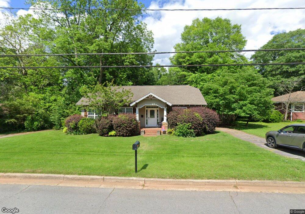
438 Adamson Ave Unit 231 Carrollton, GA 30117
Estimated Value: $275,000 - $324,000
3
Beds
2
Baths
1,610
Sq Ft
$185/Sq Ft
Est. Value
About This Home
This home is located at 438 Adamson Ave Unit 231, Carrollton, GA 30117 and is currently estimated at $297,231, approximately $184 per square foot. 438 Adamson Ave Unit 231 is a home located in Carroll County with nearby schools including Carrollton Elementary School, Carrollton Upper Elementary School, and Carrollton Middle School.
Ownership History
Date
Name
Owned For
Owner Type
Purchase Details
Closed on
May 18, 2021
Sold by
Mccoy Alaina P
Bought by
Self Travis C
Current Estimated Value
Home Financials for this Owner
Home Financials are based on the most recent Mortgage that was taken out on this home.
Original Mortgage
$242,500
Outstanding Balance
$219,075
Interest Rate
2.9%
Mortgage Type
New Conventional
Estimated Equity
$78,156
Purchase Details
Closed on
Nov 28, 2016
Sold by
Emily K
Bought by
Mccoy Alaina P
Home Financials for this Owner
Home Financials are based on the most recent Mortgage that was taken out on this home.
Original Mortgage
$147,283
Interest Rate
3.25%
Mortgage Type
FHA
Purchase Details
Closed on
Sep 23, 2013
Sold by
Flynn Wayman Daniel
Bought by
Goss Emily K
Home Financials for this Owner
Home Financials are based on the most recent Mortgage that was taken out on this home.
Original Mortgage
$107,100
Interest Rate
4.57%
Mortgage Type
New Conventional
Purchase Details
Closed on
Feb 6, 2007
Sold by
Flynn Wayman Daniel
Bought by
Regions Bank
Purchase Details
Closed on
Aug 25, 2005
Sold by
Strickland J Alan
Bought by
Flynn Wayman Daniel
Home Financials for this Owner
Home Financials are based on the most recent Mortgage that was taken out on this home.
Original Mortgage
$99,000
Interest Rate
5.71%
Mortgage Type
New Conventional
Purchase Details
Closed on
Aug 18, 2005
Sold by
Phillips Weston Wayne
Bought by
Ashmore Greg S
Home Financials for this Owner
Home Financials are based on the most recent Mortgage that was taken out on this home.
Original Mortgage
$99,000
Interest Rate
5.71%
Mortgage Type
New Conventional
Purchase Details
Closed on
Jul 5, 2005
Sold by
West Georgia National Bank
Bought by
Phillips Weston Wayne
Home Financials for this Owner
Home Financials are based on the most recent Mortgage that was taken out on this home.
Original Mortgage
$99,000
Interest Rate
5.71%
Mortgage Type
New Conventional
Purchase Details
Closed on
Feb 24, 1998
Sold by
Pritt Stephen and D P
Bought by
Pritt Stephen A
Purchase Details
Closed on
Jun 2, 1982
Bought by
Pritt Stephen and D P
Create a Home Valuation Report for This Property
The Home Valuation Report is an in-depth analysis detailing your home's value as well as a comparison with similar homes in the area
Home Values in the Area
Average Home Value in this Area
Purchase History
| Date | Buyer | Sale Price | Title Company |
|---|---|---|---|
| Self Travis C | $250,000 | -- | |
| Mccoy Alaina P | $150,000 | -- | |
| Goss Emily K | $119,000 | -- | |
| Regions Bank | $99,593 | -- | |
| Flynn Wayman Daniel | $55,000 | -- | |
| Ashmore Greg S | -- | -- | |
| Phillips Weston Wayne | -- | -- | |
| Pritt Stephen A | -- | -- | |
| Pritt Stephen | $30,000 | -- |
Source: Public Records
Mortgage History
| Date | Status | Borrower | Loan Amount |
|---|---|---|---|
| Open | Self Travis C | $242,500 | |
| Previous Owner | Mccoy Alaina P | $147,283 | |
| Previous Owner | Goss Emily K | $107,100 | |
| Previous Owner | Flynn Wayman Daniel | $99,000 | |
| Previous Owner | Ashmore Greg S | $99,000 | |
| Previous Owner | Phillips Weston Wayne | $99,000 |
Source: Public Records
Tax History Compared to Growth
Tax History
| Year | Tax Paid | Tax Assessment Tax Assessment Total Assessment is a certain percentage of the fair market value that is determined by local assessors to be the total taxable value of land and additions on the property. | Land | Improvement |
|---|---|---|---|---|
| 2024 | $2,623 | $96,002 | $17,249 | $78,753 |
| 2023 | $2,623 | $89,316 | $17,250 | $72,066 |
| 2022 | $2,023 | $69,317 | $11,500 | $57,817 |
| 2021 | $1,714 | $58,714 | $8,518 | $50,196 |
| 2020 | $1,526 | $52,212 | $8,518 | $43,694 |
| 2019 | $1,432 | $48,564 | $8,518 | $40,046 |
| 2016 | $1,108 | $42,643 | $8,518 | $34,125 |
Source: Public Records
Map
Nearby Homes
- 317 Bledsoe St
- 509 Adamson Ave
- 521 Adamson Ave
- 150 Adamson Dr
- 114 Bennett Cir
- 406 Harmon Ave
- 210 Lane Dr Unit LOT 61
- 210 Lane Dr
- 202 Laney Dr
- 212 Lane Dr Unit LOT 60
- 212 Lane Dr
- 214 Lane Dr
- 112 Lane Dr
- 112 Lane Dr Unit LOT 68
- 216 Lane Dr
- Plan 2121 at Canterbury Villas
- Plan 2307 at Canterbury Villas
- 204 Chaucer Ln
- Plan 1522 at Canterbury Villas
- Plan 1634 at Canterbury Villas
- 438 Adamson Ave
- 428 Adamson Ave
- 435 Adamson Ave
- 439 Adamson Ave
- 443 Adamson Ave
- 450 Adamson Ave
- 451 Adamson Ave
- 427 Adamson Ave
- 454 Adamson Ave
- 166 Bennett Cir
- 166 Bennett Cir
- 166 Bennett Cir
- 455 Adamson Ave
- 458 Adamson Ave
- 423 Adamson Ave
- 211 Bennett Cir
- 135 Bennett Cir
- 140 Bennett Cir
- 463 Adamson Ave
- 218 Bennett Cir